|
Current Intensity Estimates
|
ADT
|
| Date |
Time |
Vmax |
MSLP |
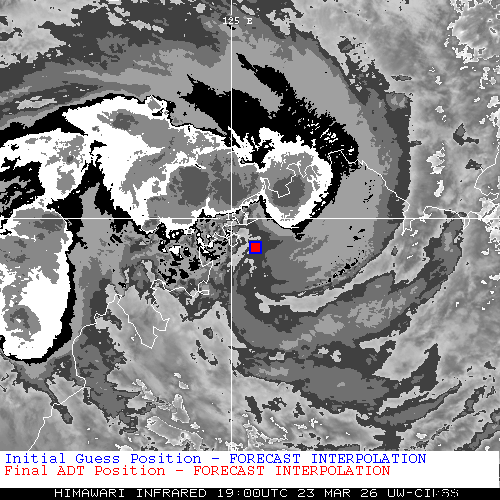
| 23Mar2026 |
1900UTC |
N/A kts |
N/A hPa |
| Scene |
CI# |
FT# |
AdjT# |
RawT# |
Eye T |
Cloud T |
| LAND |
N/A |
N/A |
N/A |
N/A |
N/AC |
N/AC |
|
|
|
|
AiDT
|
| Date |
Time |
Vmax |
|
| 21Mar2026 |
1600UTC |
81 kts |
|
|
|
|
|
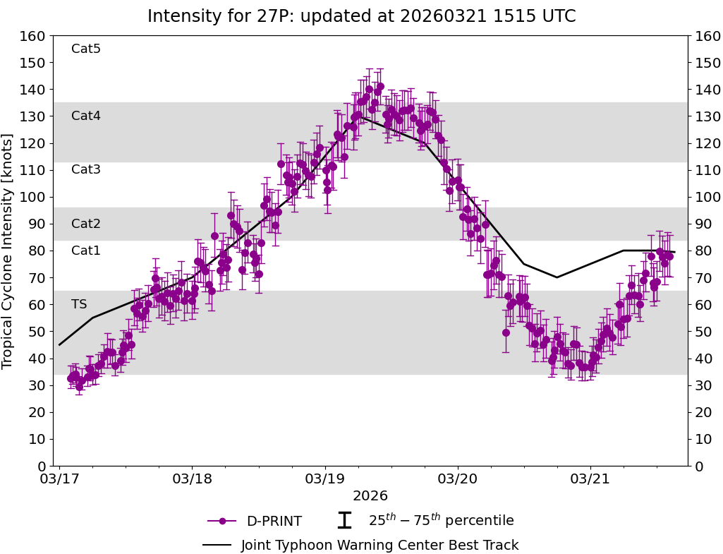
DPRINT
|
| Date |
Time |
Vmax |
MSLP |
| 23Mar2026 |
1900UTC |
39 kts |
993 hPa |
| Vmax 25% |
Vmax 75% |
|
|
| 34 kts |
45 kts |
|
|
|
|
|
|
DMINT
|
| Date |
Time |
Vmax |
MSLP |
| 23Mar2026 |
1711UTC |
43 kts |
991 hPa |
| Vmax 25% |
Vmax 75% |
MW Instr. |
|
| 38 kts |
49 kts |
ATMS-N21 |
|
|
|
| Date |
Time |
Vmax |
MSLP |
| 23Mar2026 |
1649UTC |
41 kts |
990 hPa |
| Vmax 25% |
Vmax 75% |
MW Instr. |
|
| 35 kts |
47 kts |
AMSR2 |
|
22Mar2026 |
2357UTC |
-14.58S |
128.47E |
| Satellite |
Sensor |
Eye Diameter |
Eye Cert % |
| Metop-A |
ASCAT |
--- deg |
---% |
|
|
|
|
TC Structure
|
MPERC
|
| Date |
Time |
Prob. ERC onset
Full Model |
Prob. ERC onset
V-based |
| 23Mar2026 |
1600UTC |
0% |
0% |
|
|
|
|
MIMIC-TPW
|
|
|
|
MIMIC-TC
|
|
|
|
Shear Analysis
|
| Date |
Time |
Shear Magnitude
|
Shear Direction
|
| 23Mar2026 |
1800UTC |
18 kts |
89 deg |
| Deep-layer vertical wind shear interpolated to storm center derived from the CIMSS AMV-aided analyses with vortex removed |
|
|
|
|
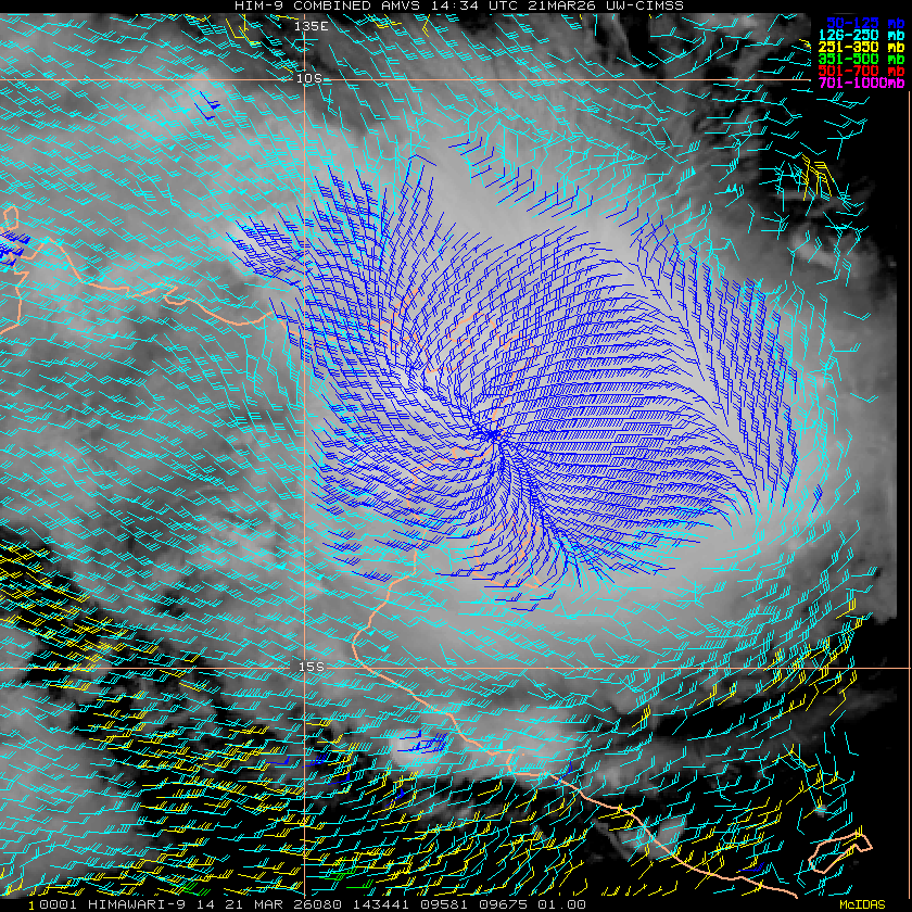
TC-Scale AMVs
|
|
|
|