|
Current Intensity Estimates
|
ADT
|
| Date |
Time |
Vmax |
MSLP |
| 25Mar2026 |
0400UTC |
90 kts |
965 hPa |
| Scene |
CI# |
FT# |
AdjT# |
RawT# |
Eye T |
Cloud T |
| EYE |
5.0 |
5.0 |
5.5 |
5.5 |
-25.73C |
-69.23C |
|
|
|
|
AiDT
|
| Date |
Time |
Vmax |
|
| 25Mar2026 |
0400UTC |
70 kts |
|
|
|
|
|
DPRINT
|
| Date |
Time |
Vmax |
MSLP |
| 25Mar2026 |
0400UTC |
76 kts |
973 hPa |
| Vmax 25% |
Vmax 75% |
|
|
| 69 kts |
84 kts |
|
|
|
|
|
|
DMINT
|
| Date |
Time |
Vmax |
MSLP |
| 24Mar2026 |
2236UTC |
55 kts |
982 hPa |
| Vmax 25% |
Vmax 75% |
MW Instr. |
|
| 50 kts |
61 kts |
SSMISF16 |
|
|
|
|
|
MW Sounders
|
| Date |
Time |
Vmax |
MSLP |
| 24Mar2026 |
2237UTC |
60 kts |
983 hPa |
|
|
Shear Analysis
|
| Date |
Time |
Shear Magnitude
|
Shear Direction
|
| 25Mar2026 |
000UTC |
8 kts |
88 deg |
| Deep-layer vertical wind shear interpolated to storm center derived from the CIMSS AMV-aided analyses with vortex removed |
|
|
|
|
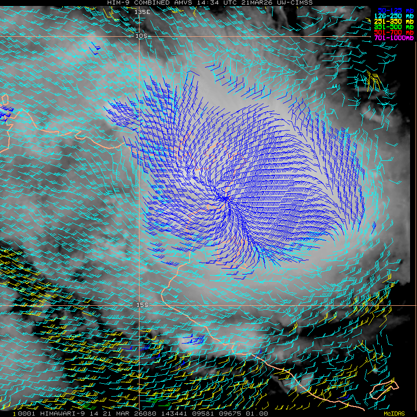
TC-Scale AMVs
|
|
|
|