|
Current Intensity Estimates
|
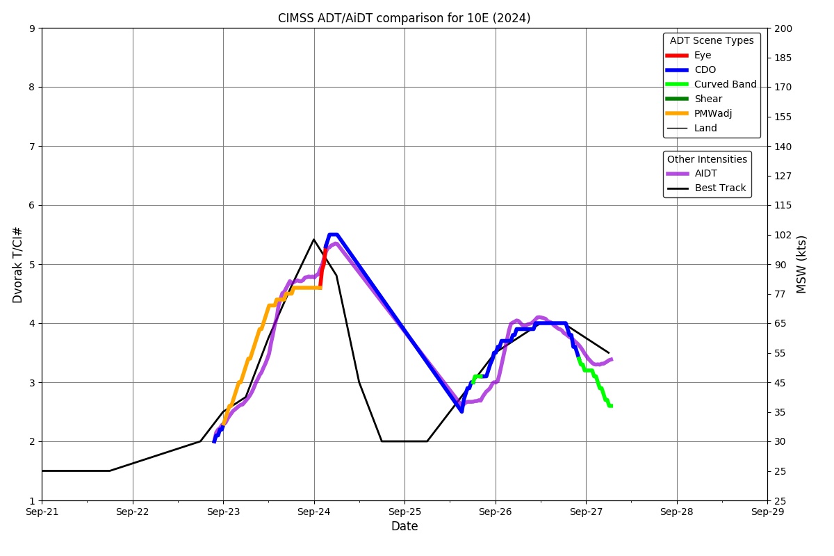
ADT
|
| Date |
Time |
Vmax |
MSLP |
| 27Sep2024 |
0310UTC |
45 kts |
991 hPa |
| Scene |
CI# |
FT# |
AdjT# |
RawT# |
Eye T |
Cloud T |
| CRVBND |
3.0 |
2.5 |
2.4 |
2.3 |
-9.81C |
-38.30C |
|
|
|
|
AiDT
|
| Date |
Time |
Vmax |
|
| 27Sep2024 |
0310UTC |
51 kts |
|
|
|
|
|
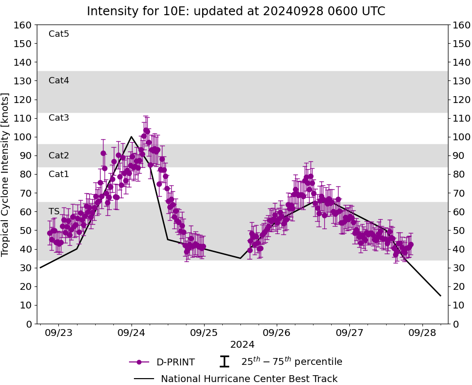
DPRINT
|
| Date |
Time |
Vmax |
MSLP |
| 27Sep2024 |
0310UTC |
46 kts |
993 hPa |
| Vmax 25% |
Vmax 75% |
|
|
| 41 kts |
52 kts |
|
|
|
|
|
|
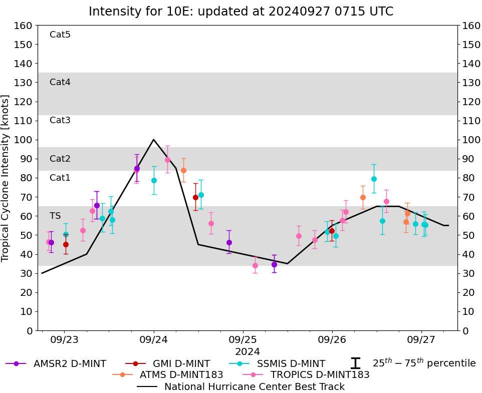
DMINT
|
| Date |
Time |
Vmax |
MSLP |
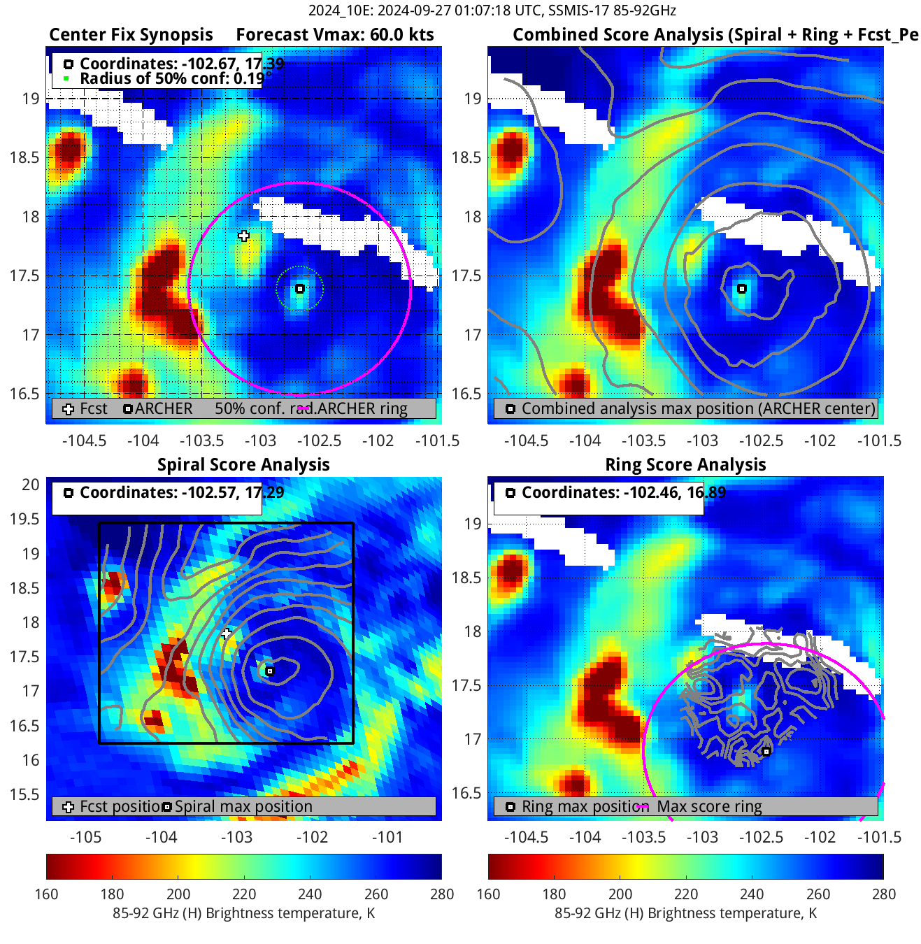
| 27Sep2024 |
0106UTC |
55 kts |
989 hPa |
| Vmax 25% |
Vmax 75% |
MW Instr. |
|
| 50 kts |
61 kts |
SSMISF17 |
|
|
|
|
|
MW Sounders
|
| Date |
Time |
Vmax |
MSLP |
| 26Sep2024 |
2012UTC |
62 kts |
978 hPa |
|
|
|
|
SATCON
|
| Date |
Time |
Vmax |
MSLP |
| 26Sep2024 |
2240UTC |
57 kts |
984 hPa |
| Consensus Members |
| 2 (ADT+Sounders) |
|
|
|