|
Current Intensity Estimates
|
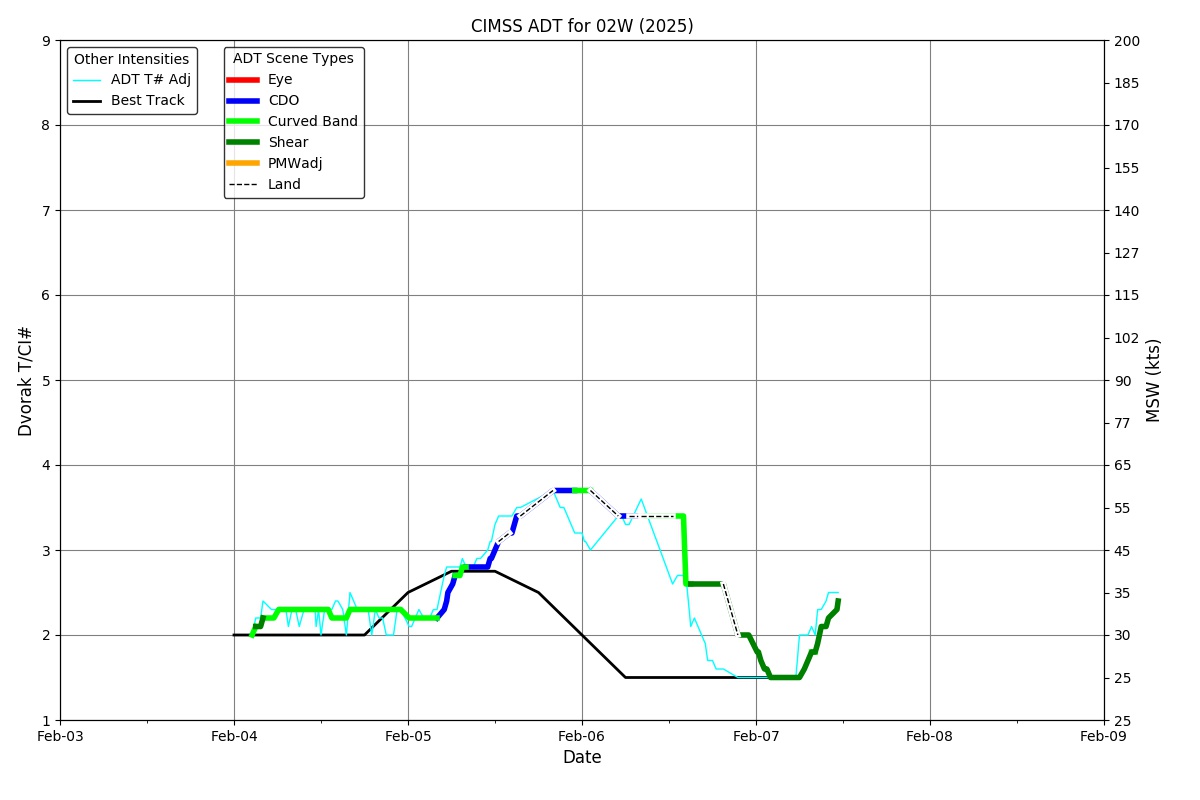
ADT
|
| Date |
Time |
Vmax |
MSLP |
| 04Feb2026 |
0800UTC |
33 kts |
1006 hPa |
| Scene |
CI# |
FT# |
AdjT# |
RawT# |
Eye T |
Cloud T |
| CRVBND |
2.3 |
2.2 |
2.3 |
2.3 |
-19.51C |
-30.28C |
|
|
|
|
AiDT
|
| Date |
Time |
Vmax |
|
| 04Feb2026 |
0800UTC |
32 kts |
|
|
|
|
|
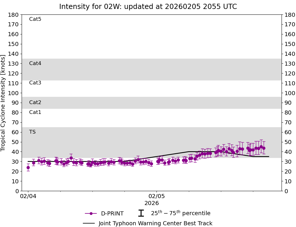
DPRINT
|
| Date |
Time |
Vmax |
MSLP |
| 04Feb2026 |
0800UTC |
34 kts |
1000 hPa |
| Vmax 25% |
Vmax 75% |
|
|
| 30 kts |
38 kts |
|
|
|
|
|
|
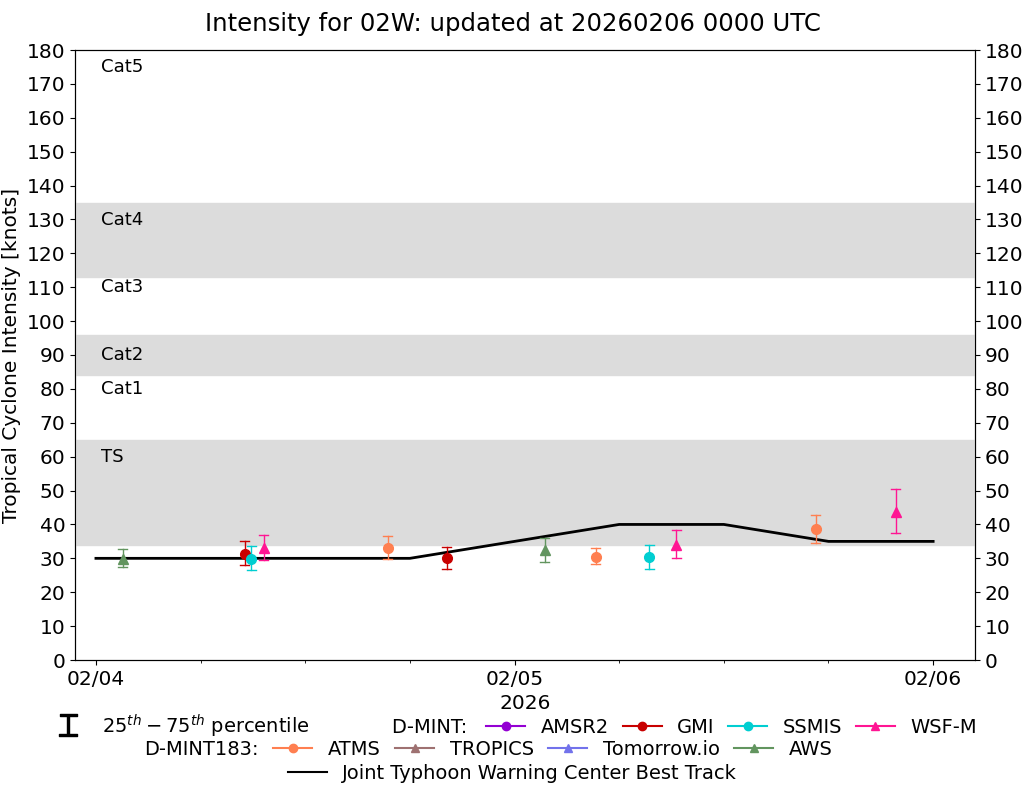
DMINT
|
| Date |
Time |
Vmax |
MSLP |
| 04Feb2026 |
0832UTC |
31 kts |
998 hPa |
| Vmax 25% |
Vmax 75% |
MW Instr. |
|
| 28 kts |
35 kts |
GMI |
|
|
|
|
|
MW Sounders
|
| Date |
Time |
Vmax |
MSLP |
| 04Feb2026 |
0459UTC |
29 kts |
1001 hPa |
|
|
Shear Analysis
|
| Date |
Time |
Shear Magnitude
|
Shear Direction
|
| 04Feb2026 |
600UTC |
21 kts |
100 deg |
| Deep-layer vertical wind shear interpolated to storm center derived from the CIMSS AMV-aided analyses with vortex removed |
|
|
|
|
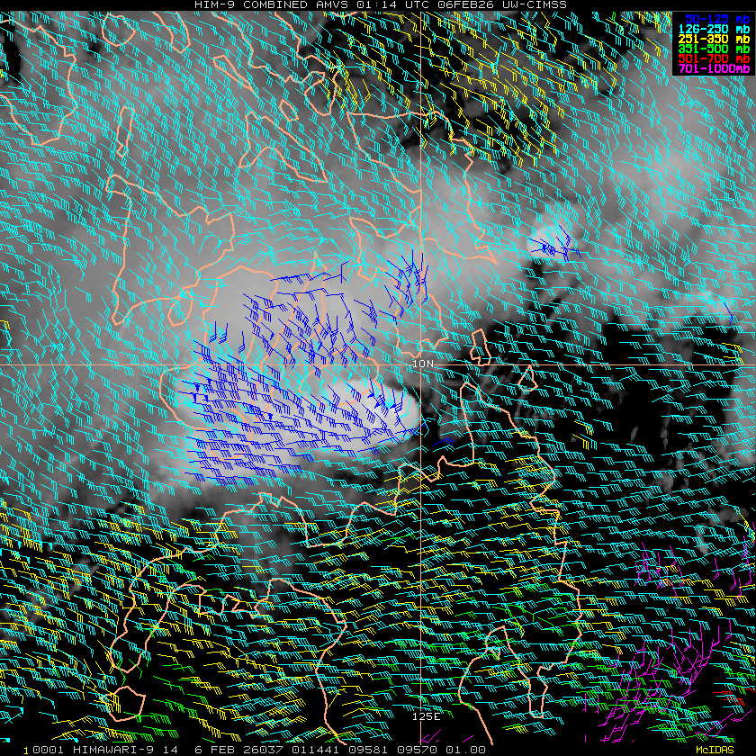
TC-Scale AMVs
|
|
|
|