|
Current Intensity Estimates
|
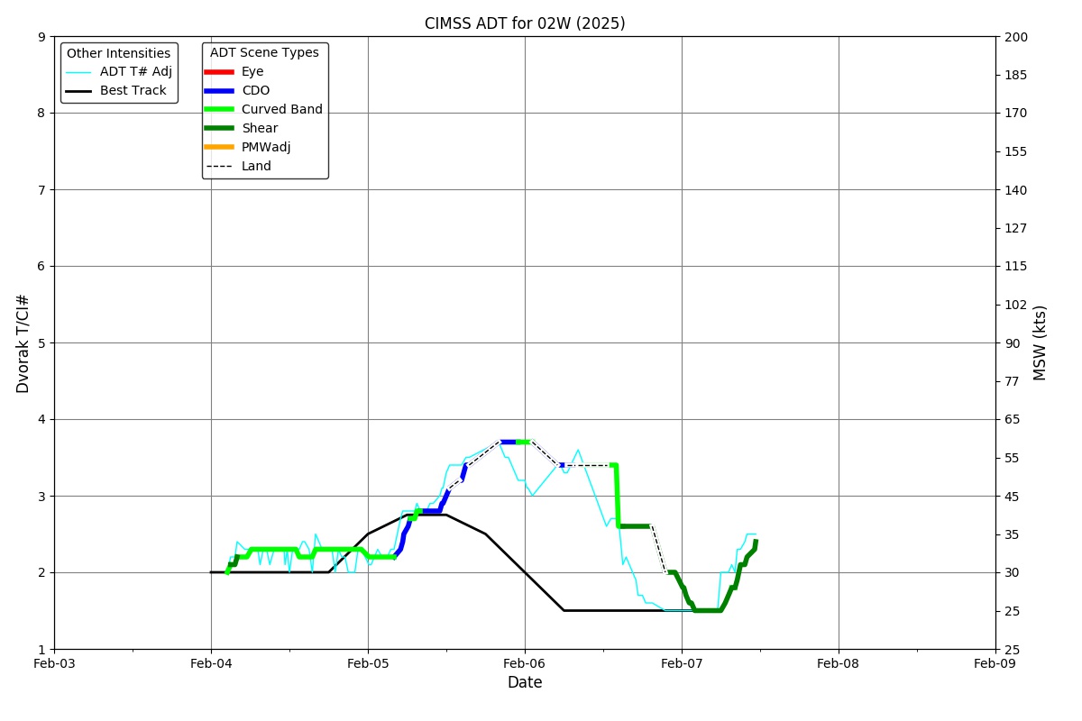
ADT
|
| Date |
Time |
Vmax |
MSLP |
| 07Feb2026 |
0110UTC |
26 kts |
1008 hPa |
| Scene |
CI# |
FT# |
AdjT# |
RawT# |
Eye T |
Cloud T |
| SHEAR |
1.6 |
1.5 |
1.5 |
1.5 |
17.26C |
11.42C |
|
|
|
|
AiDT
|
| Date |
Time |
Vmax |
|
| 07Feb2026 |
0110UTC |
29 kts |
|
|
|
|
|
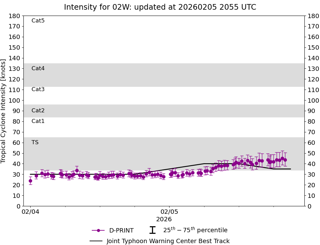
DPRINT
|
| Date |
Time |
Vmax |
MSLP |
| 07Feb2026 |
0110UTC |
28 kts |
1003 hPa |
| Vmax 25% |
Vmax 75% |
|
|
| 25 kts |
32 kts |
|
|
|
|
|
|
DMINT
|
| Date |
Time |
Vmax |
MSLP |
| 06Feb2026 |
2132UTC |
27 kts |
1002 hPa |
| Vmax 25% |
Vmax 75% |
MW Instr. |
|
| 24 kts |
30 kts |
WSFM01 |
|
|
|
| Date |
Time |
Vmax |
MSLP |
| 06Feb2026 |
2022UTC |
34 kts |
1001 hPa |
| Vmax 25% |
Vmax 75% |
MW Instr. |
|
| 30 kts |
39 kts |
GMI |
|
06Feb2026 |
1713UTC |
10.43N |
122.34E |
| Satellite |
Sensor |
Eye Diameter |
Eye Cert % |
| AMSR2 |
85-92GHz |
1.20 deg |
1.2% |
|
|
|
|
TC Structure
|
MPERC
|
| Date |
Time |
Prob. ERC onset
Full Model |
Prob. ERC onset
V-based |
| 06Feb2026 |
2000UTC |
0% |
0% |
|
|
|
|
MIMIC-TPW
|
|
|
|
MIMIC-TC
|
|
|
|
Shear Analysis
|
| Date |
Time |
Shear Magnitude
|
Shear Direction
|
| 07Feb2026 |
000UTC |
26 kts |
131 deg |
| Deep-layer vertical wind shear interpolated to storm center derived from the CIMSS AMV-aided analyses with vortex removed |
|
|
|
|
TC-Scale AMVs
|
|
|
|