|
Current Intensity Estimates
|
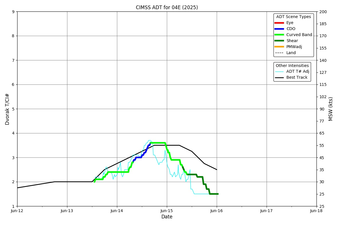
ADT
|
| Date |
Time |
Vmax |
MSLP |
| 14Jun2025 |
2010UTC |
57 kts |
989 hPa |
| Scene |
CI# |
FT# |
AdjT# |
RawT# |
Eye T |
Cloud T |
| CRVBND |
3.6 |
3.0 |
2.7 |
2.4 |
-47.69C |
-50.66C |
|
|
|
|
AiDT
|
| Date |
Time |
Vmax |
|
| 14Jun2025 |
2010UTC |
44 kts |
|
|
|
|
|
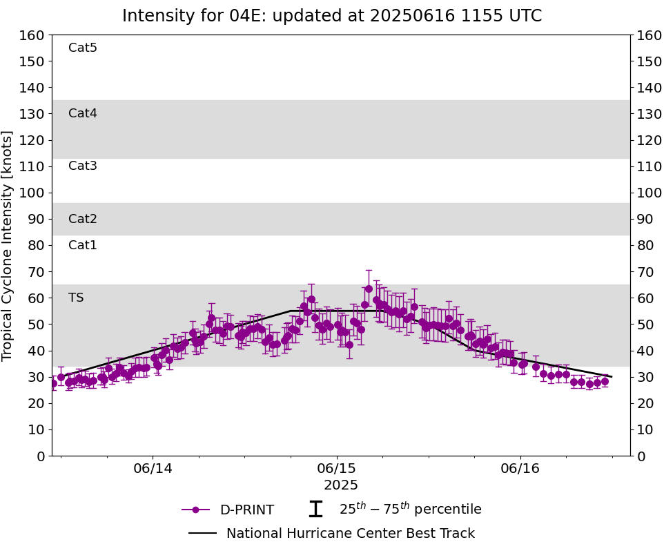
DPRINT
|
| Date |
Time |
Vmax |
MSLP |
| 14Jun2025 |
2010UTC |
55 kts |
993 hPa |
| Vmax 25% |
Vmax 75% |
|
|
| 49 kts |
60 kts |
|
|
|
|
|
|
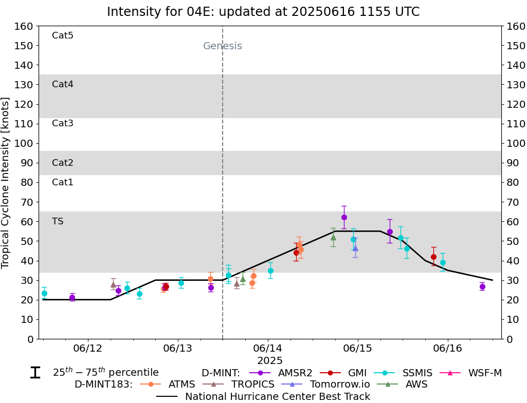
DMINT
|
| Date |
Time |
Vmax |
MSLP |
| 14Jun2025 |
0847UTC |
46 kts |
1001 hPa |
| Vmax 25% |
Vmax 75% |
MW Instr. |
|
| 41 kts |
50 kts |
ATMS-N20 |
|
|
|
|
|
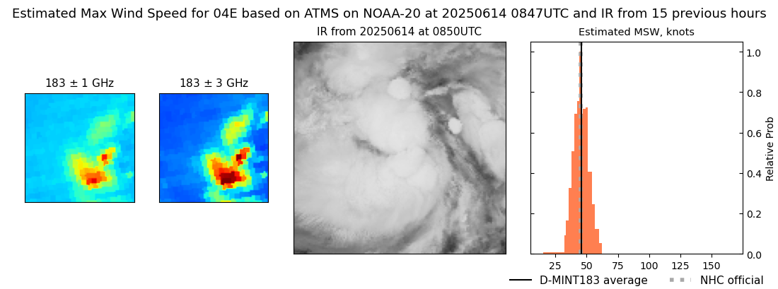
MW Sounders
|
| Date |
Time |
Vmax |
MSLP |
| 14Jun2025 |
0847UTC |
39 kts |
992 hPa |
|
|
|
|
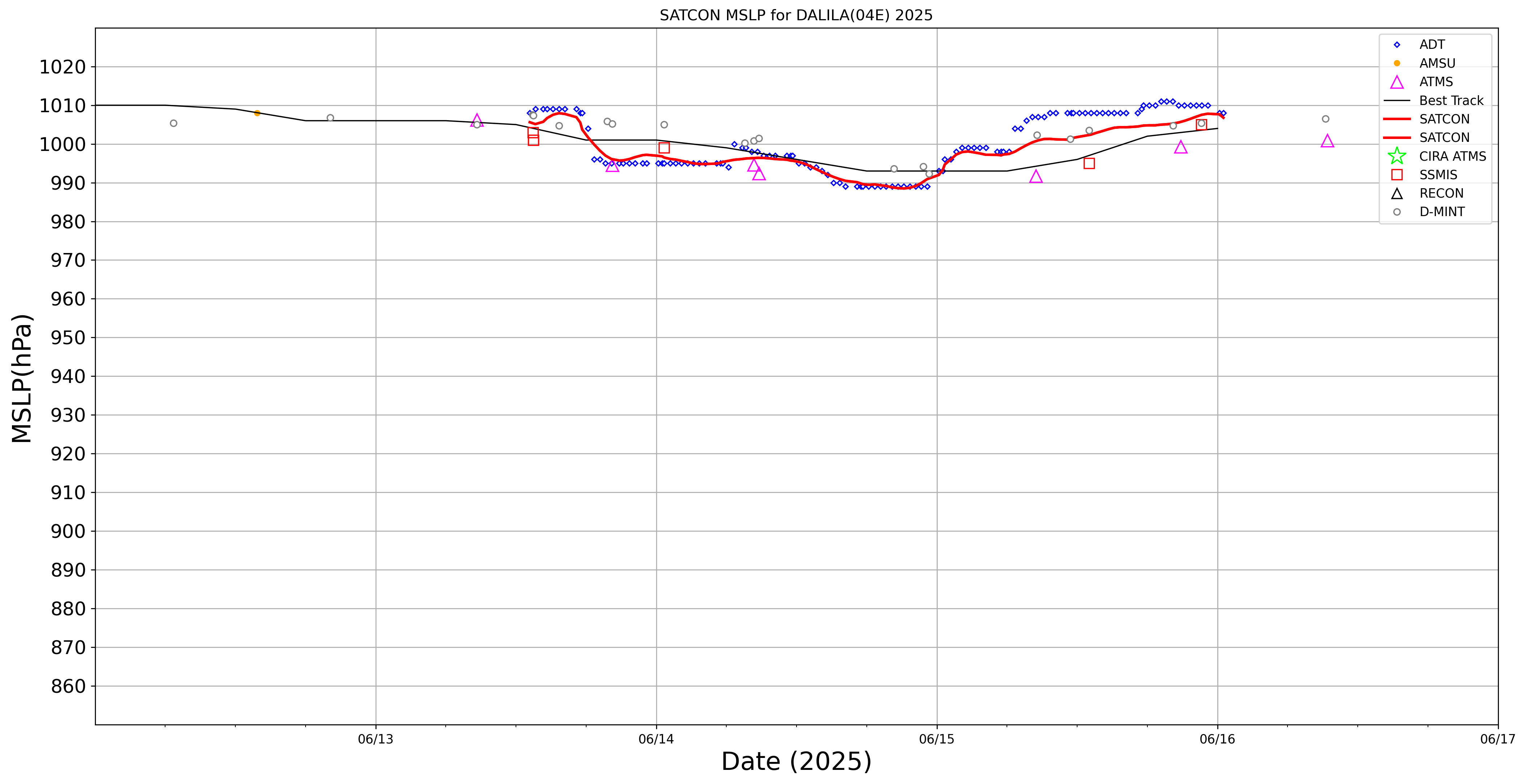
SATCON
|
| Date |
Time |
Vmax |
MSLP |
| 14Jun2025 |
1140UTC |
44 kts |
995 hPa |
| Consensus Members |
| 2 (ADT+Sounders) |
|
|
|