|
Current Intensity Estimates
|
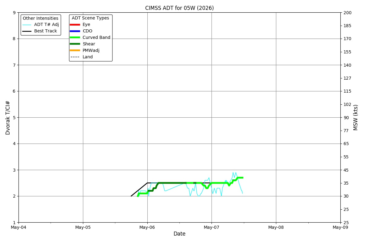
ADT
|
| Date |
Time |
Vmax |
MSLP |
| 06May2026 |
0700UTC |
35 kts |
1009 hPa |
| Scene |
CI# |
FT# |
AdjT# |
RawT# |
Eye T |
Cloud T |
| SHEAR |
2.5 |
2.4 |
2.2 |
2.2 |
11.01C |
-4.61C |
|
|
|
|
AiDT
|
| Date |
Time |
Vmax |
|
| 06May2026 |
0700UTC |
34 kts |
|
|
|
|
|
DPRINT
|
| Date |
Time |
Vmax |
MSLP |
| 06May2026 |
0630UTC |
24 kts |
1004 hPa |
| Vmax 25% |
Vmax 75% |
|
|
| 22 kts |
26 kts |
|
|
|
|
|
|
DMINT
|
| Date |
Time |
Vmax |
MSLP |
| 06May2026 |
0638UTC |
22 kts |
1003 hPa |
| Vmax 25% |
Vmax 75% |
MW Instr. |
|
| 20 kts |
24 kts |
SSMISF18 |
|
|
|
|
|
MW Sounders
|
| Date |
Time |
Vmax |
MSLP |
| 06May2026 |
0401UTC |
25 kts |
1005 hPa |
|
|
Shear Analysis
|
| Date |
Time |
Shear Magnitude
|
Shear Direction
|
| 06May2026 |
600UTC |
6 kts |
209 deg |
| Deep-layer vertical wind shear interpolated to storm center derived from the CIMSS AMV-aided analyses with vortex removed |
|
|
|
|
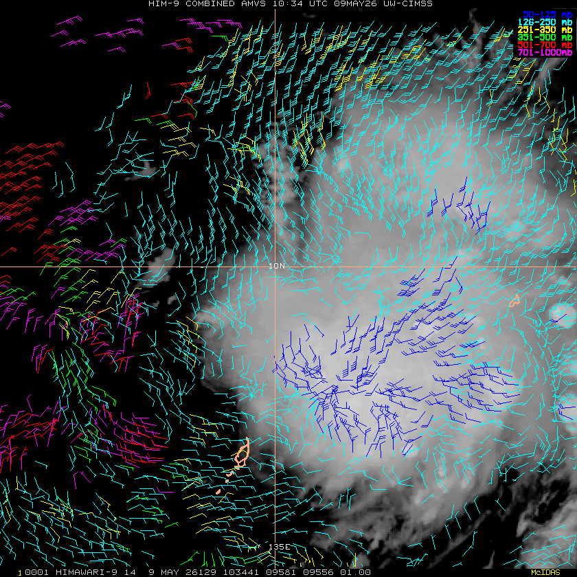
TC-Scale AMVs
|
|
|
|