|
Current Intensity Estimates
|
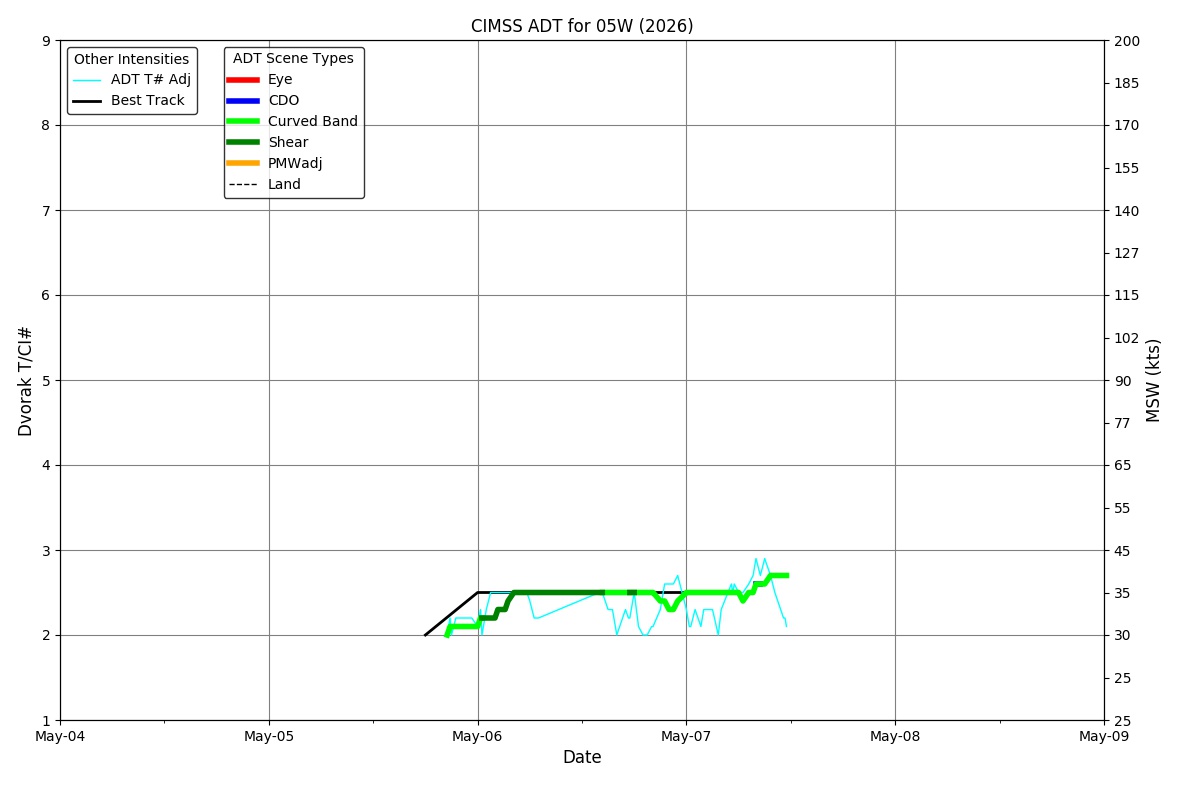
ADT
|
| Date |
Time |
Vmax |
MSLP |
| 07May2026 |
1800UTC |
41 kts |
1004 hPa |
| Scene |
CI# |
FT# |
AdjT# |
RawT# |
Eye T |
Cloud T |
| UNIFRM |
2.8 |
2.8 |
3.0 |
3.1 |
-76.41C |
-73.71C |
|
|
|
|
AiDT
|
| Date |
Time |
Vmax |
|
| 07May2026 |
1800UTC |
38 kts |
|
|
|
|
|
DPRINT
|
| Date |
Time |
Vmax |
MSLP |
| 07May2026 |
1800UTC |
32 kts |
1000 hPa |
| Vmax 25% |
Vmax 75% |
|
|
| 28 kts |
37 kts |
|
|
|
|
|
|
DMINT
|
| Date |
Time |
Vmax |
MSLP |
| 07May2026 |
1620UTC |
34 kts |
1000 hPa |
| Vmax 25% |
Vmax 75% |
MW Instr. |
|
| 30 kts |
38 kts |
ATMS-N21 |
|
|
|
| Date |
Time |
Vmax |
MSLP |
| 07May2026 |
1611UTC |
29 kts |
1000 hPa |
| Vmax 25% |
Vmax 75% |
MW Instr. |
|
| 25 kts |
32 kts |
AMSR2 |
|
07May2026 |
1612UTC |
7.95N |
141.18E |
| Satellite |
Sensor |
Eye Diameter |
Eye Cert % |
| AMSR2 |
37GHz |
1.70 deg |
---% |
|
|
|
|
TC Structure
|
MPERC
|
| Date |
Time |
Prob. ERC onset
Full Model |
Prob. ERC onset
V-based |
| 07May2026 |
1600UTC |
0% |
0% |
|
|
|
|
MIMIC-TPW
|
|
|
|
MIMIC-TC
|
|
|
|
Shear Analysis
|
| Date |
Time |
Shear Magnitude
|
Shear Direction
|
| 07May2026 |
1200UTC |
13 kts |
219 deg |
| Deep-layer vertical wind shear interpolated to storm center derived from the CIMSS AMV-aided analyses with vortex removed |
|
|
|
|
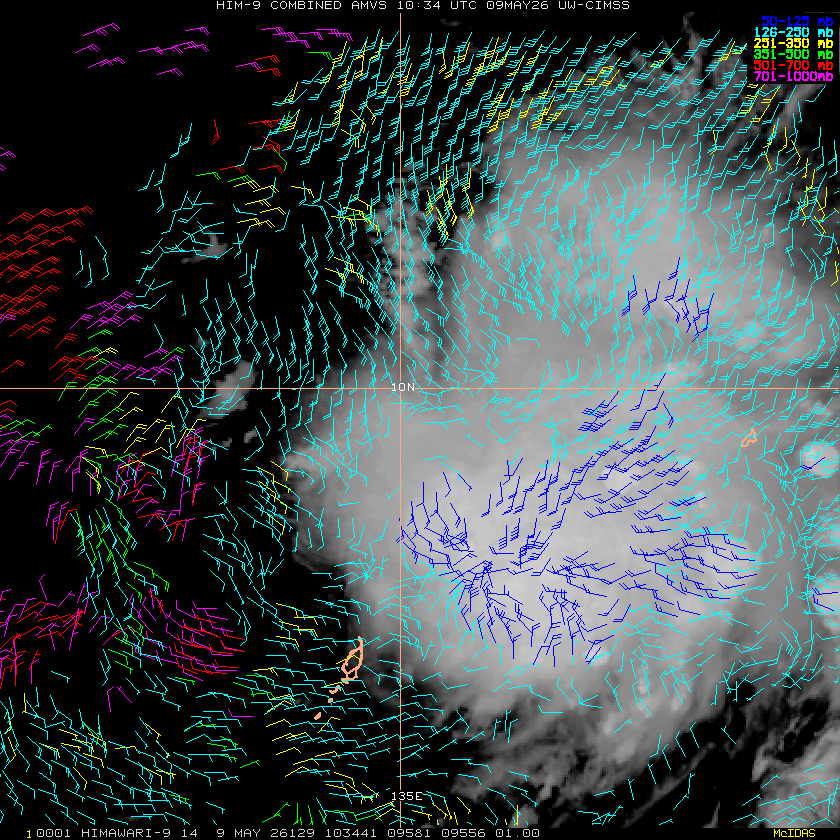
TC-Scale AMVs
|
|
|
|