|
Current Intensity Estimates
|
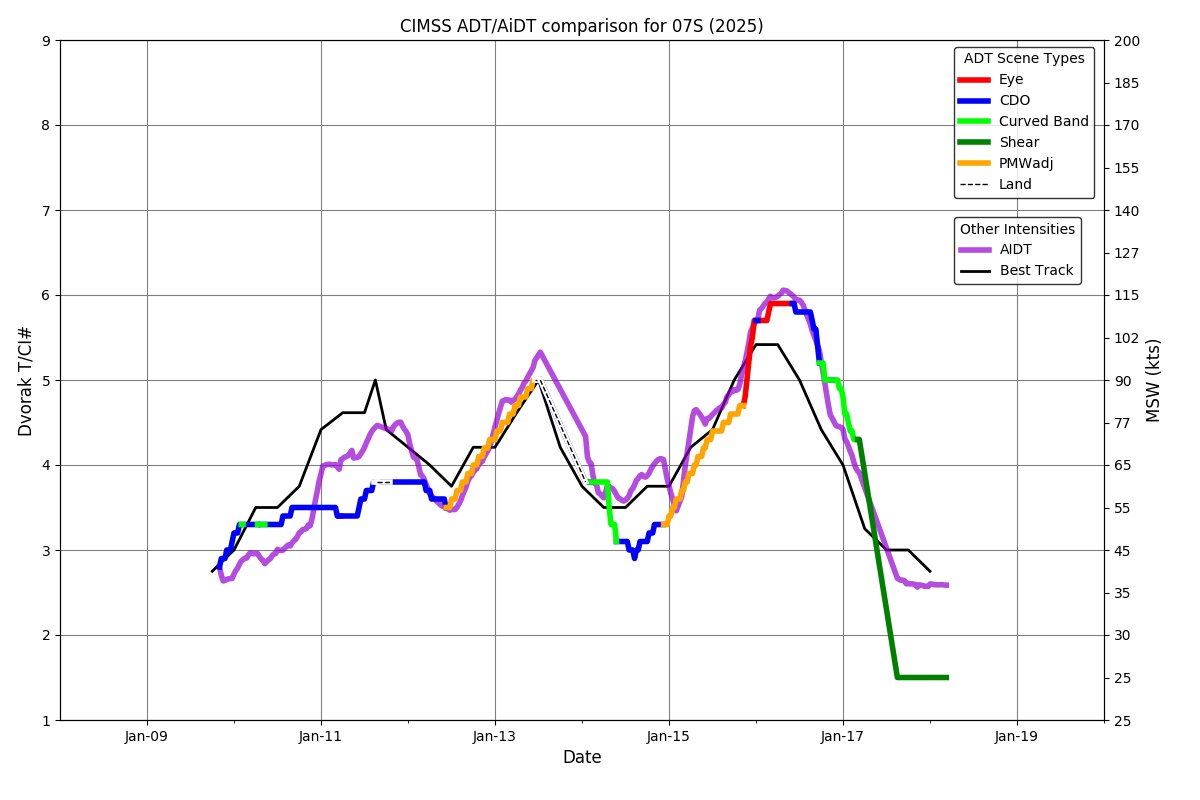
ADT
|
| Date |
Time |
Vmax |
MSLP |
| 15Jan2025 |
2230UTC |
99 kts |
949 hPa |
| Scene |
CI# |
FT# |
AdjT# |
RawT# |
Eye T |
Cloud T |
| EYE |
5.4 |
5.4 |
5.8 |
6.0 |
-32.41C |
-75.04C |
|
|
|
|
AiDT
|
| Date |
Time |
Vmax |
|
| 15Jan2025 |
2230UTC |
103 kts |
|
|
|
|
|
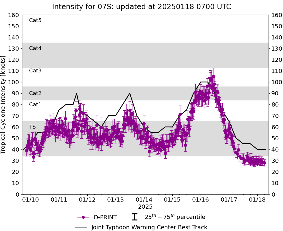
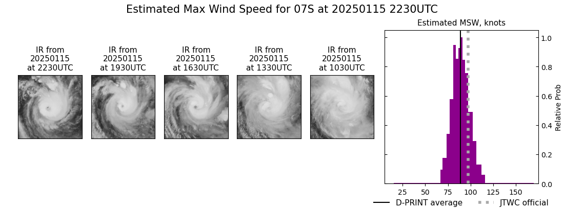
DPRINT
|
| Date |
Time |
Vmax |
MSLP |
| 15Jan2025 |
2230UTC |
89 kts |
950 hPa |
| Vmax 25% |
Vmax 75% |
|
|
| 82 kts |
96 kts |
|
|
|
|
|
|
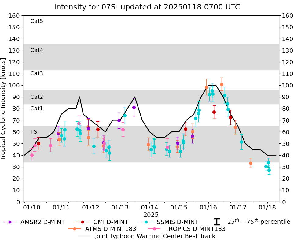
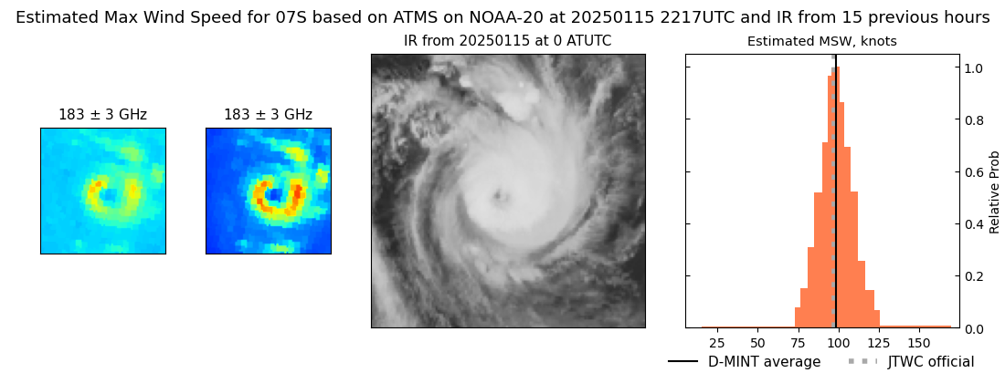
DMINT
|
| Date |
Time |
Vmax |
MSLP |
| 15Jan2025 |
2217UTC |
98 kts |
953 hPa |
| Vmax 25% |
Vmax 75% |
MW Instr. |
|
| 92 kts |
106 kts |
ATMS-N20 |
|
|
|
|
|
MW Sounders
|
| Date |
Time |
Vmax |
MSLP |
| 15Jan2025 |
2217UTC |
101 kts |
951 hPa |
|
|
|
|
SATCON
|
| Date |
Time |
Vmax |
MSLP |
| 15Jan2025 |
2230UTC |
105 kts |
951 hPa |
| Consensus Members |
| 2 (ADT+Sounders) |
|
|
|