|
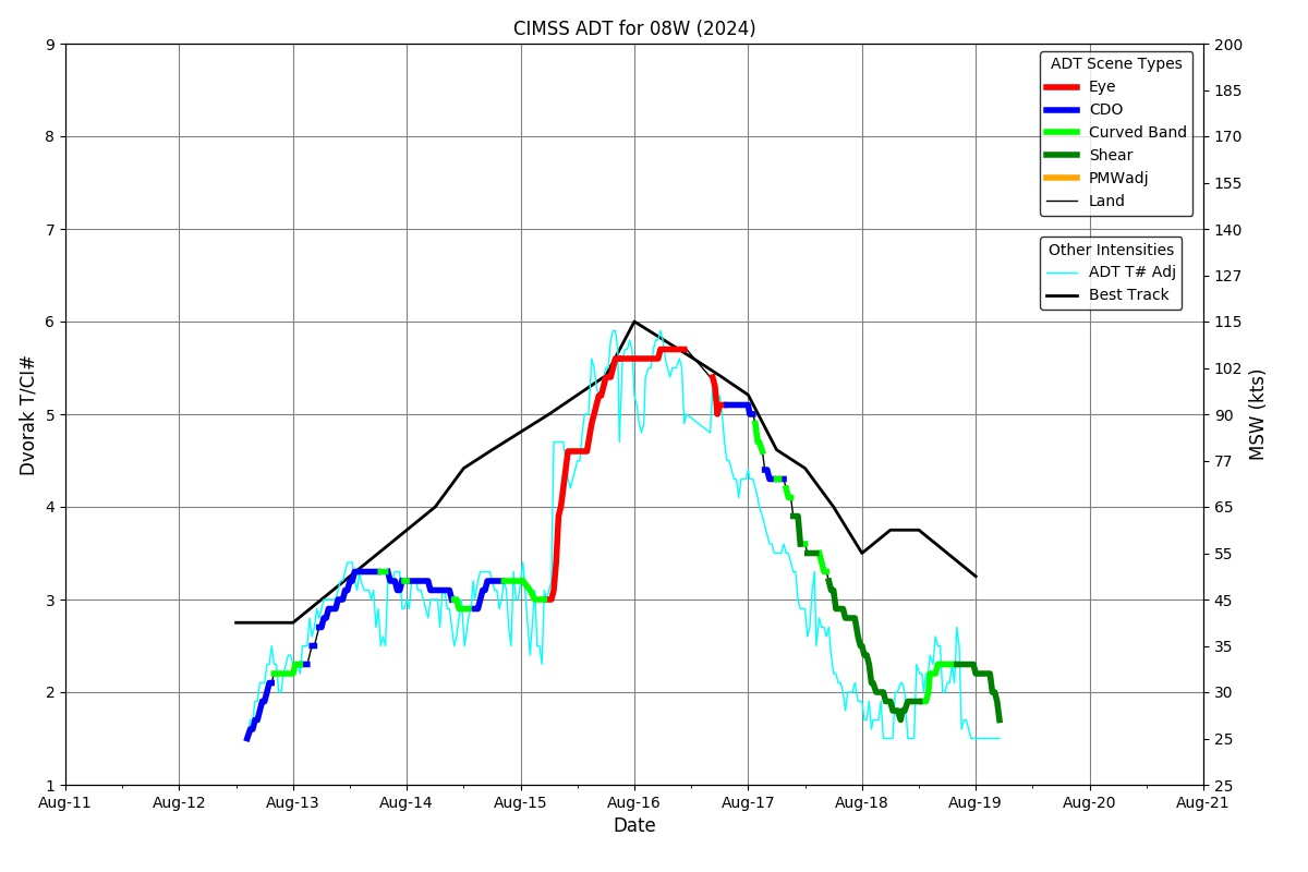
Current Intensity Estimates
|
ADT
|
| Date |
Time |
Vmax |
MSLP |
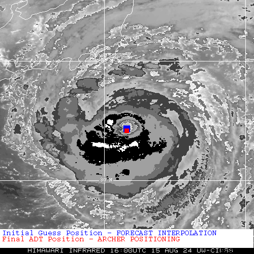
| 15Aug2024 |
1600UTC |
92 kts |
954 hPa |
| Scene |
CI# |
FT# |
AdjT# |
RawT# |
Eye T |
Cloud T |
| EYE |
5.1 |
5.1 |
5.3 |
5.5 |
13.64C |
-61.59C |
|
|
|
|
AiDT
|
| Date |
Time |
Vmax |
|
| 15Aug2024 |
1600UTC |
91 kts |
|
|
|
|
|
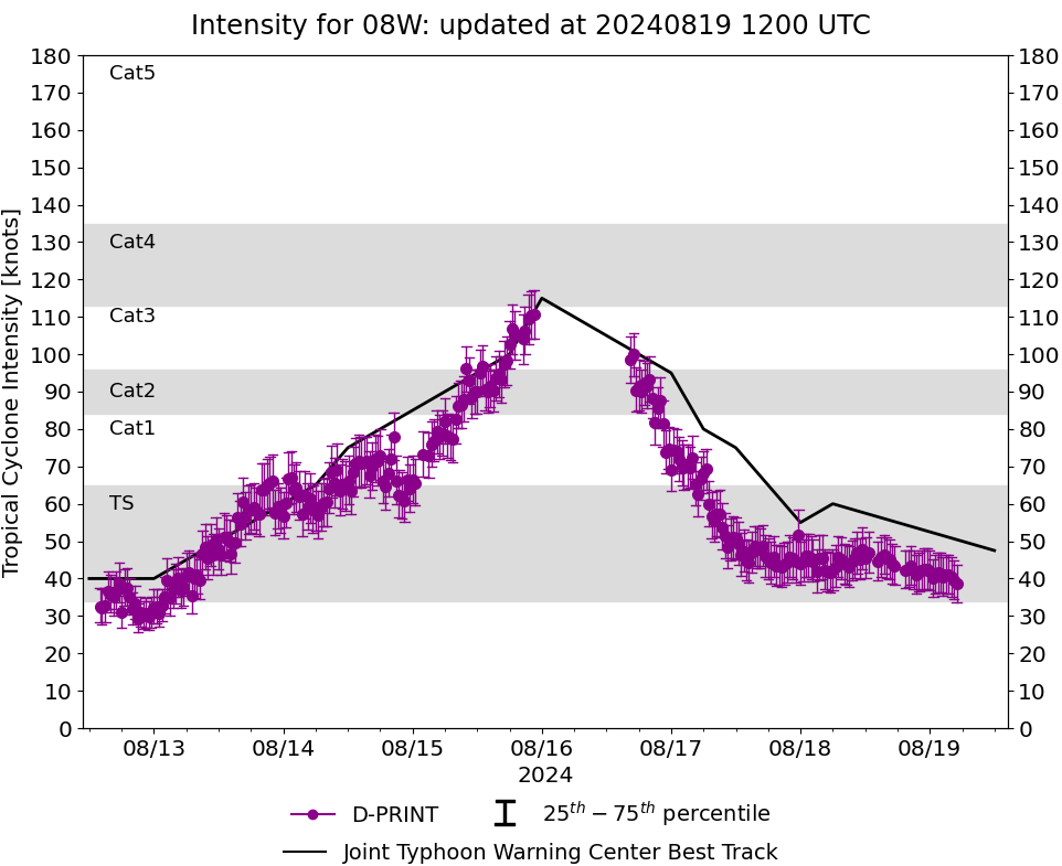
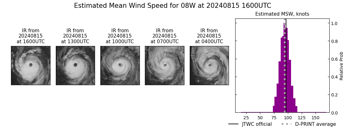
DPRINT
|
| Date |
Time |
Vmax |
MSLP |
| 15Aug2024 |
1600UTC |
95 kts |
955 hPa |
| Vmax 25% |
Vmax 75% |
|
|
| 88 kts |
101 kts |
|
|
|
|
|
|
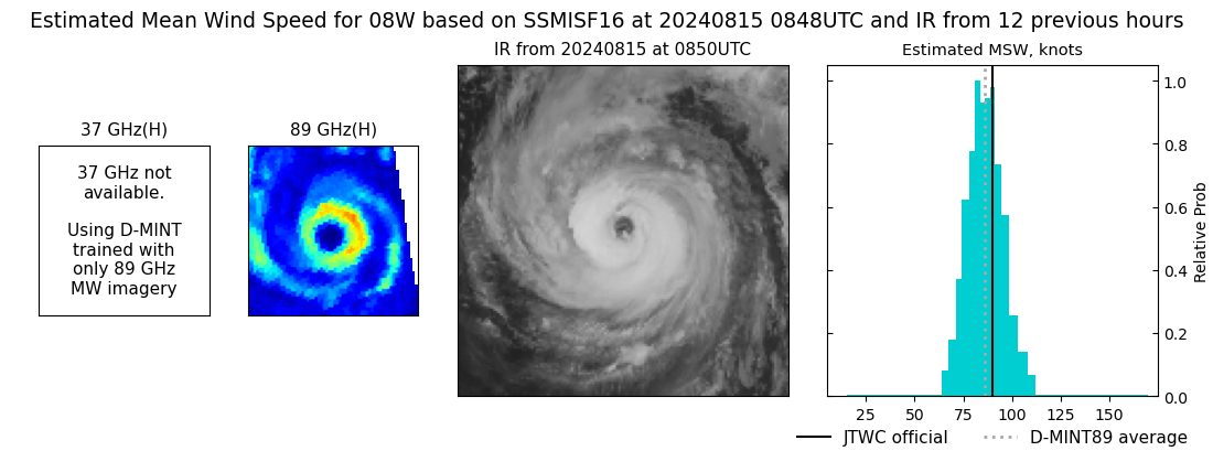
DMINT
|
| Date |
Time |
Vmax |
MSLP |
| 15Aug2024 |
0848UTC |
86 kts |
962 hPa |
| Vmax 25% |
Vmax 75% |
MW Instr. |
|
| 80 kts |
93 kts |
SSMISF16 |
|
|
|
|
|
MW Sounders
|
| Date |
Time |
Vmax |
MSLP |
| 15Aug2024 |
0400UTC |
96 kts |
944 hPa |
|
|
|
|
SATCON
|
| Date |
Time |
Vmax |
MSLP |
| 15Aug2024 |
1530UTC |
91 kts |
952 hPa |
| Consensus Members |
| 3 (ADT+Sounders) |
|
|
|