|
Current Intensity Estimates
|
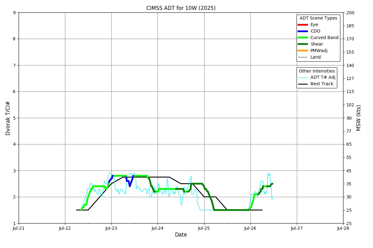
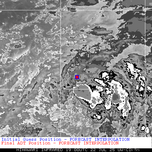
ADT
|
| Date |
Time |
Vmax |
MSLP |
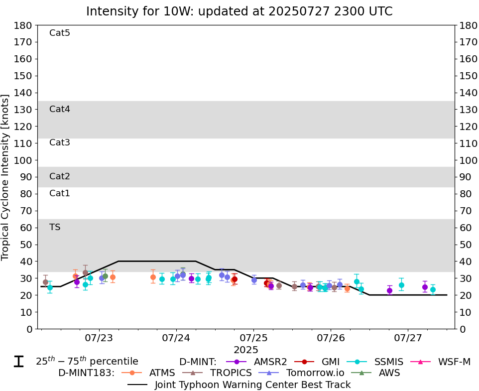
| 22Jul2025 |
1900UTC |
34 kts |
994 hPa |
| Scene |
CI# |
FT# |
AdjT# |
RawT# |
Eye T |
Cloud T |
| CRVBND |
2.4 |
2.1 |
2.0 |
2.0 |
-38.23C |
-48.83C |
|
|
|
|
AiDT
|
| Date |
Time |
Vmax |
|
| 22Jul2025 |
1900UTC |
36 kts |
|
|
|
|
|
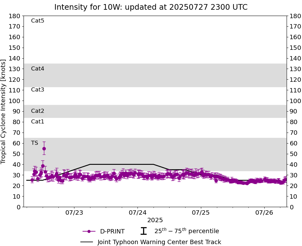
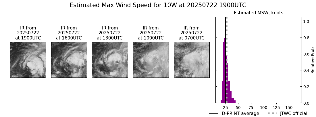
DPRINT
|
| Date |
Time |
Vmax |
MSLP |
| 22Jul2025 |
1900UTC |
25 kts |
995 hPa |
| Vmax 25% |
Vmax 75% |
|
|
| 22 kts |
29 kts |
|
|
|
|
|
|
DMINT
|
| Date |
Time |
Vmax |
MSLP |
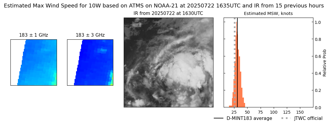
| 22Jul2025 |
1635UTC |
31 kts |
1001 hPa |
| Vmax 25% |
Vmax 75% |
MW Instr. |
|
| 28 kts |
35 kts |
ATMS-N21 |
|
|
|
|
|
MW Sounders
|
| Date |
Time |
Vmax |
MSLP |
| 22Jul2025 |
1635UTC |
33 kts |
1000 hPa |
|
|
|
|
SATCON
|
| Date |
Time |
Vmax |
MSLP |
| 22Jul2025 |
1900UTC |
38 kts |
997 hPa |
| Consensus Members |
| 2 (ADT+Sounders) |
|
|
|