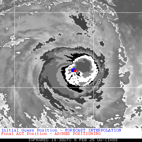
|
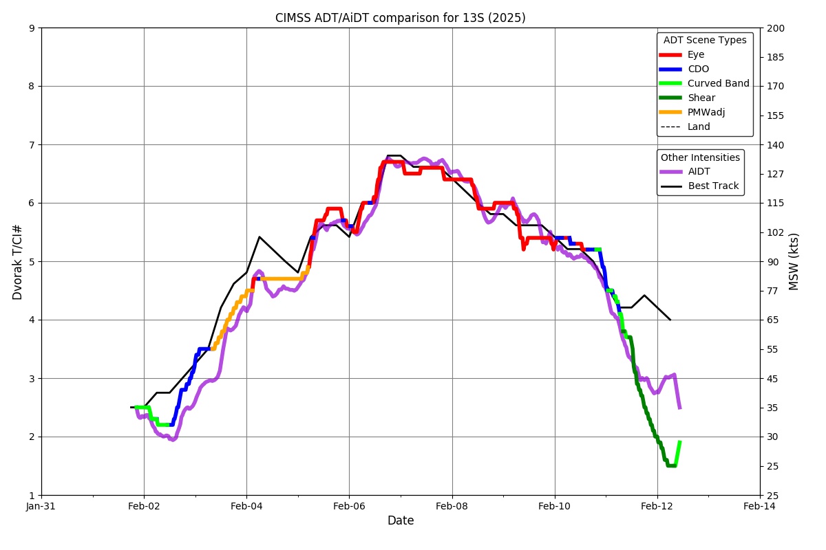
Current Intensity Estimates
|
ADT
|
| Date |
Time |
Vmax |
MSLP |
| 05Feb2025 |
1930UTC |
112 kts |
947 hPa |
| Scene |
CI# |
FT# |
AdjT# |
RawT# |
Eye T |
Cloud T |
| EYE |
5.9 |
5.6 |
5.5 |
5.5 |
-45.93C |
-73.13C |
|
|
|
|
AiDT
|
| Date |
Time |
Vmax |
|
| 05Feb2025 |
1930UTC |
107 kts |
|
|
|
|
|
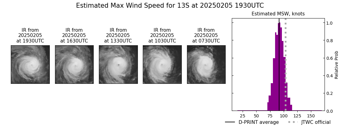
DPRINT
|
| Date |
Time |
Vmax |
MSLP |
| 05Feb2025 |
1930UTC |
92 kts |
955 hPa |
| Vmax 25% |
Vmax 75% |
|
|
| 86 kts |
98 kts |
|
|
|
|
|
|
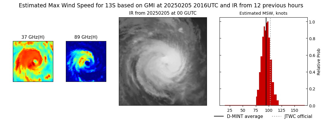
DMINT
|
| Date |
Time |
Vmax |
MSLP |
| 05Feb2025 |
2016UTC |
95 kts |
954 hPa |
| Vmax 25% |
Vmax 75% |
MW Instr. |
|
| 89 kts |
101 kts |
GMI |
|
|
|
|
|
MW Sounders
|
| Date |
Time |
Vmax |
MSLP |
| 05Feb2025 |
1859UTC |
95 kts |
949 hPa |
|
|
|
|
SATCON
|
| Date |
Time |
Vmax |
MSLP |
| 05Feb2025 |
1930UTC |
104 kts |
948 hPa |
| Consensus Members |
| 2 (ADT+Sounders) |
|
|
|