|
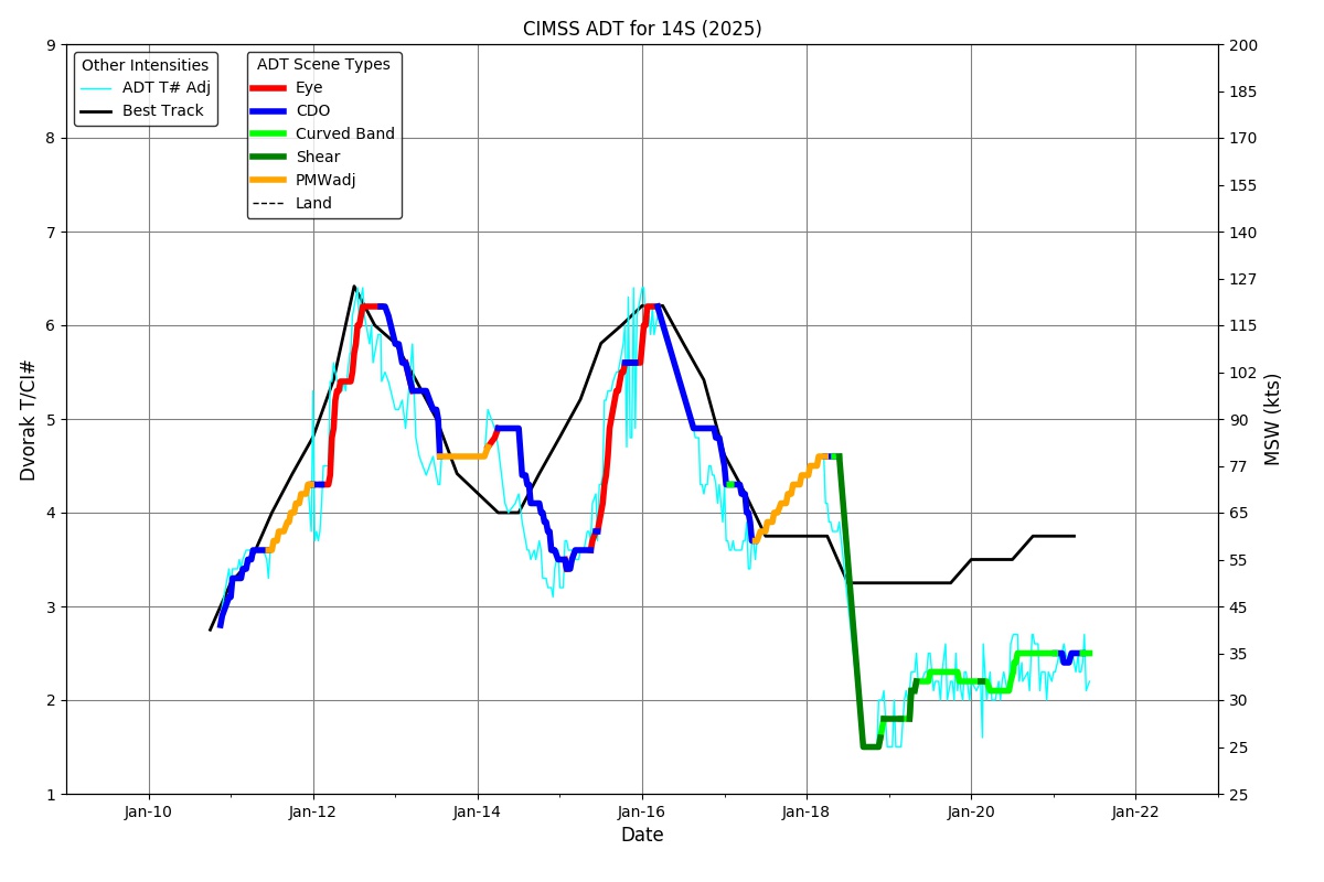
Current Intensity Estimates
|
ADT
|
| Date |
Time |
Vmax |
MSLP |
| 10Jan2026 |
2130UTC |
43 kts |
1003 hPa |
| Scene |
CI# |
FT# |
AdjT# |
RawT# |
Eye T |
Cloud T |
| UNIFRM |
2.9 |
2.9 |
3.0 |
3.3 |
-78.25C |
-72.16C |
|
|
|
|
AiDT
|
| Date |
Time |
Vmax |
|
| 10Jan2026 |
2130UTC |
38 kts |
|
|
|
|
|
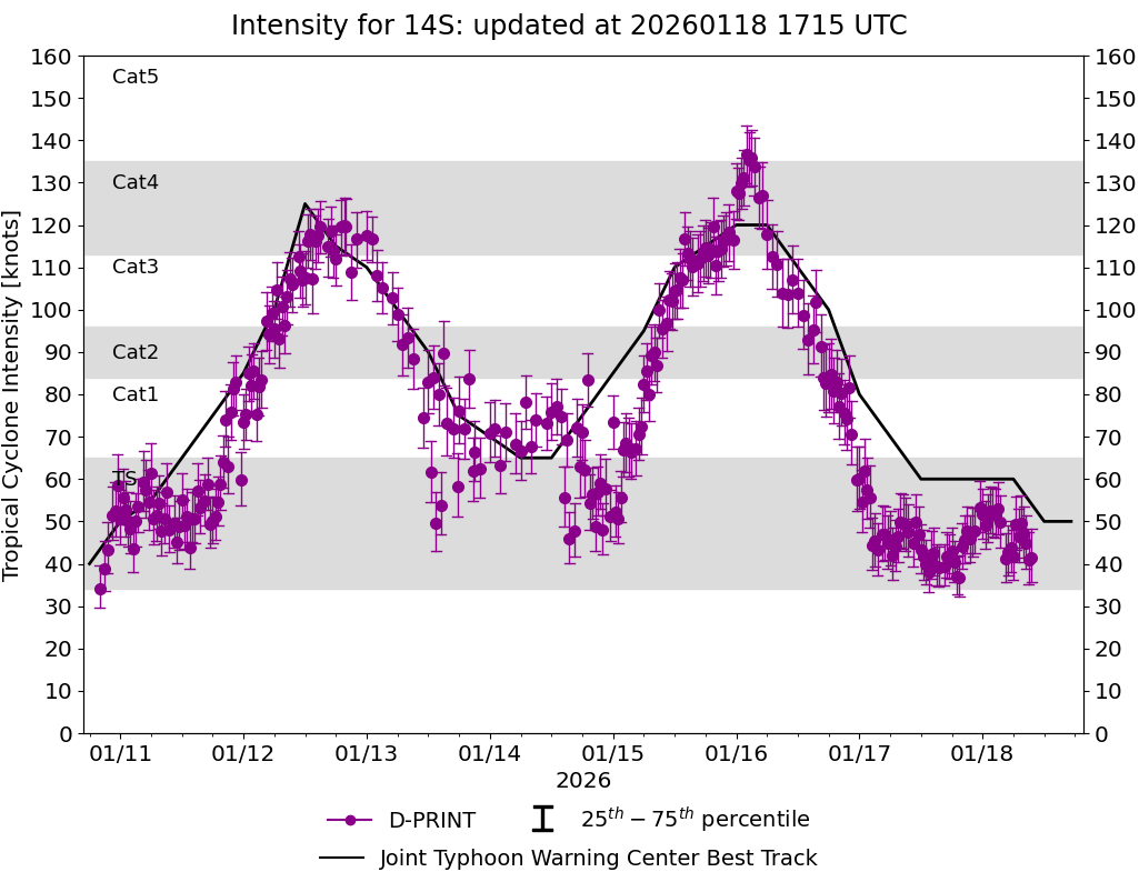
DPRINT
|
| Date |
Time |
Vmax |
MSLP |
| 10Jan2026 |
2130UTC |
43 kts |
997 hPa |
| Vmax 25% |
Vmax 75% |
|
|
| 38 kts |
50 kts |
|
|
|
|
|
|
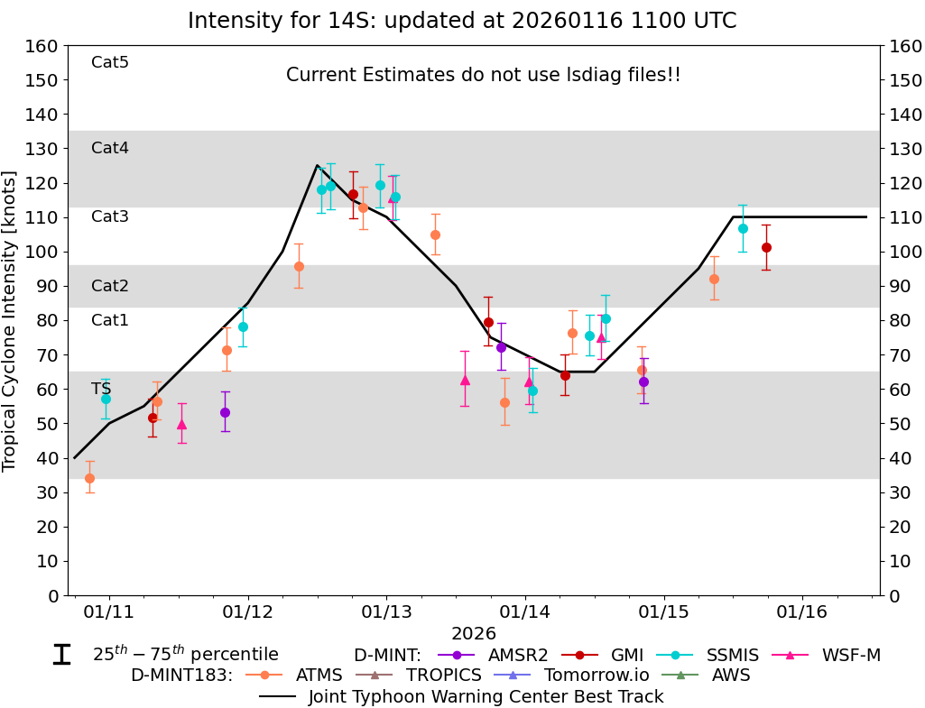
DMINT
|
| Date |
Time |
Vmax |
MSLP |
| 10Jan2026 |
2033UTC |
34 kts |
997 hPa |
| Vmax 25% |
Vmax 75% |
MW Instr. |
|
| 30 kts |
39 kts |
ATMS-N20 |
|
|
|
|
|
MW Sounders
|
| Date |
Time |
Vmax |
MSLP |
| 10Jan2026 |
2033UTC |
44 kts |
997 hPa |
|
|
Shear Analysis
|
| Date |
Time |
Shear Magnitude
|
Shear Direction
|
| N/A |
N/AUTC |
N/A kts |
N/A deg |
| Deep-layer vertical wind shear interpolated to storm center derived from the CIMSS AMV-aided analyses with vortex removed |
|
|
|
|
TC-Scale AMVs
|
|
|
|