|
Current Intensity Estimates
|
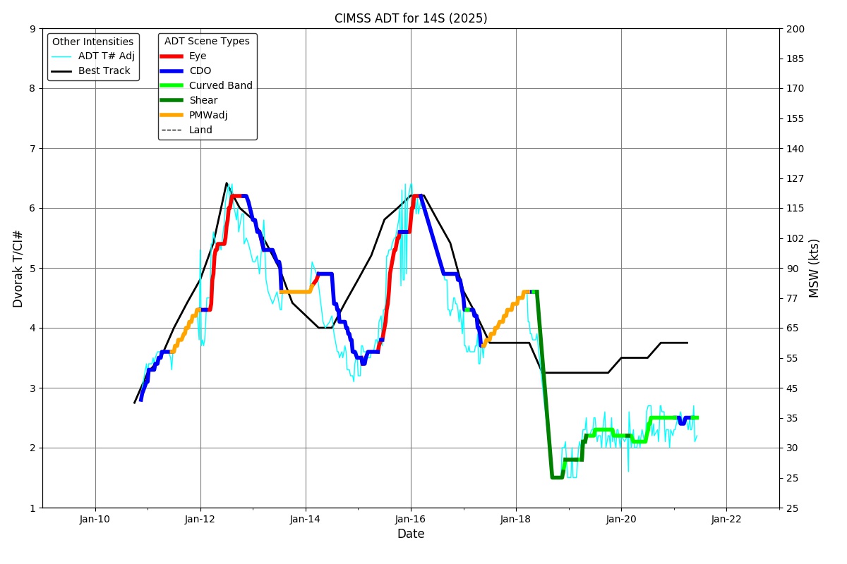
ADT
|
| Date |
Time |
Vmax |
MSLP |
| 11Jan2026 |
0030UTC |
51 kts |
997 hPa |
| Scene |
CI# |
FT# |
AdjT# |
RawT# |
Eye T |
Cloud T |
| UNIFRM |
3.3 |
3.3 |
3.4 |
3.4 |
-75.45C |
-71.60C |
|
|
|
|
AiDT
|
| Date |
Time |
Vmax |
|
| 11Jan2026 |
0030UTC |
39 kts |
|
|
|
|
|
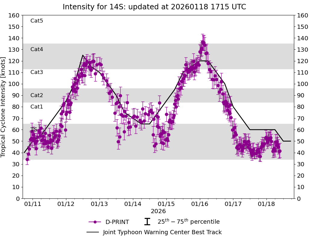
DPRINT
|
| Date |
Time |
Vmax |
MSLP |
| 11Jan2026 |
0030UTC |
56 kts |
990 hPa |
| Vmax 25% |
Vmax 75% |
|
|
| 49 kts |
63 kts |
|
|
|
|
|
|
DMINT
|
| Date |
Time |
Vmax |
MSLP |
| 10Jan2026 |
2318UTC |
57 kts |
990 hPa |
| Vmax 25% |
Vmax 75% |
MW Instr. |
|
| 51 kts |
63 kts |
SSMISF18 |
|
|
|
| Date |
Time |
Vmax |
MSLP |
| 10Jan2026 |
2033UTC |
34 kts |
997 hPa |
| Vmax 25% |
Vmax 75% |
MW Instr. |
|
| 30 kts |
39 kts |
ATMS-N20 |
|
MPERC
|
| Date |
Time |
Prob. ERC onset
Full Model |
Prob. ERC onset
V-based |
| 19Feb2025 |
2000UTC |
0% |
0% |
|
|
|
|
MIMIC-TPW
|
|
|
|
MIMIC-TC
|
|
|
|
Shear Analysis
|
| Date |
Time |
Shear Magnitude
|
Shear Direction
|
| 11Jan2026 |
000UTC |
14 kts |
67 deg |
| Deep-layer vertical wind shear interpolated to storm center derived from the CIMSS AMV-aided analyses with vortex removed |
|
|
|
|
TC-Scale AMVs
|
|
|
|