|
Current Intensity Estimates
|
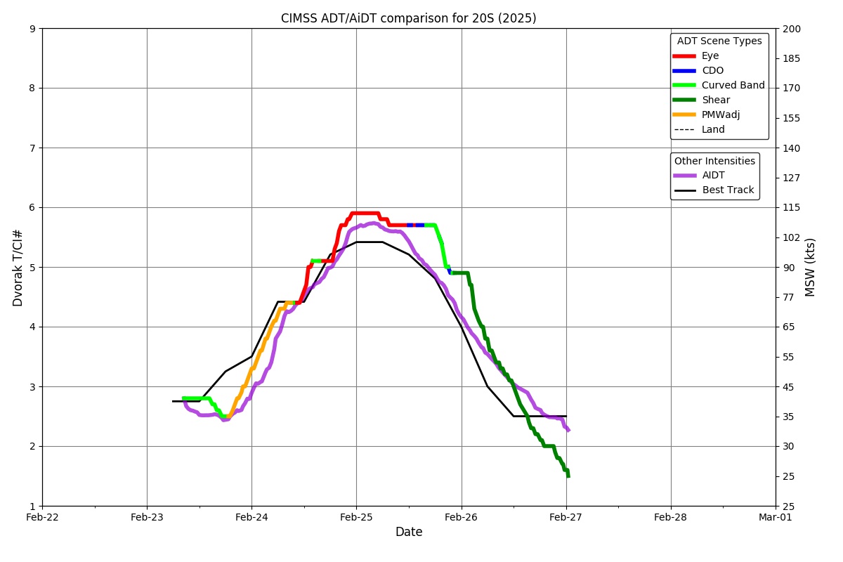
ADT
|
| Date |
Time |
Vmax |
MSLP |
| 25Feb2025 |
0000UTC |
112 kts |
951 hPa |
| Scene |
CI# |
FT# |
AdjT# |
RawT# |
Eye T |
Cloud T |
| EYE |
5.9 |
5.8 |
5.6 |
5.6 |
15.22C |
-61.22C |
|
|
|
|
AiDT
|
| Date |
Time |
Vmax |
|
| 25Feb2025 |
0000UTC |
105 kts |
|
|
|
|
|
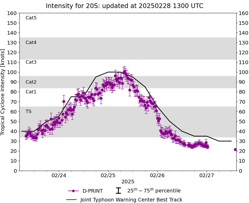
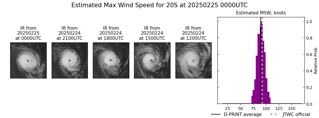
DPRINT
|
| Date |
Time |
Vmax |
MSLP |
| 25Feb2025 |
0000UTC |
90 kts |
961 hPa |
| Vmax 25% |
Vmax 75% |
|
|
| 84 kts |
95 kts |
|
|
|
|
|
|
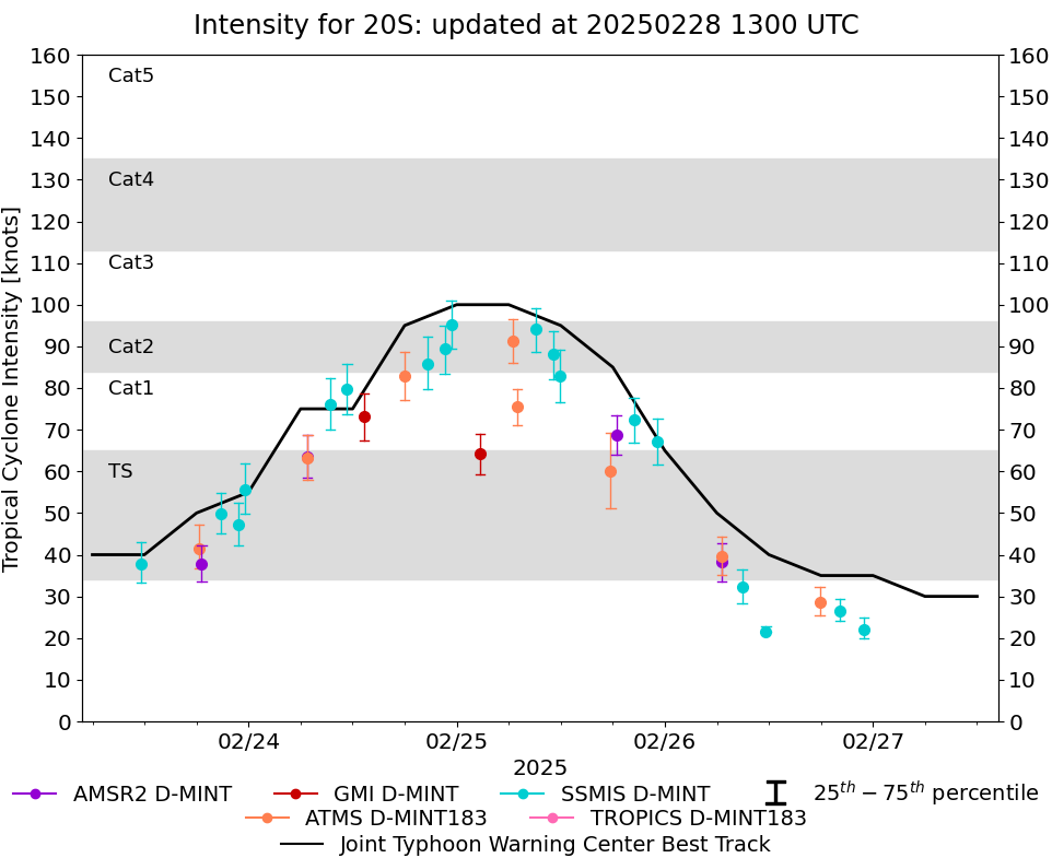
DMINT
|
| Date |
Time |
Vmax |
MSLP |
| 24Feb2025 |
2322UTC |
95 kts |
964 hPa |
| Vmax 25% |
Vmax 75% |
MW Instr. |
|
| 89 kts |
101 kts |
SSMISF16 |
|
|
|
|
|
MW Sounders
|
| Date |
Time |
Vmax |
MSLP |
| 24Feb2025 |
1801UTC |
69 kts |
973 hPa |
|
|
|
|
SATCON
|
| Date |
Time |
Vmax |
MSLP |
| 24Feb2025 |
1900UTC |
82 kts |
969 hPa |
| Consensus Members |
| 2 (ADT+Sounders) |
|
|
|