|
Current Intensity Estimates
|
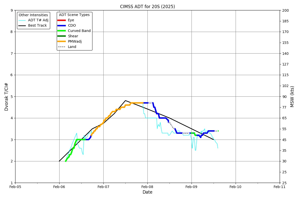
ADT
|
| Date |
Time |
Vmax |
MSLP |
| 06Feb2026 |
1400UTC |
45 kts |
992 hPa |
| Scene |
CI# |
FT# |
AdjT# |
RawT# |
Eye T |
Cloud T |
| CRVBND |
3.0 |
2.6 |
3.0 |
3.5 |
-58.06C |
-68.14C |
|
|
|
|
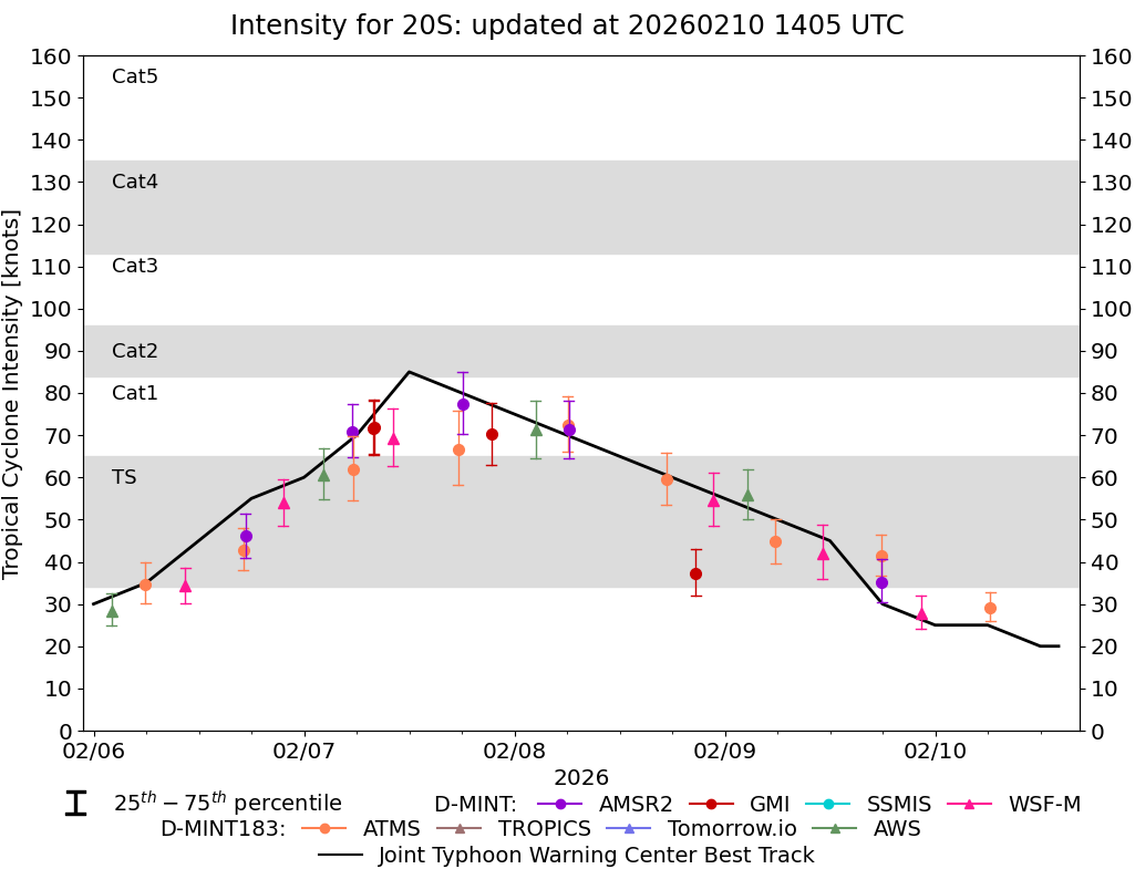
AiDT
|
| Date |
Time |
Vmax |
|
| 06Feb2026 |
1400UTC |
38 kts |
|
|
|
|
|
DPRINT
|
| Date |
Time |
Vmax |
MSLP |
| 06Feb2026 |
1400UTC |
36 kts |
991 hPa |
| Vmax 25% |
Vmax 75% |
|
|
| 31 kts |
41 kts |
|
|
|
|
|
|
DMINT
|
| Date |
Time |
Vmax |
MSLP |
| 06Feb2026 |
1029UTC |
34 kts |
992 hPa |
| Vmax 25% |
Vmax 75% |
MW Instr. |
|
| 30 kts |
39 kts |
WSFM01 |
|
|
|
|
|
MW Sounders
|
| Date |
Time |
Vmax |
MSLP |
| 06Feb2026 |
0555UTC |
48 kts |
990 hPa |
|
|
Shear Analysis
|
| Date |
Time |
Shear Magnitude
|
Shear Direction
|
| 06Feb2026 |
1200UTC |
14 kts |
79 deg |
| Deep-layer vertical wind shear interpolated to storm center derived from the CIMSS AMV-aided analyses with vortex removed |
|
|
|
|
TC-Scale AMVs
|
|
|
|