|
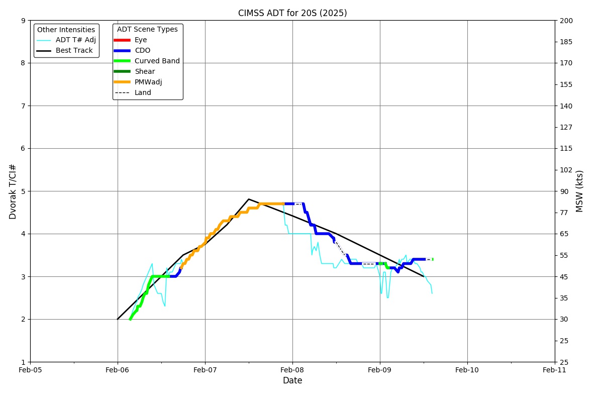
Current Intensity Estimates
|
ADT
|
| Date |
Time |
Vmax |
MSLP |
| 07Feb2026 |
0810UTC |
74 kts |
971 hPa |
| Scene |
CI# |
FT# |
AdjT# |
RawT# |
Eye T |
Cloud T |
| UNIFRM |
4.4 |
4.4 |
4.4 |
3.7 |
-78.02C |
-77.46C |
|
|
|
|
AiDT
|
| Date |
Time |
Vmax |
|
| 07Feb2026 |
0810UTC |
72 kts |
|
|
|
|
|
DPRINT
|
| Date |
Time |
Vmax |
MSLP |
| 07Feb2026 |
0810UTC |
55 kts |
971 hPa |
| Vmax 25% |
Vmax 75% |
|
|
| 49 kts |
62 kts |
|
|
|
|
|
|
DMINT
|
| Date |
Time |
Vmax |
MSLP |
| 07Feb2026 |
0800UTC |
72 kts |
964 hPa |
| Vmax 25% |
Vmax 75% |
MW Instr. |
|
| 66 kts |
78 kts |
GMI |
|
|
|
| Date |
Time |
Vmax |
MSLP |
| 07Feb2026 |
0757UTC |
72 kts |
964 hPa |
| Vmax 25% |
Vmax 75% |
MW Instr. |
|
| 65 kts |
78 kts |
GMI |
|
28.0% |
18.1% |
10.4% |
4.3% |
1.2% |
|
|
|
|
Position Estimates
|
ARCHER
|
| Date |
Time |
Latitude |
Longitude |
| 07Feb2026 |
0757UTC |
-19.70S |
117.28E |
| Satellite |
Sensor |
Eye Diameter |
Eye Cert % |
| GMI |
85-92GHz |
0.60 deg |
100.0% |
|
|
|
|
TC Structure
|
MPERC
|
| Date |
Time |
Prob. ERC onset
Full Model |
Prob. ERC onset
V-based |
| N/A |
N/AUTC |
N/A |
N/A |
|
|
|
|
MIMIC-TPW
|
|
|
|
MIMIC-TC
|
|
|
|
Shear Analysis
|
| Date |
Time |
Shear Magnitude
|
Shear Direction
|
| 07Feb2026 |
600UTC |
21 kts |
83 deg |
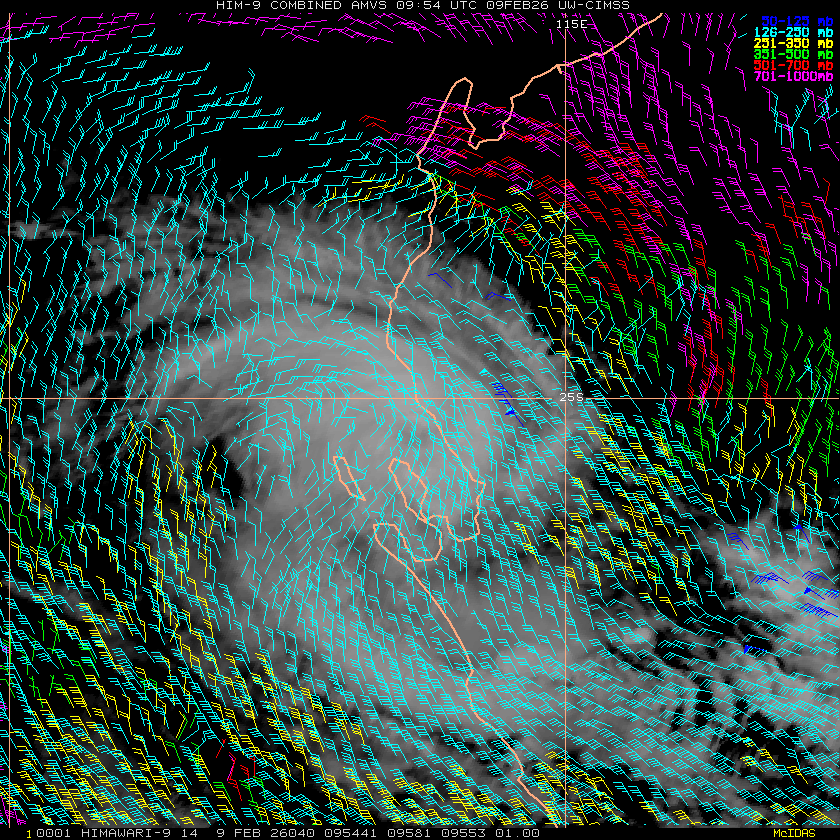
| Deep-layer vertical wind shear interpolated to storm center derived from the CIMSS AMV-aided analyses with vortex removed |
|
|
|
|
TC-Scale AMVs
|
|
|
|