|
Current Intensity Estimates
|
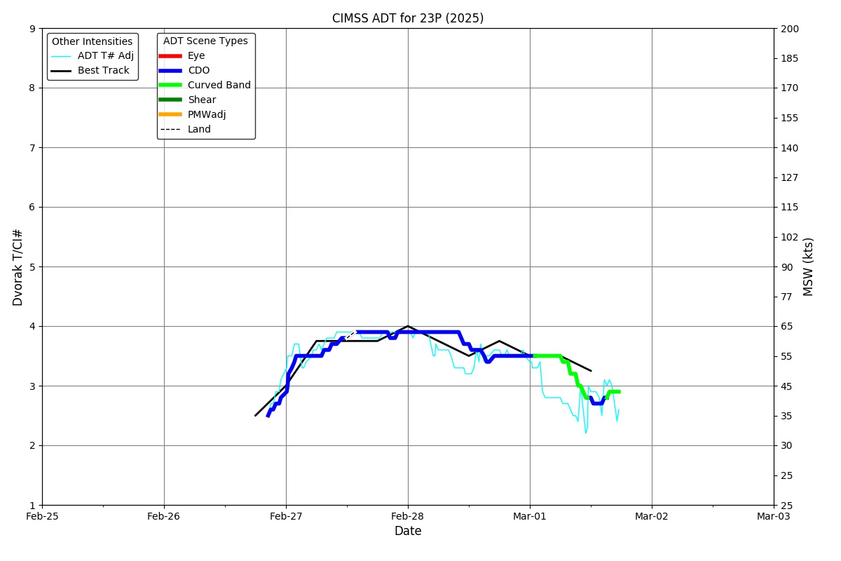
ADT
|
| Date |
Time |
Vmax |
MSLP |
| 28Feb2026 |
1900UTC |
55 kts |
987 hPa |
| Scene |
CI# |
FT# |
AdjT# |
RawT# |
Eye T |
Cloud T |
| EMBC |
3.5 |
3.5 |
3.5 |
3.5 |
-67.92C |
-69.30C |
|
|
|
|
AiDT
|
| Date |
Time |
Vmax |
|
| 28Feb2026 |
1900UTC |
61 kts |
|
|
|
|
|
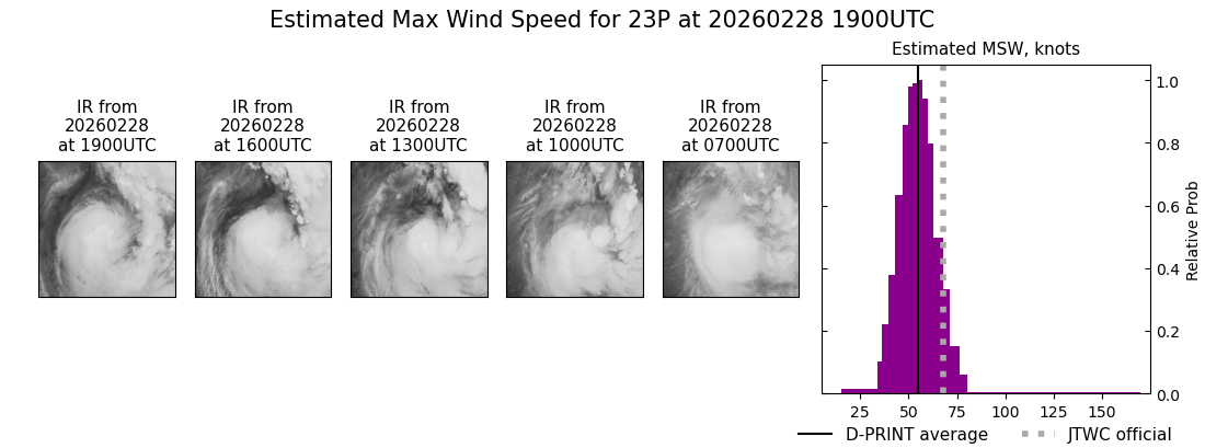
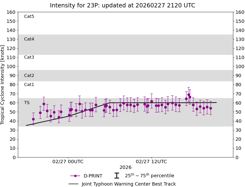
DPRINT
|
| Date |
Time |
Vmax |
MSLP |
| 28Feb2026 |
1900UTC |
55 kts |
984 hPa |
| Vmax 25% |
Vmax 75% |
|
|
| 48 kts |
61 kts |
|
|
|
|
|
|
DMINT
|
| Date |
Time |
Vmax |
MSLP |
| 28Feb2026 |
1739UTC |
48 kts |
990 hPa |
| Vmax 25% |
Vmax 75% |
MW Instr. |
|
| 42 kts |
55 kts |
SSMISF17 |
|
|
|
| Date |
Time |
Vmax |
MSLP |
| 28Feb2026 |
1646UTC |
45 kts |
990 hPa |
| Vmax 25% |
Vmax 75% |
MW Instr. |
|
| 39 kts |
52 kts |
SSMISF18 |
|
MPERC
|
| Date |
Time |
Prob. ERC onset
Full Model |
Prob. ERC onset
V-based |
| 28Feb2026 |
1700UTC |
10% |
3% |
|
|
|
|
MIMIC-TPW
|
|
|
|
MIMIC-TC
|
|
|
|
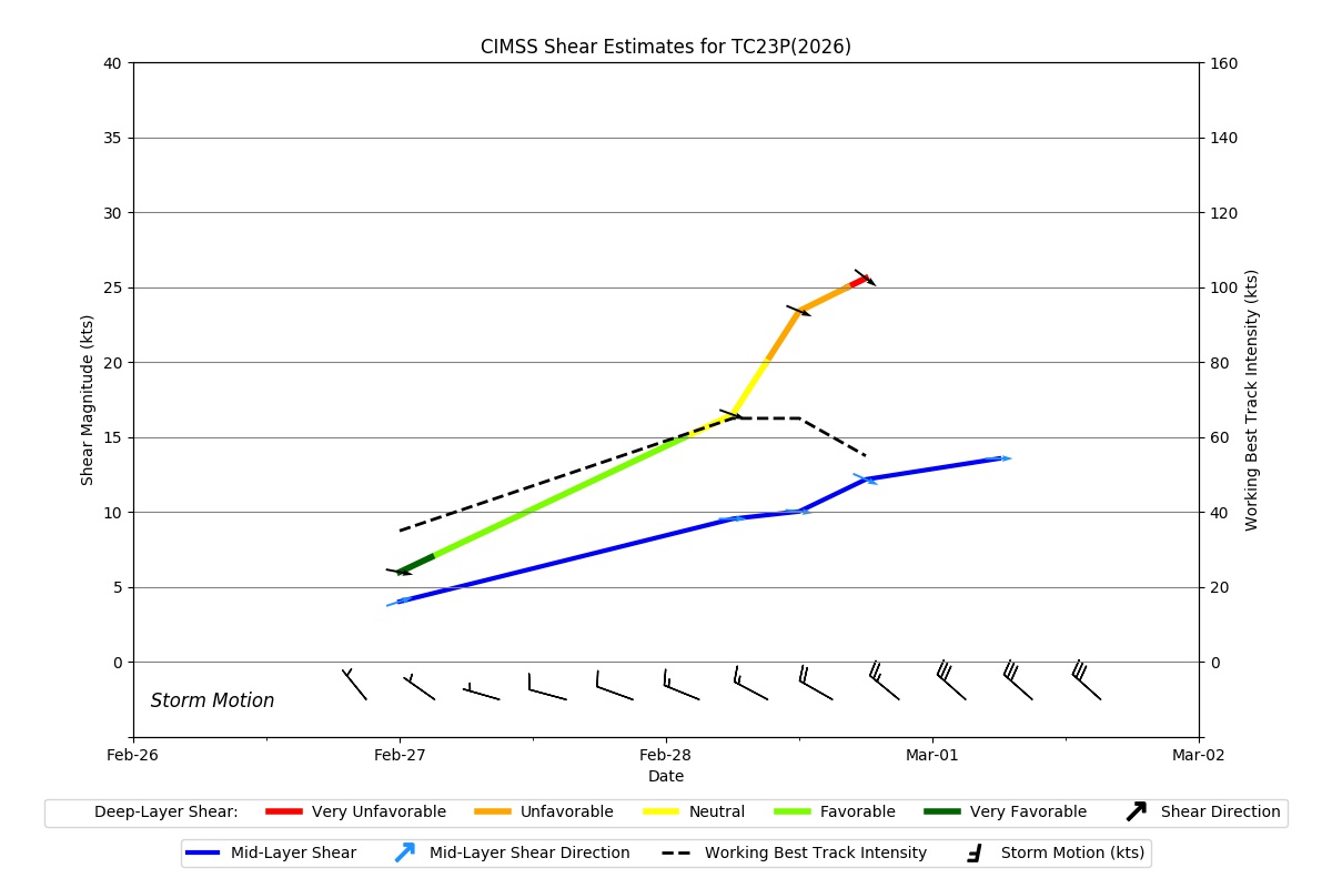
Shear Analysis
|
| Date |
Time |
Shear Magnitude
|
Shear Direction
|
| 28Feb2026 |
1800UTC |
26 kts |
308 deg |
| Deep-layer vertical wind shear interpolated to storm center derived from the CIMSS AMV-aided analyses with vortex removed |
|
|
|
|
TC-Scale AMVs
|
|
|
|