|
Current Intensity Estimates
|
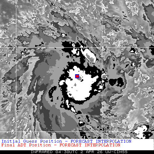
ADT
|
| Date |
Time |
Vmax |
MSLP |
| 02Apr2026 |
0430UTC |
41 kts |
1004 hPa |
| Scene |
CI# |
FT# |
AdjT# |
RawT# |
Eye T |
Cloud T |
| UNIFRM |
2.8 |
2.8 |
3.1 |
3.4 |
-70.83C |
-70.40C |
|
|
|
|
AiDT
|
| Date |
Time |
Vmax |
|
| 02Apr2026 |
0130UTC |
35 kts |
|
|
|
|
|
DPRINT
|
| Date |
Time |
Vmax |
MSLP |
| 02Apr2026 |
0500UTC |
30 kts |
998 hPa |
| Vmax 25% |
Vmax 75% |
|
|
| 27 kts |
34 kts |
|
|
|
|
|
|
DMINT
|
| Date |
Time |
Vmax |
MSLP |
| 02Apr2026 |
0328UTC |
36 kts |
1000 hPa |
| Vmax 25% |
Vmax 75% |
MW Instr. |
|
| 31 kts |
40 kts |
SSMISF16 |
|
|
|
| Date |
Time |
Vmax |
MSLP |
| 02Apr2026 |
0125UTC |
28 kts |
1000 hPa |
| Vmax 25% |
Vmax 75% |
MW Instr. |
|
| 24 kts |
32 kts |
WSFM01 |
|
02Apr2026 |
0150UTC |
-11.82S |
73.38E |
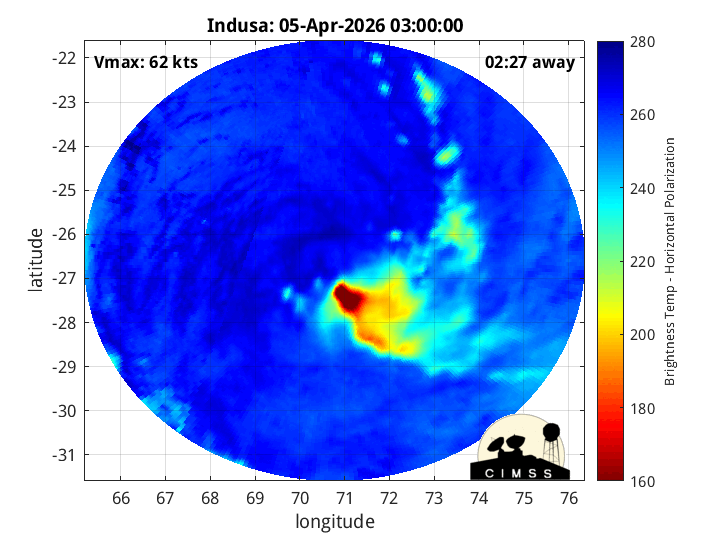
| Satellite |
Sensor |
Eye Diameter |
Eye Cert % |
| SSMIS-16 |
85-92GHz |
1.00 deg |
57.3% |
|
|
|
|
TC Structure
|
MPERC
|
| Date |
Time |
Prob. ERC onset
Full Model |
Prob. ERC onset
V-based |
| N/A |
N/AUTC |
N/A |
N/A |
|
|
|
|
MIMIC-TPW
|
|
|
|
MIMIC-TC
|
|
|
|
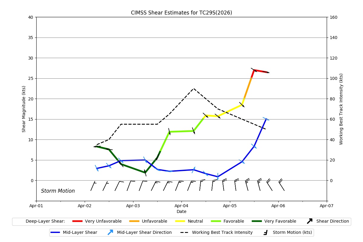
Shear Analysis
|
| Date |
Time |
Shear Magnitude
|
Shear Direction
|
| N/A |
N/AUTC |
N/A kts |
N/A deg |
| Deep-layer vertical wind shear interpolated to storm center derived from the CIMSS AMV-aided analyses with vortex removed |
|
|
|
|
TC-Scale AMVs
|
|
|
|