|
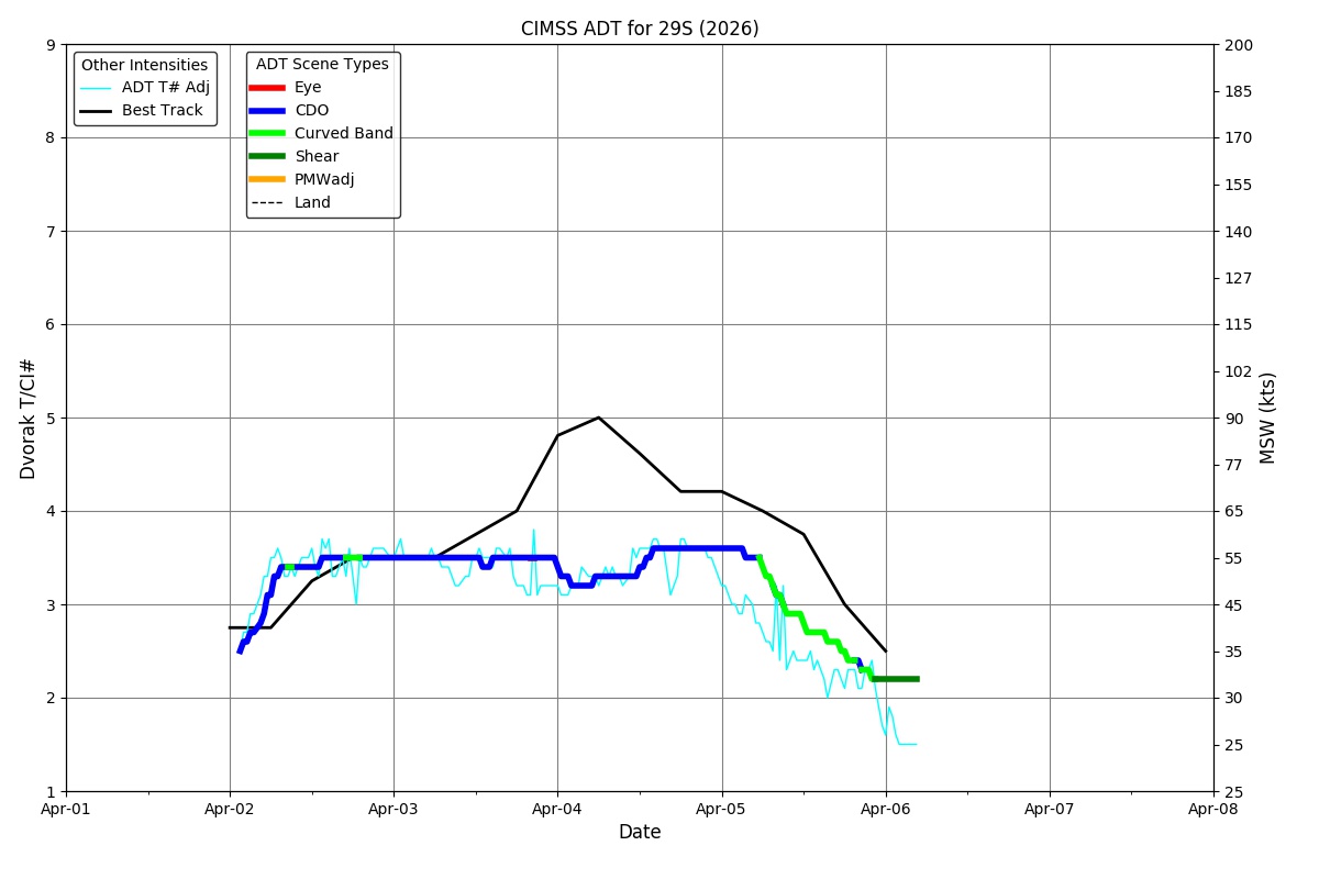
Current Intensity Estimates
|
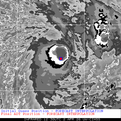
ADT
|
| Date |
Time |
Vmax |
MSLP |
| 02Apr2026 |
1230UTC |
53 kts |
996 hPa |
| Scene |
CI# |
FT# |
AdjT# |
RawT# |
Eye T |
Cloud T |
| UNIFRM |
3.4 |
3.4 |
3.4 |
3.4 |
-74.91C |
-66.69C |
|
|
|
|
AiDT
|
| Date |
Time |
Vmax |
|
| 02Apr2026 |
0130UTC |
35 kts |
|
|
|
|
|
DPRINT
|
| Date |
Time |
Vmax |
MSLP |
| 02Apr2026 |
1230UTC |
44 kts |
996 hPa |
| Vmax 25% |
Vmax 75% |
|
|
| 39 kts |
51 kts |
|
|
|
|
|
|
DMINT
|
| Date |
Time |
Vmax |
MSLP |
| 02Apr2026 |
1116UTC |
41 kts |
998 hPa |
| Vmax 25% |
Vmax 75% |
MW Instr. |
|
| 36 kts |
47 kts |
SSMISF18 |
|
|
|
| Date |
Time |
Vmax |
MSLP |
| 02Apr2026 |
0850UTC |
42 kts |
995 hPa |
| Vmax 25% |
Vmax 75% |
MW Instr. |
|
| 37 kts |
47 kts |
ATMS-N20 |
|
MPERC
|
| Date |
Time |
Prob. ERC onset
Full Model |
Prob. ERC onset
V-based |
| N/A |
N/AUTC |
N/A |
N/A |
|
|
|
|
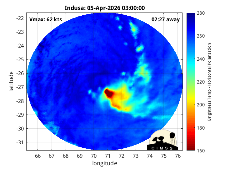
MIMIC-TPW
|
|
|
|
MIMIC-TC
|
|
|
|
Shear Analysis
|
| Date |
Time |
Shear Magnitude
|
Shear Direction
|
| 02Apr2026 |
1200UTC |
8 kts |
97 deg |
| Deep-layer vertical wind shear interpolated to storm center derived from the CIMSS AMV-aided analyses with vortex removed |
|
|
|
|
TC-Scale AMVs
|
|
|
|