|
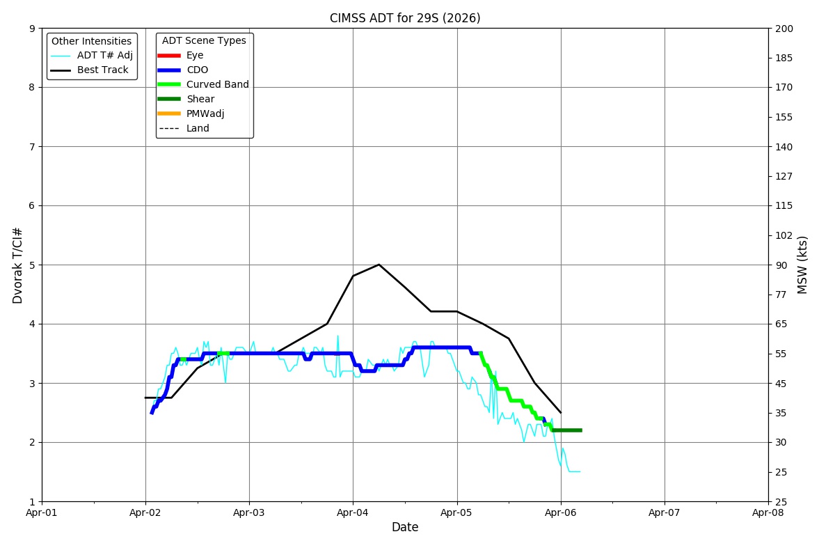
Current Intensity Estimates
|
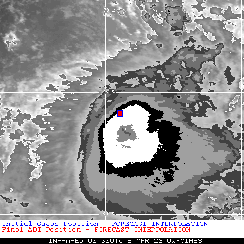
ADT
|
| Date |
Time |
Vmax |
MSLP |
| 05Apr2026 |
0030UTC |
57 kts |
988 hPa |
| Scene |
CI# |
FT# |
AdjT# |
RawT# |
Eye T |
Cloud T |
| UNIFRM |
3.6 |
3.3 |
3.2 |
3.2 |
-64.49C |
-63.01C |
|
|
|
|
AiDT
|
| Date |
Time |
Vmax |
|
| 05Apr2026 |
0030UTC |
55 kts |
|
|
|
|
|
DPRINT
|
| Date |
Time |
Vmax |
MSLP |
| 05Apr2026 |
0030UTC |
59 kts |
987 hPa |
| Vmax 25% |
Vmax 75% |
|
|
| 52 kts |
67 kts |
|
|
|
|
|
|
DMINT
|
| Date |
Time |
Vmax |
MSLP |
| 05Apr2026 |
0031UTC |
49 kts |
985 hPa |
| Vmax 25% |
Vmax 75% |
MW Instr. |
|
| 43 kts |
56 kts |
SSMISF17 |
|
|
|
| Date |
Time |
Vmax |
MSLP |
| 04Apr2026 |
2103UTC |
72 kts |
977 hPa |
| Vmax 25% |
Vmax 75% |
MW Instr. |
|
| 66 kts |
78 kts |
ATMS-N20 |
|
0.1% |
0.1% |
3.8% |
2.3% |
2.4% |
|
|
|
|
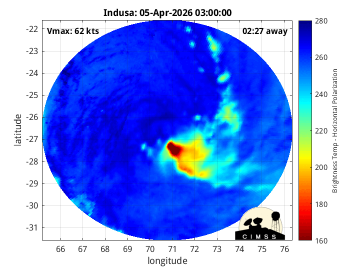
Position Estimates
|
ARCHER
|
| Date |
Time |
Latitude |
Longitude |
| 05Apr2026 |
0032UTC |
-26.83S |
71.17E |
| Satellite |
Sensor |
Eye Diameter |
Eye Cert % |
| SSMIS-17 |
85-92GHz |
0.50 deg |
7.5% |
|
|
|
|
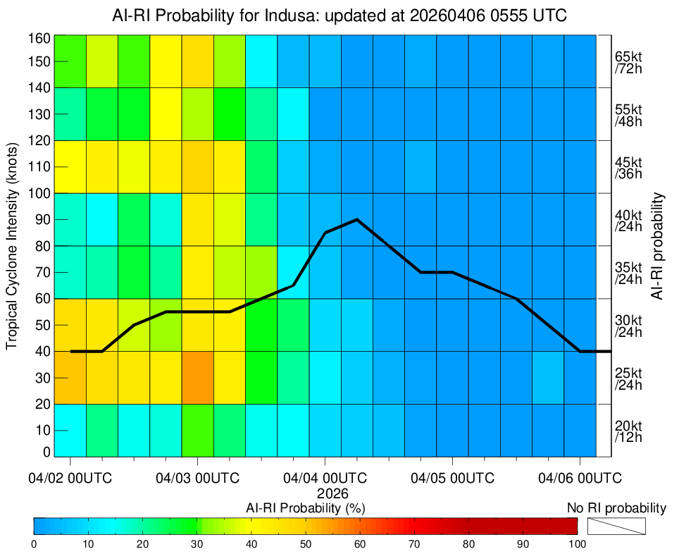
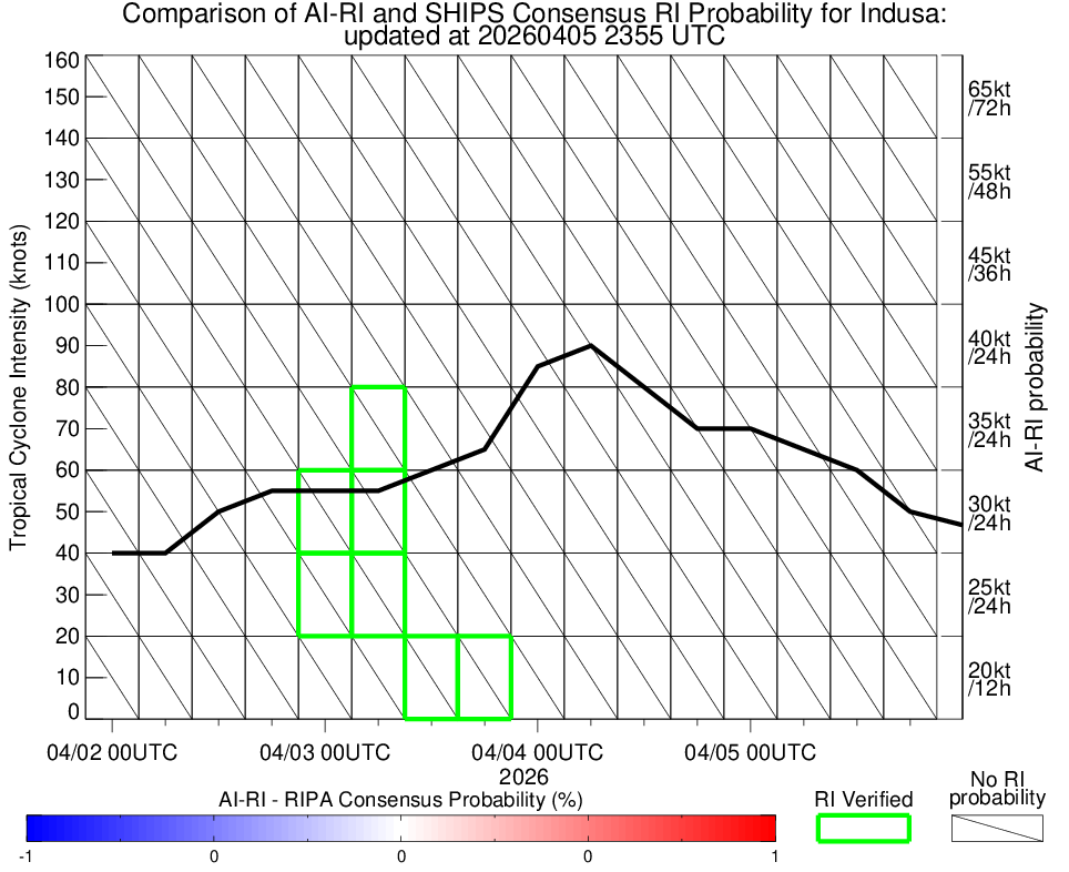
TC Structure
|
MPERC
|
| Date |
Time |
Prob. ERC onset
Full Model |
Prob. ERC onset
V-based |
| 05Apr2026 |
0000UTC |
4% |
3% |
|
|
|
|
MIMIC-TPW
|
|
|
|
MIMIC-TC
|
|
|
|
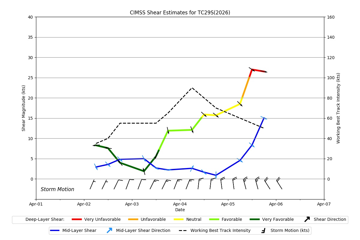
Shear Analysis
|
| Date |
Time |
Shear Magnitude
|
Shear Direction
|
| 05Apr2026 |
000UTC |
20 kts |
299 deg |
| Deep-layer vertical wind shear interpolated to storm center derived from the CIMSS AMV-aided analyses with vortex removed |
|
|
|
|
TC-Scale AMVs
|
|
|
|