|
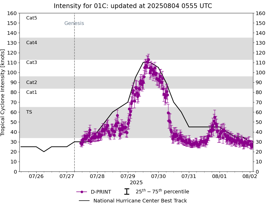
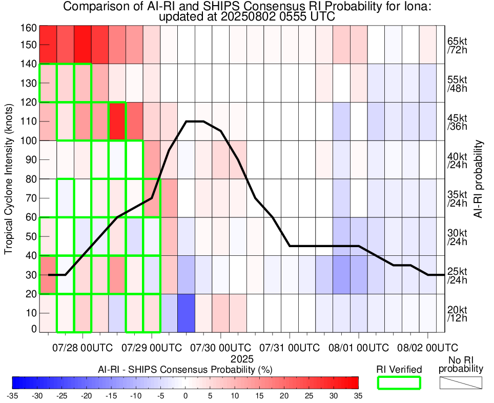
Current Intensity Estimates
|
ADT
|
| Date |
Time |
Vmax |
MSLP |
| 02Aug2025 |
1720UTC |
47 kts |
1001 hPa |
| Scene |
CI# |
FT# |
AdjT# |
RawT# |
Eye T |
Cloud T |
| UNIFRM |
3.1 |
3.1 |
3.0 |
3.4 |
-55.81C |
-59.24C |
|
|
|
|
AiDT
|
| Date |
Time |
Vmax |
|
| 02Aug2025 |
1720UTC |
39 kts |
|
|
|
|
|
DPRINT
|
| Date |
Time |
Vmax |
MSLP |
| 02Aug2025 |
1710UTC |
35 kts |
1005 hPa |
| Vmax 25% |
Vmax 75% |
|
|
| 31 kts |
39 kts |
|
|
|
|
|
|
DMINT
|
| Date |
Time |
Vmax |
MSLP |
| 02Aug2025 |
1306UTC |
27 kts |
1008 hPa |
| Vmax 25% |
Vmax 75% |
MW Instr. |
|
| 25 kts |
31 kts |
ATMS- |
|
|
|
|
|
MW Sounders
|
| Date |
Time |
Vmax |
MSLP |
| 02Aug2025 |
0100UTC |
48 kts |
1000 hPa |
|
|
|
|
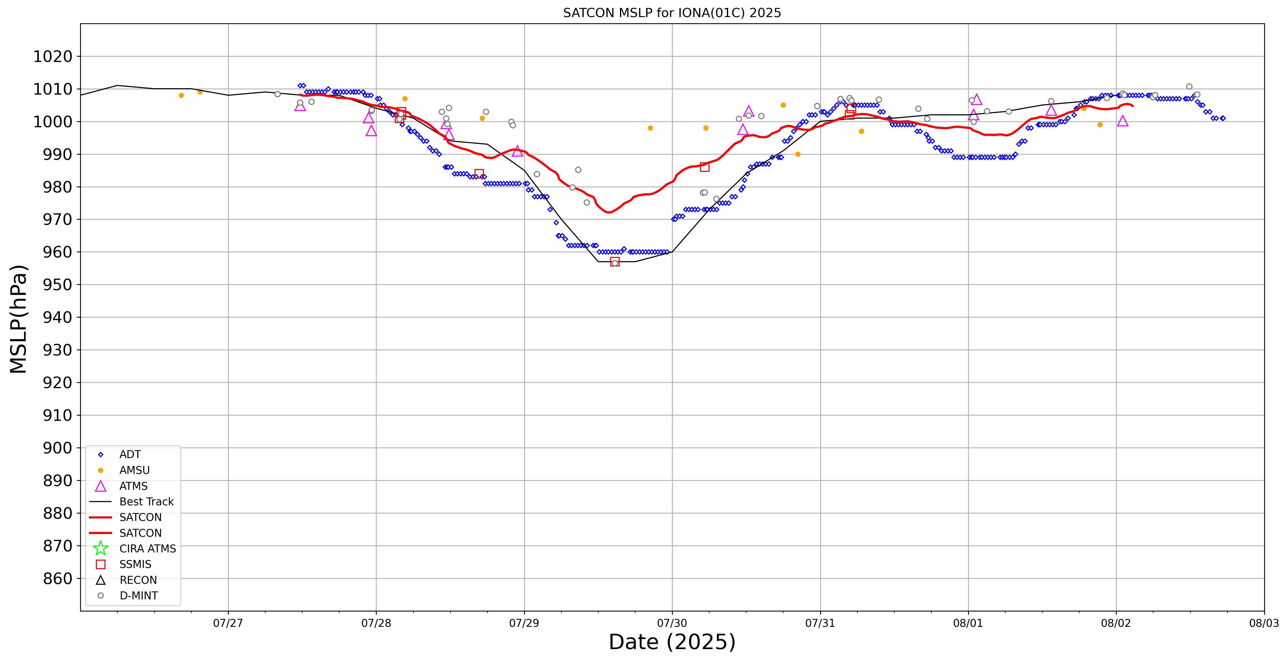
SATCON
|
| Date |
Time |
Vmax |
MSLP |
| 02Aug2025 |
0240UTC |
42 kts |
1005 hPa |
| Consensus Members |
| 2 (ADT+Sounders) |
|
|
|