|
Current Intensity Estimates
|
ADT
|
| Date |
Time |
Vmax |
MSLP |
| 15Jun2025 |
0520UTC |
N/A kts |
N/A hPa |
| Scene |
CI# |
FT# |
AdjT# |
RawT# |
Eye T |
Cloud T |
| LAND |
N/A |
N/A |
N/A |
N/A |
N/AC |
N/AC |
|
|
|
|
AiDT
|
| Date |
Time |
Vmax |
|
| 14Jun2025 |
0730UTC |
66 kts |
|
|
|
|
|
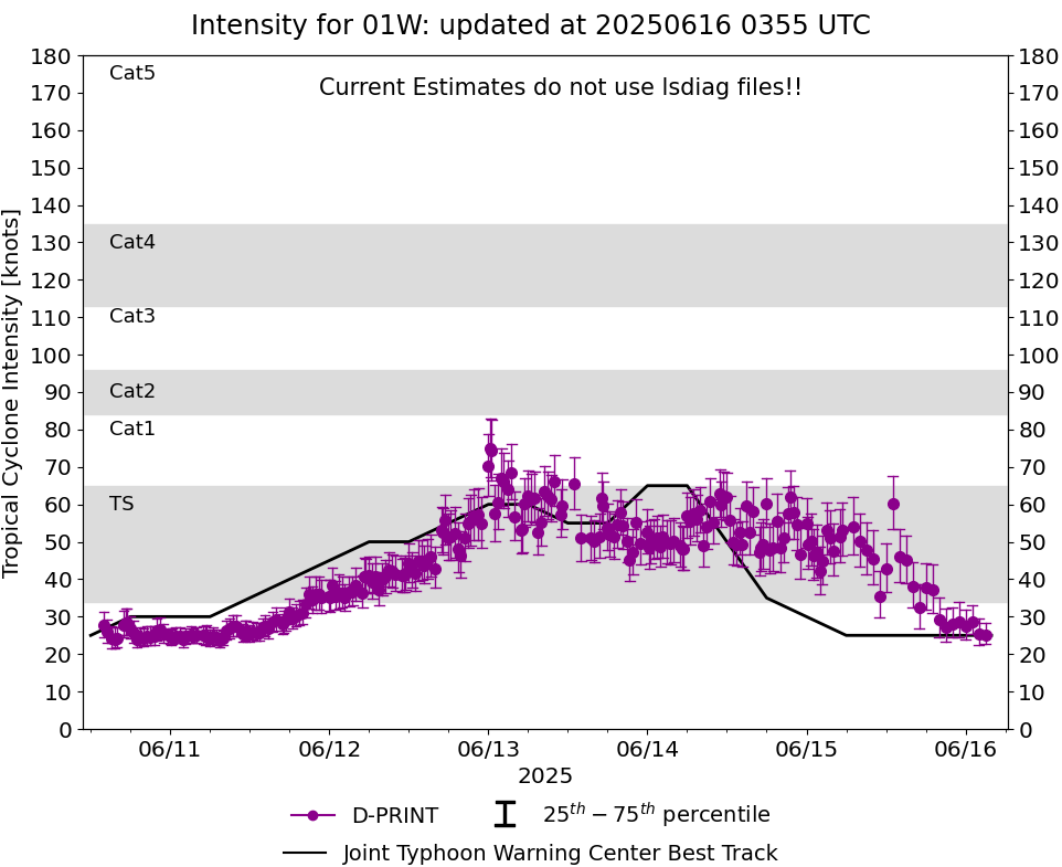
DPRINT
|
| Date |
Time |
Vmax |
MSLP |
| 15Jun2025 |
0520UTC |
53 kts |
982 hPa |
| Vmax 25% |
Vmax 75% |
|
|
| 46 kts |
60 kts |
|
|
|
|
|
|
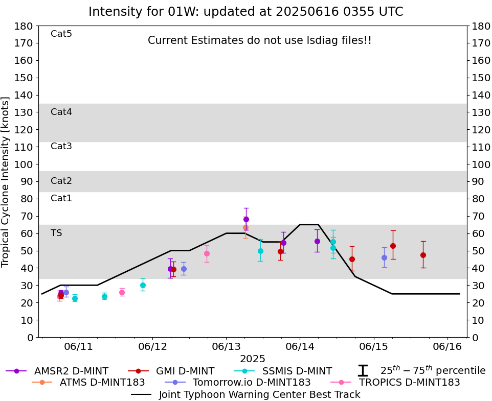
DMINT
|
| Date |
Time |
Vmax |
MSLP |
| 14Jun2025 |
1653UTC |
45 kts |
988 hPa |
| Vmax 25% |
Vmax 75% |
MW Instr. |
|
| 38 kts |
53 kts |
GMI |
|
|
|
|
|
MW Sounders
|
| Date |
Time |
Vmax |
MSLP |
| 15Jun2025 |
0215UTC |
86 kts |
958 hPa |
|
|
|
|
SATCON
|
| Date |
Time |
Vmax |
MSLP |
| 14Jun2025 |
0730UTC |
68 kts |
971 hPa |
| Consensus Members |
| 3 (ADT+Sounders) |
|
|
|