|
Current Intensity Estimates
|
ADT
|
| Date |
Time |
Vmax |
MSLP |
| 21Jan2026 |
1110UTC |
25 kts |
1004 hPa |
| Scene |
CI# |
FT# |
AdjT# |
RawT# |
Eye T |
Cloud T |
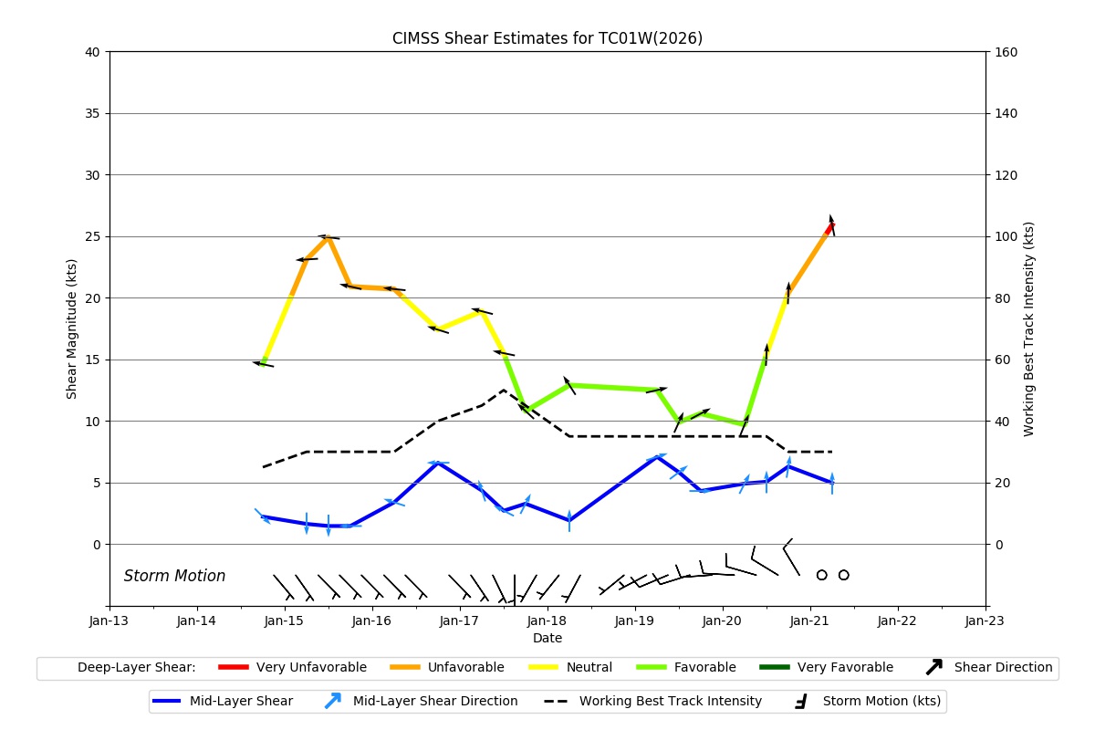
| SHEAR |
1.5 |
1.5 |
1.5 |
1.5 |
22.46C |
18.67C |
|
|
|
|
AiDT
|
| Date |
Time |
Vmax |
|
| 21Jan2026 |
1110UTC |
29 kts |
|
|
|
|
|
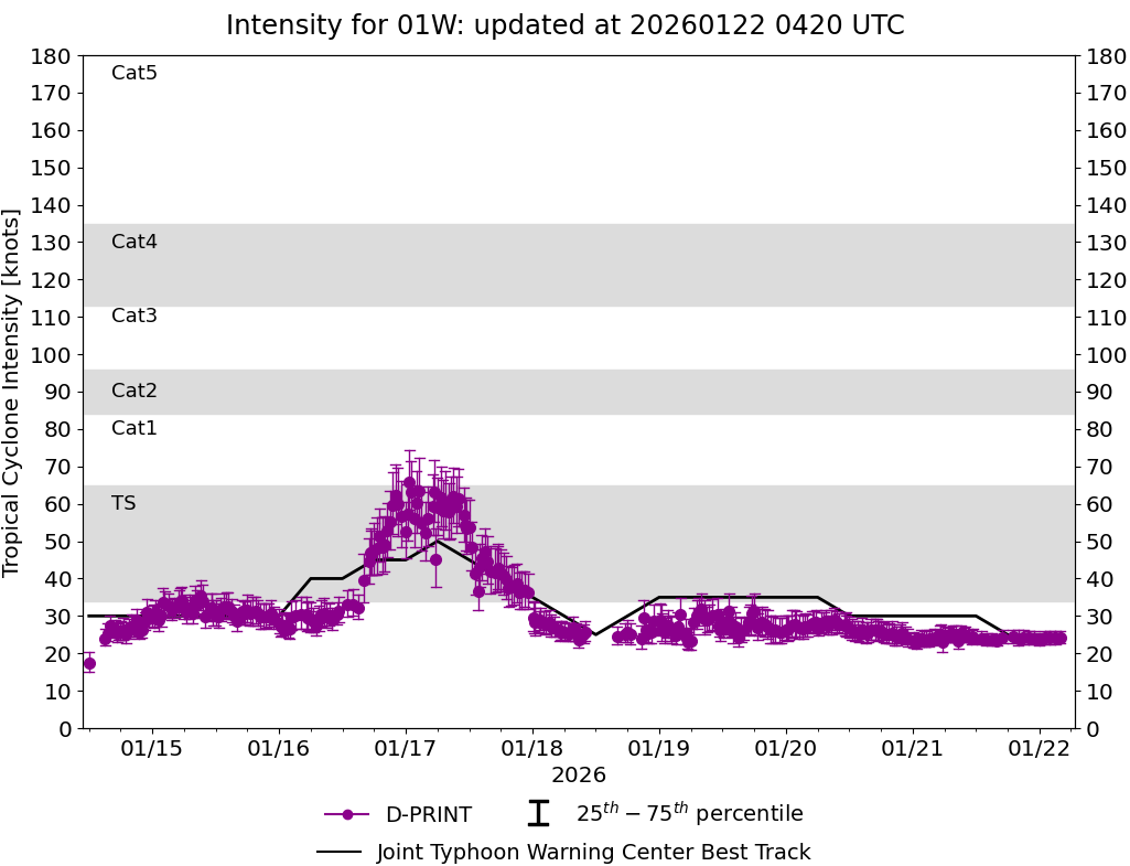
DPRINT
|
| Date |
Time |
Vmax |
MSLP |
| 21Jan2026 |
1110UTC |
24 kts |
999 hPa |
| Vmax 25% |
Vmax 75% |
|
|
| 22 kts |
26 kts |
|
|
|
|
|
|
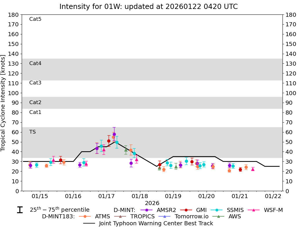
DMINT
|
| Date |
Time |
Vmax |
MSLP |
| 21Jan2026 |
0423UTC |
24 kts |
1001 hPa |
| Vmax 25% |
Vmax 75% |
MW Instr. |
|
| 22 kts |
27 kts |
ATMS-N20 |
|
|
|
|
|
MW Sounders
|
| Date |
Time |
Vmax |
MSLP |
| 21Jan2026 |
0423UTC |
39 kts |
996 hPa |
|
|
|
|
SATCON
|
| Date |
Time |
Vmax |
MSLP |
| 21Jan2026 |
0610UTC |
37 kts |
1000 hPa |
| Consensus Members |
| 2 (ADT+Sounders) |
|
|
|