|
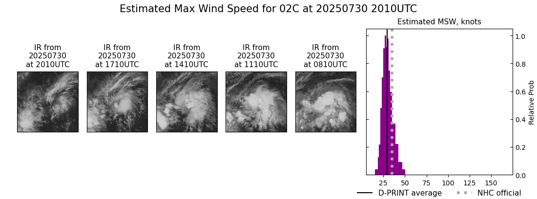
Current Intensity Estimates
|
ADT
|
| Date |
Time |
Vmax |
MSLP |
| 30Jul2025 |
2010UTC |
49 kts |
1000 hPa |
| Scene |
CI# |
FT# |
AdjT# |
RawT# |
Eye T |
Cloud T |
| SHEAR |
3.2 |
2.5 |
2.9 |
3.4 |
13.86C |
-7.88C |
|
|
|
|
AiDT
|
| Date |
Time |
Vmax |
|
| 30Jul2025 |
2010UTC |
42 kts |
|
|
|
|
|
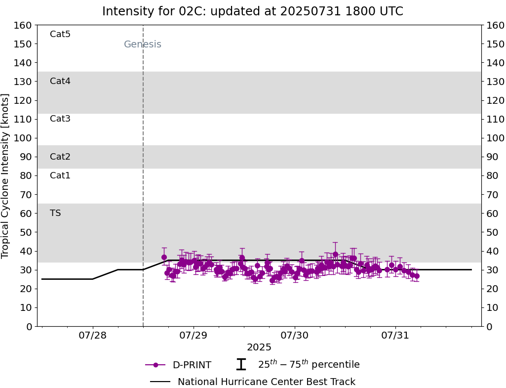
DPRINT
|
| Date |
Time |
Vmax |
MSLP |
| 30Jul2025 |
2010UTC |
30 kts |
1009 hPa |
| Vmax 25% |
Vmax 75% |
|
|
| 26 kts |
34 kts |
|
|
|
|
|
|
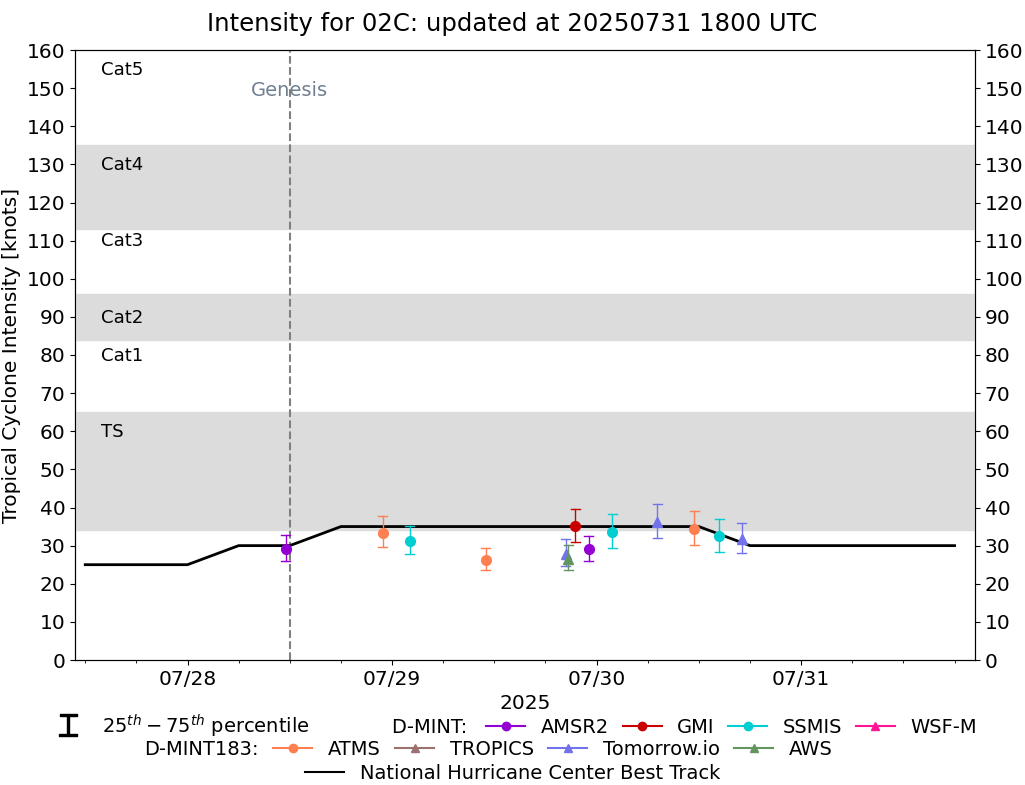
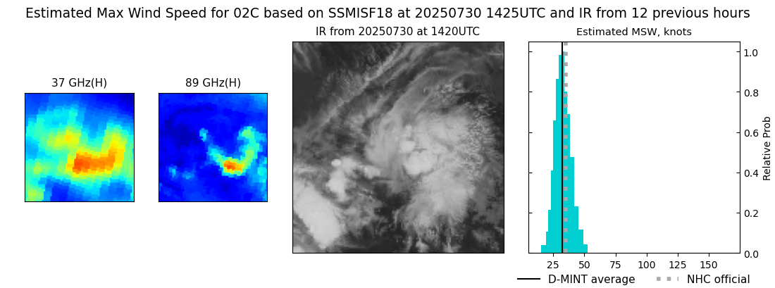
DMINT
|
| Date |
Time |
Vmax |
MSLP |
| 30Jul2025 |
1425UTC |
32 kts |
1007 hPa |
| Vmax 25% |
Vmax 75% |
MW Instr. |
|
| 28 kts |
37 kts |
SSMISF18 |
|
|
|
|
|
MW Sounders
|
| Date |
Time |
Vmax |
MSLP |
| 30Jul2025 |
1222UTC |
40 kts |
1007 hPa |
|
|
|
|
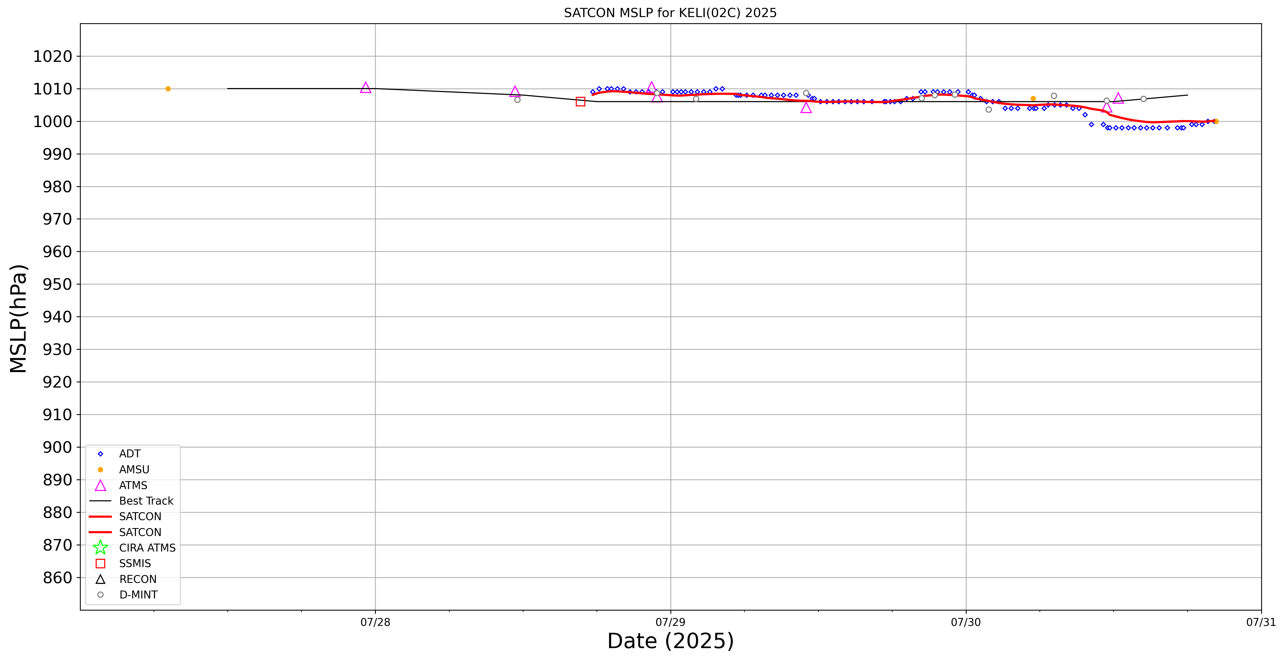
SATCON
|
| Date |
Time |
Vmax |
MSLP |
| 30Jul2025 |
1440UTC |
45 kts |
1002 hPa |
| Consensus Members |
| 2 (ADT+Sounders) |
|
|
|