|
Current Intensity Estimates
|
ADT
|
| Date |
Time |
Vmax |
MSLP |
| 26Jul2024 |
1810UTC |
25 kts |
1010 hPa |
| Scene |
CI# |
FT# |
AdjT# |
RawT# |
Eye T |
Cloud T |
| SHEAR |
1.5 |
1.5 |
1.5 |
1.5 |
20.55C |
14.22C |
|
|
|
|
AiDT
|
| Date |
Time |
Vmax |
|
| 26Jul2024 |
1810UTC |
30 kts |
|
|
|
|
|
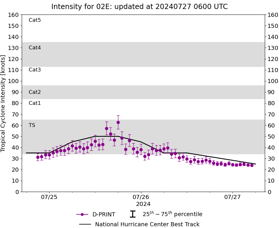
DPRINT
|
| Date |
Time |
Vmax |
MSLP |
| 26Jul2024 |
1800UTC |
27 kts |
1010 hPa |
| Vmax 25% |
Vmax 75% |
|
|
| 25 kts |
30 kts |
|
|
|
|
|
|
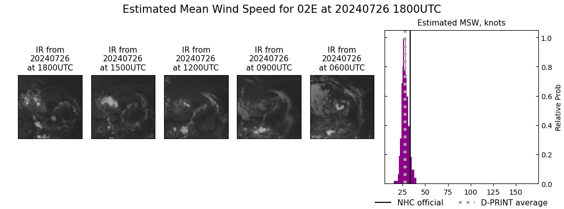
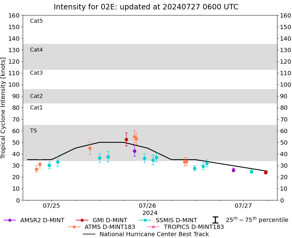
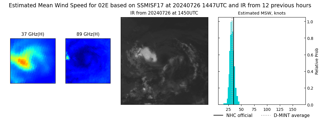
DMINT
|
| Date |
Time |
Vmax |
MSLP |
| 26Jul2024 |
1447UTC |
32 kts |
1008 hPa |
| Vmax 25% |
Vmax 75% |
MW Instr. |
|
| 29 kts |
35 kts |
SSMISF17 |
|
|
|
|
|
MW Sounders
|
| Date |
Time |
Vmax |
MSLP |
| 26Jul2024 |
0942UTC |
43 kts |
1004 hPa |
|
|
|
|
SATCON
|
| Date |
Time |
Vmax |
MSLP |
| 26Jul2024 |
1210UTC |
39 kts |
1007 hPa |
| Consensus Members |
| 2 (ADT+Sounders) |
|
|
|