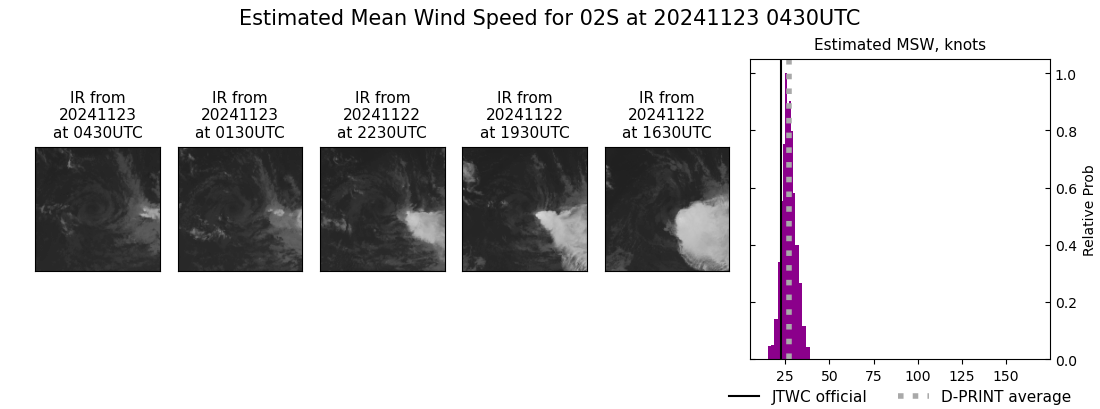
|
Current Intensity Estimates
|
ADT
|
| Date |
Time |
Vmax |
MSLP |
| 23Nov2024 |
0430UTC |
25 kts |
1007 hPa |
| Scene |
CI# |
FT# |
AdjT# |
RawT# |
Eye T |
Cloud T |
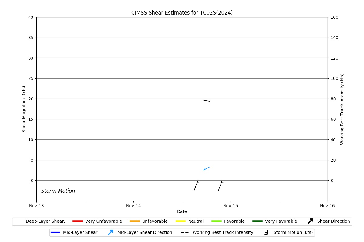
| SHEAR |
1.5 |
1.5 |
1.5 |
1.5 |
20.71C |
16.69C |
|
|
|
|
AiDT
|
| Date |
Time |
Vmax |
|
| 23Nov2024 |
0430UTC |
36 kts |
|
|
|
|
|
DPRINT
|
| Date |
Time |
Vmax |
MSLP |
| 23Nov2024 |
0430UTC |
27 kts |
NaN hPa |
| Vmax 25% |
Vmax 75% |
|
|
| 25 kts |
30 kts |
|
|
|
|
|
|
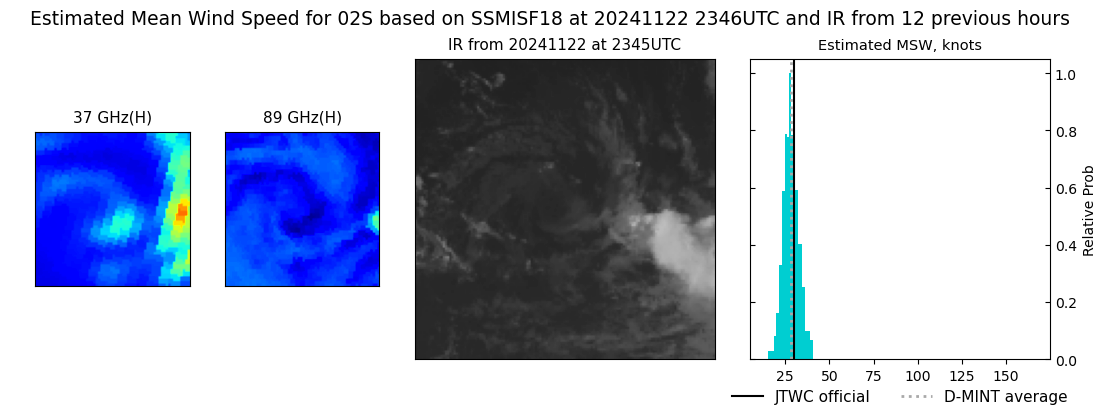
DMINT
|
| Date |
Time |
Vmax |
MSLP |
| 22Nov2024 |
2346UTC |
28 kts |
NaN hPa |
| Vmax 25% |
Vmax 75% |
MW Instr. |
|
| 25 kts |
31 kts |
SSMISF18 |
|
|
|
|
|
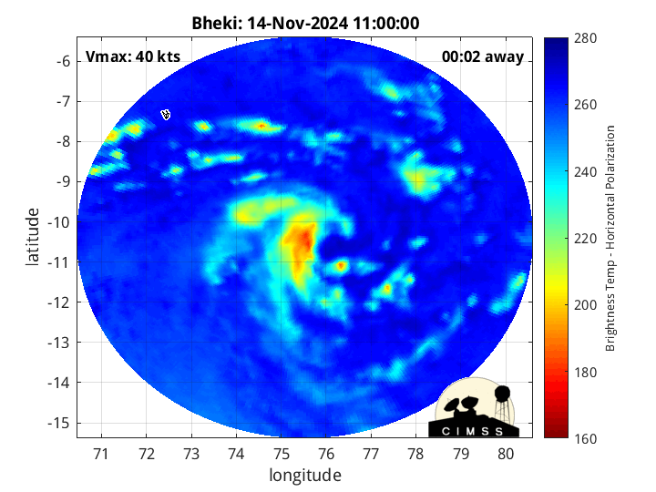
MW Sounders
|
| Date |
Time |
Vmax |
MSLP |
| 15Nov2025 |
0916UTC |
39 kts |
992 hPa |
|
|
|
|
SATCON
|
| Date |
Time |
Vmax |
MSLP |
| 23Nov2024 |
0430UTC |
44 kts |
1004 hPa |
| Consensus Members |
| 2 (ADT+Sounders) |
|
|
|