|
Current Intensity Estimates
|
ADT
|
| Date |
Time |
Vmax |
MSLP |
| 25Oct2024 |
2230UTC |
N/A kts |
N/A hPa |
| Scene |
CI# |
FT# |
AdjT# |
RawT# |
Eye T |
Cloud T |
| LAND |
N/A |
N/A |
N/A |
N/A |
N/AC |
N/AC |
|
|
|
|
AiDT
|
| Date |
Time |
Vmax |
|
| 25Oct2024 |
0300UTC |
57 kts |
|
|
|
|
|
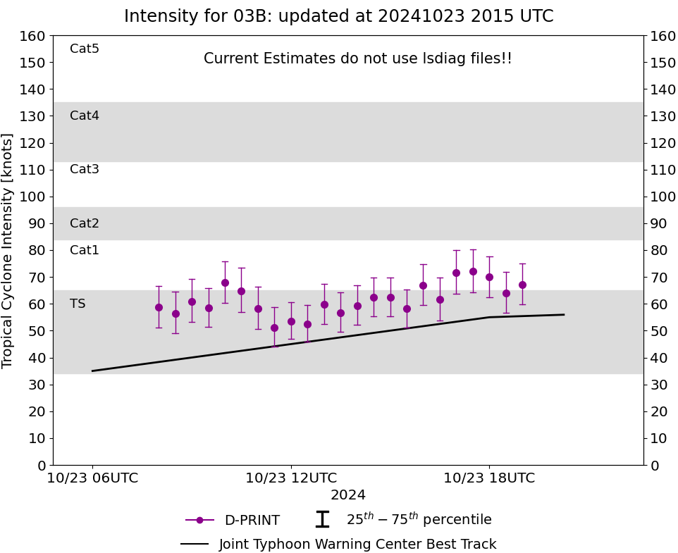
DPRINT
|
| Date |
Time |
Vmax |
MSLP |
| 25Oct2024 |
2200UTC |
40 kts |
NaN hPa |
| Vmax 25% |
Vmax 75% |
|
|
| 35 kts |
46 kts |
|
|
|
|
|
|
DMINT
|
| Date |
Time |
Vmax |
MSLP |
| 25Oct2024 |
2008UTC |
43 kts |
NaN hPa |
| Vmax 25% |
Vmax 75% |
MW Instr. |
|
| 37 kts |
49 kts |
AMSR2 |
|
|
|
|
|
MW Sounders
|
| Date |
Time |
Vmax |
MSLP |
| 25Oct2024 |
2008UTC |
42 kts |
989 hPa |
|
|
|
|
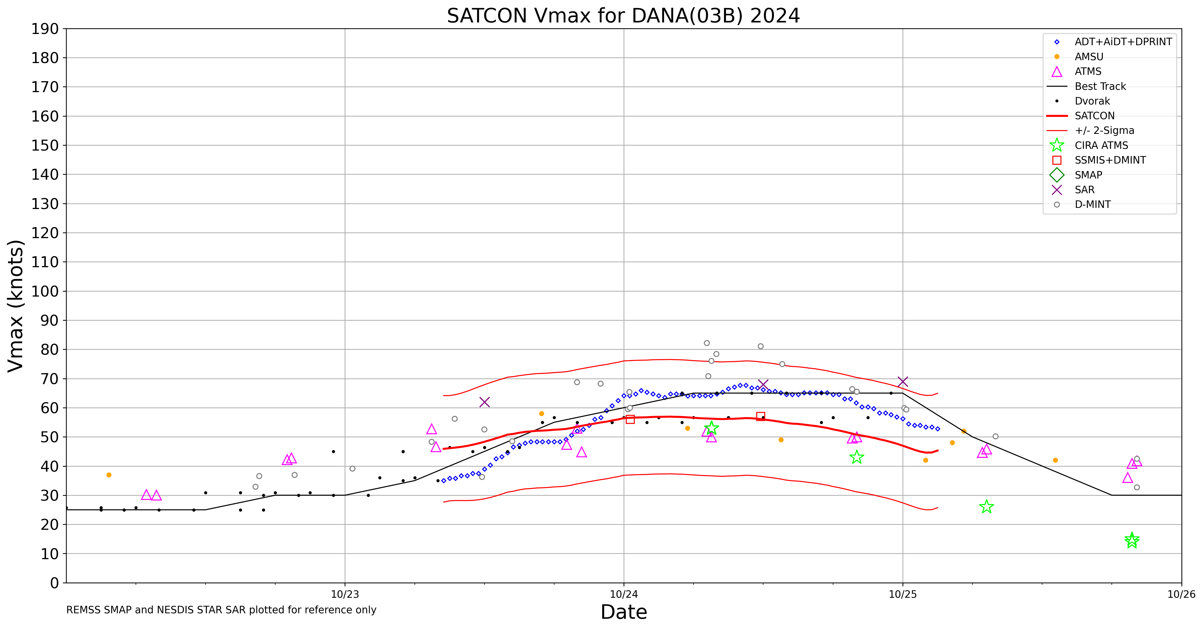
SATCON
|
| Date |
Time |
Vmax |
MSLP |
| 25Oct2024 |
0300UTC |
45 kts |
997 hPa |
| Consensus Members |
| 3 (ADT+Sounders) |
|
|
|