|
Current Intensity Estimates
|
ADT
|
| Date |
Time |
Vmax |
MSLP |
| 11Jun2025 |
1210UTC |
25 kts |
1010 hPa |
| Scene |
CI# |
FT# |
AdjT# |
RawT# |
Eye T |
Cloud T |
| SHEAR |
1.5 |
1.5 |
1.5 |
1.5 |
18.01C |
7.70C |
|
|
|
|
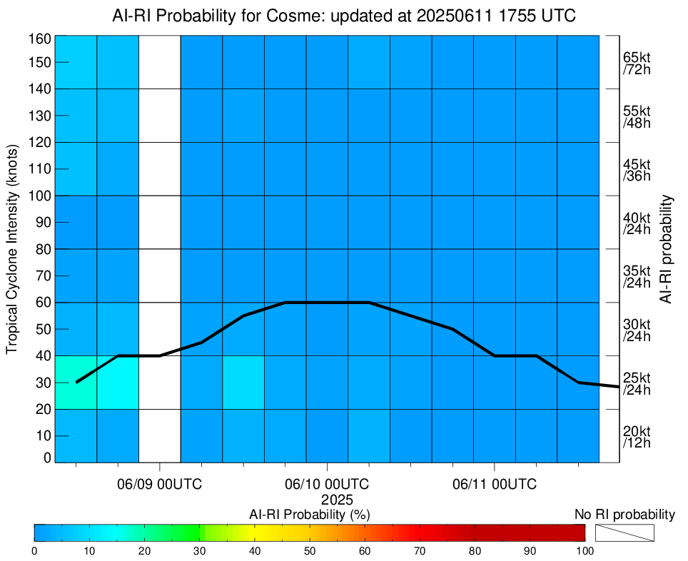
AiDT
|
| Date |
Time |
Vmax |
|
| 11Jun2025 |
1210UTC |
32 kts |
|
|
|
|
|
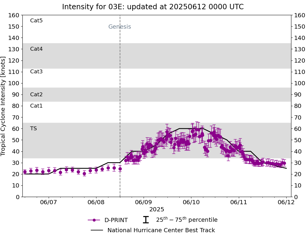
DPRINT
|
| Date |
Time |
Vmax |
MSLP |
| 11Jun2025 |
1210UTC |
31 kts |
1008 hPa |
| Vmax 25% |
Vmax 75% |
|
|
| 28 kts |
34 kts |
|
|
|
|
|
|
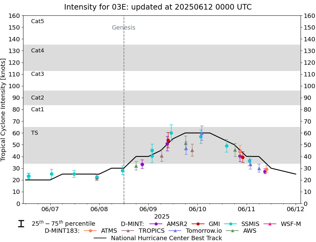
DMINT
|
| Date |
Time |
Vmax |
MSLP |
| 11Jun2025 |
0944UTC |
29 kts |
1008 hPa |
| Vmax 25% |
Vmax 75% |
MW Instr. |
|
| 26 kts |
32 kts |
ATMS-N20 |
|
|
|
|
|
MW Sounders
|
| Date |
Time |
Vmax |
MSLP |
| 10Jun2025 |
2045UTC |
42 kts |
1002 hPa |
|
|
|
|
SATCON
|
| Date |
Time |
Vmax |
MSLP |
| 10Jun2025 |
2310UTC |
42 kts |
1006 hPa |
| Consensus Members |
| 2 (ADT+Sounders) |
|
|
|