|
Current Intensity Estimates
|
ADT
|
| Date |
Time |
Vmax |
MSLP |
| 11Jun2026 |
1110UTC |
N/A kts |
N/A hPa |
| Scene |
CI# |
FT# |
AdjT# |
RawT# |
Eye T |
Cloud T |
| LAND |
N/A |
N/A |
N/A |
N/A |
N/AC |
N/AC |
|
|
|
|
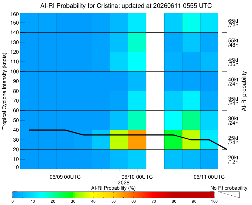
AiDT
|
| Date |
Time |
Vmax |
|
| 11Jun2026 |
0740UTC |
32 kts |
|
|
|
|
|
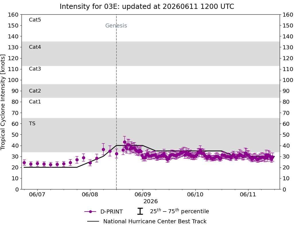
DPRINT
|
| Date |
Time |
Vmax |
MSLP |
| 11Jun2026 |
1110UTC |
29 kts |
1007 hPa |
| Vmax 25% |
Vmax 75% |
|
|
| 26 kts |
33 kts |
|
|
|
|
|
|
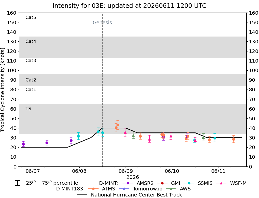
DMINT
|
| Date |
Time |
Vmax |
MSLP |
| 11Jun2026 |
0747UTC |
28 kts |
1006 hPa |
| Vmax 25% |
Vmax 75% |
MW Instr. |
|
| 25 kts |
32 kts |
ATMS-N20 |
|
|
|
|
|
MW Sounders
|
| Date |
Time |
Vmax |
MSLP |
| 11Jun2026 |
0747UTC |
40 kts |
1005 hPa |
|
|
|
|
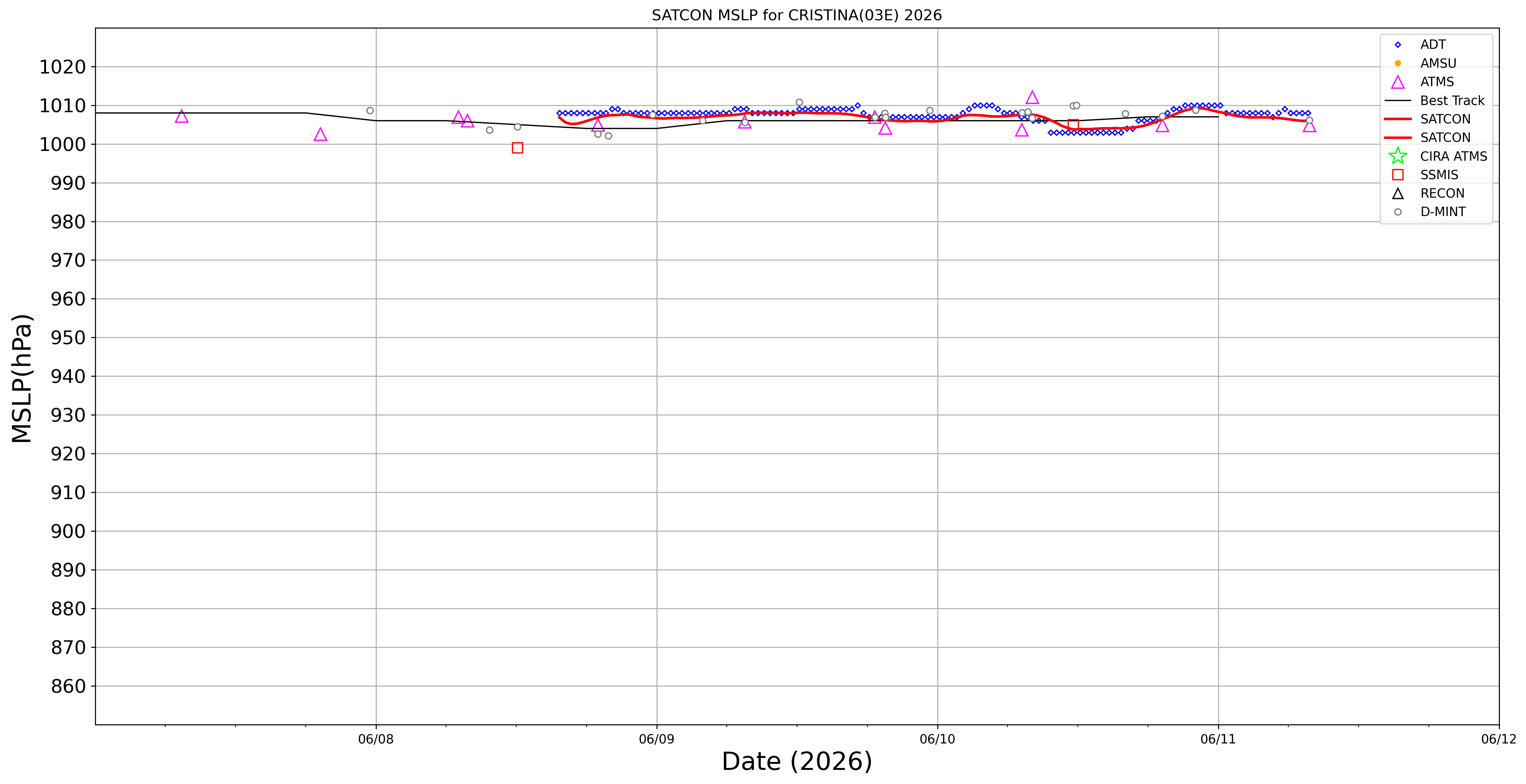
SATCON
|
| Date |
Time |
Vmax |
MSLP |
| 11Jun2026 |
0740UTC |
36 kts |
1006 hPa |
| Consensus Members |
| 2 (ADT+Sounders) |
|
|
|