|
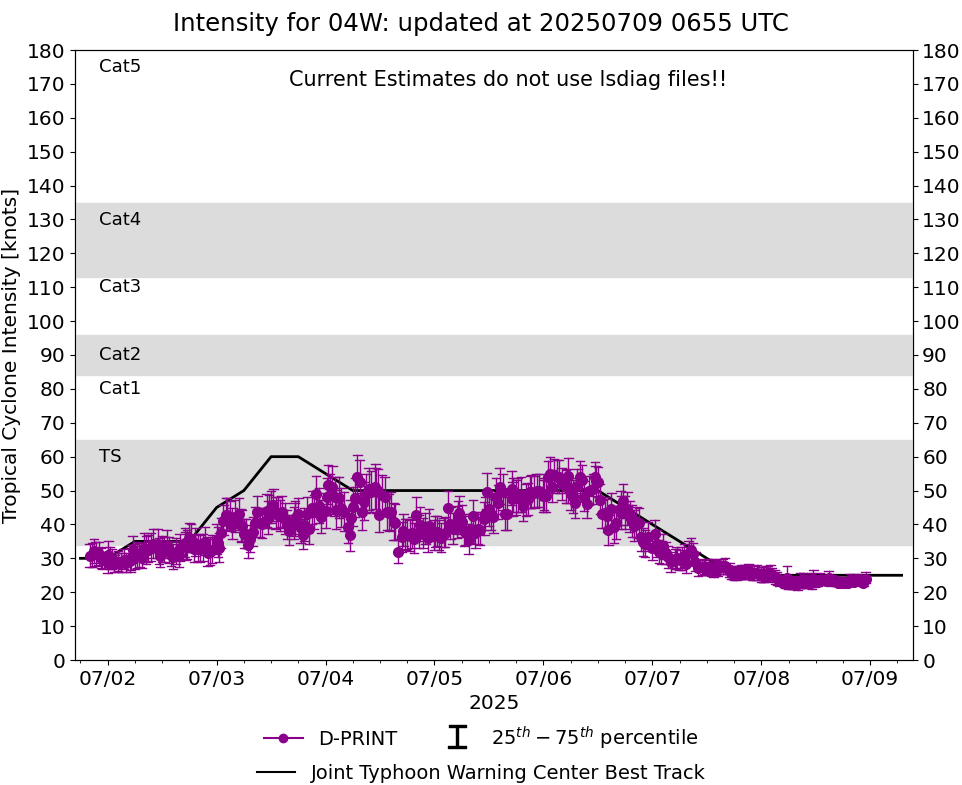
Current Intensity Estimates
|
ADT
|
| Date |
Time |
Vmax |
MSLP |
| 08Jul2025 |
2300UTC |
32 kts |
988 hPa |
| Scene |
CI# |
FT# |
AdjT# |
RawT# |
Eye T |
Cloud T |
| SHEAR |
2.2 |
1.6 |
1.5 |
1.5 |
-1.76C |
-7.81C |
|
|
|
|
AiDT
|
| Date |
Time |
Vmax |
|
| 08Jul2025 |
2300UTC |
42 kts |
|
|
|
|
|
DPRINT
|
| Date |
Time |
Vmax |
MSLP |
| 08Jul2025 |
2300UTC |
24 kts |
NaN hPa |
| Vmax 25% |
Vmax 75% |
|
|
| 23 kts |
26 kts |
|
|
|
|
|
|
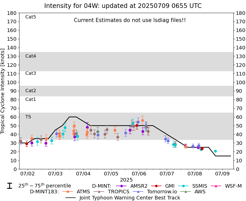
DMINT
|
| Date |
Time |
Vmax |
MSLP |
| 08Jul2025 |
1746UTC |
21 kts |
NaN hPa |
| Vmax 25% |
Vmax 75% |
MW Instr. |
|
| 20 kts |
21 kts |
SSMISF18 |
|
|
|
|
|
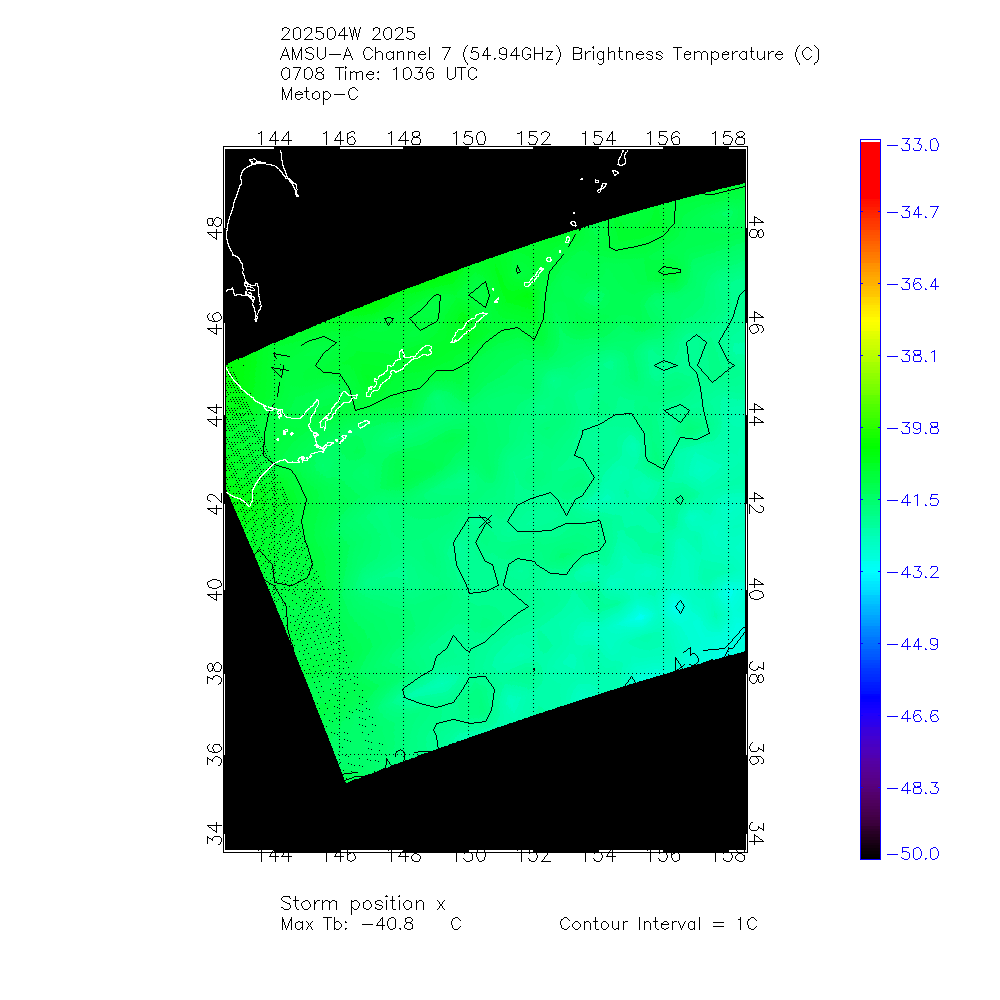
MW Sounders
|
| Date |
Time |
Vmax |
MSLP |
| 08Jul2025 |
1036UTC |
37 kts |
989 hPa |
|
|
|
|
SATCON
|
| Date |
Time |
Vmax |
MSLP |
| 08Jul2025 |
1200UTC |
35 kts |
995 hPa |
| Consensus Members |
| 3 (ADT+Sounders) |
|
|
|