|
Current Intensity Estimates
|
ADT
|
| Date |
Time |
Vmax |
MSLP |
| 12Apr2026 |
1000UTC |
155 kts |
896 hPa |
| Scene |
CI# |
FT# |
AdjT# |
RawT# |
Eye T |
Cloud T |
| EYE |
7.5 |
7.5 |
7.6 |
8.0 |
22.54C |
-83.48C |
|
|
|
|
AiDT
|
| Date |
Time |
Vmax |
|
| 12Apr2026 |
1000UTC |
149 kts |
|
|
|
|
|
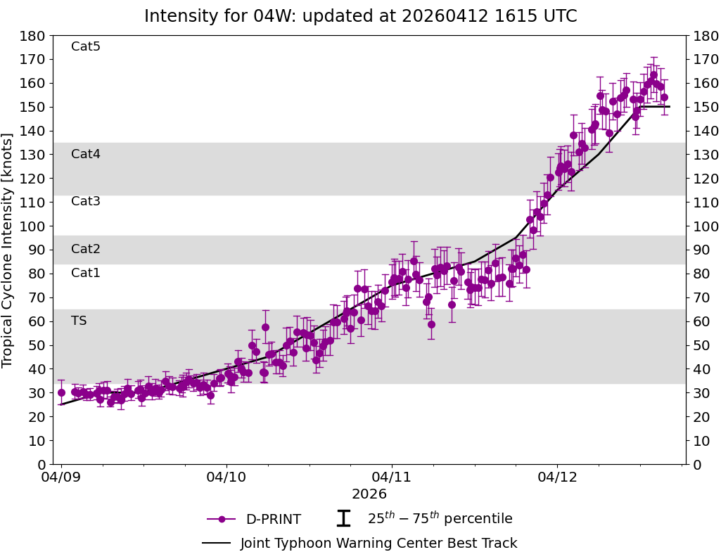
DPRINT
|
| Date |
Time |
Vmax |
MSLP |
| 12Apr2026 |
1000UTC |
157 kts |
917 hPa |
| Vmax 25% |
Vmax 75% |
|
|
| 150 kts |
164 kts |
|
|
|
|
|
|
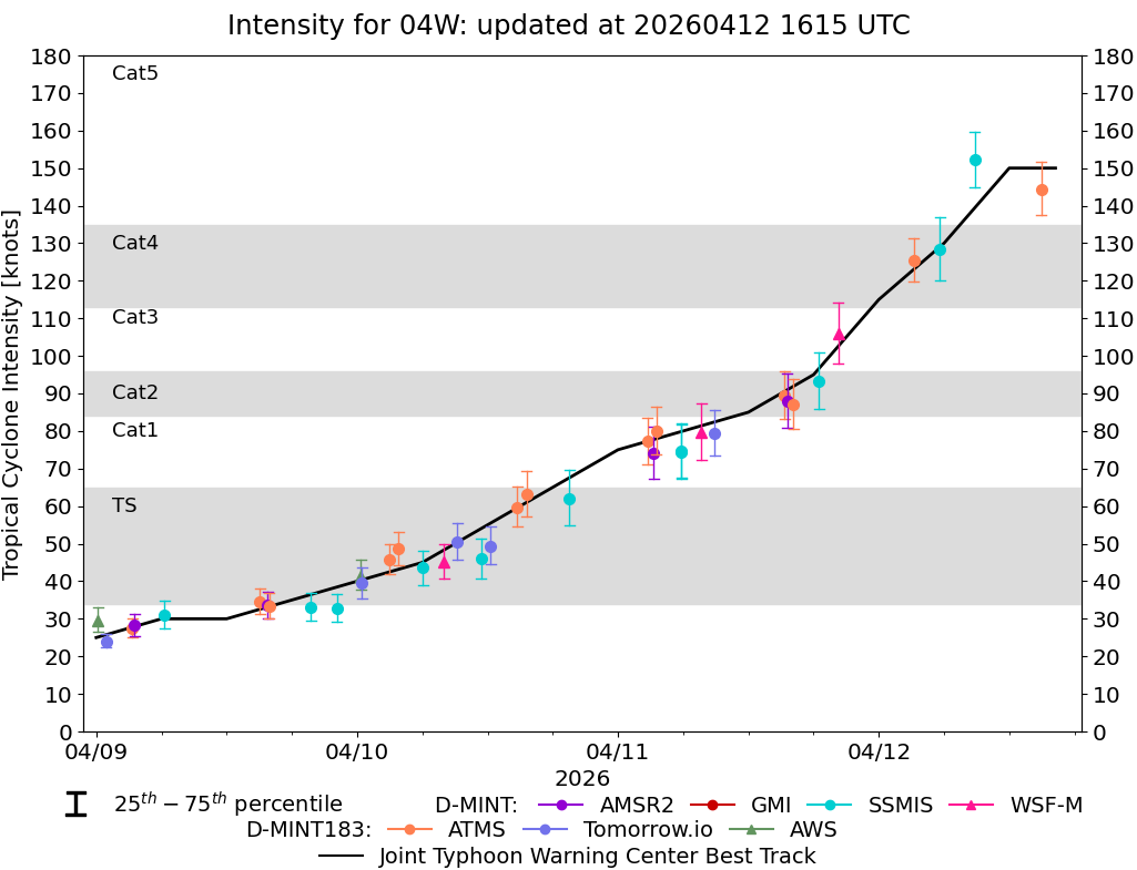
DMINT
|
| Date |
Time |
Vmax |
MSLP |
| 12Apr2026 |
0536UTC |
128 kts |
932 hPa |
| Vmax 25% |
Vmax 75% |
MW Instr. |
|
| 120 kts |
137 kts |
SSMISF18 |
|
|
|
|
|
MW Sounders
|
| Date |
Time |
Vmax |
MSLP |
| 12Apr2026 |
0311UTC |
118 kts |
924 hPa |
|
|
|
|
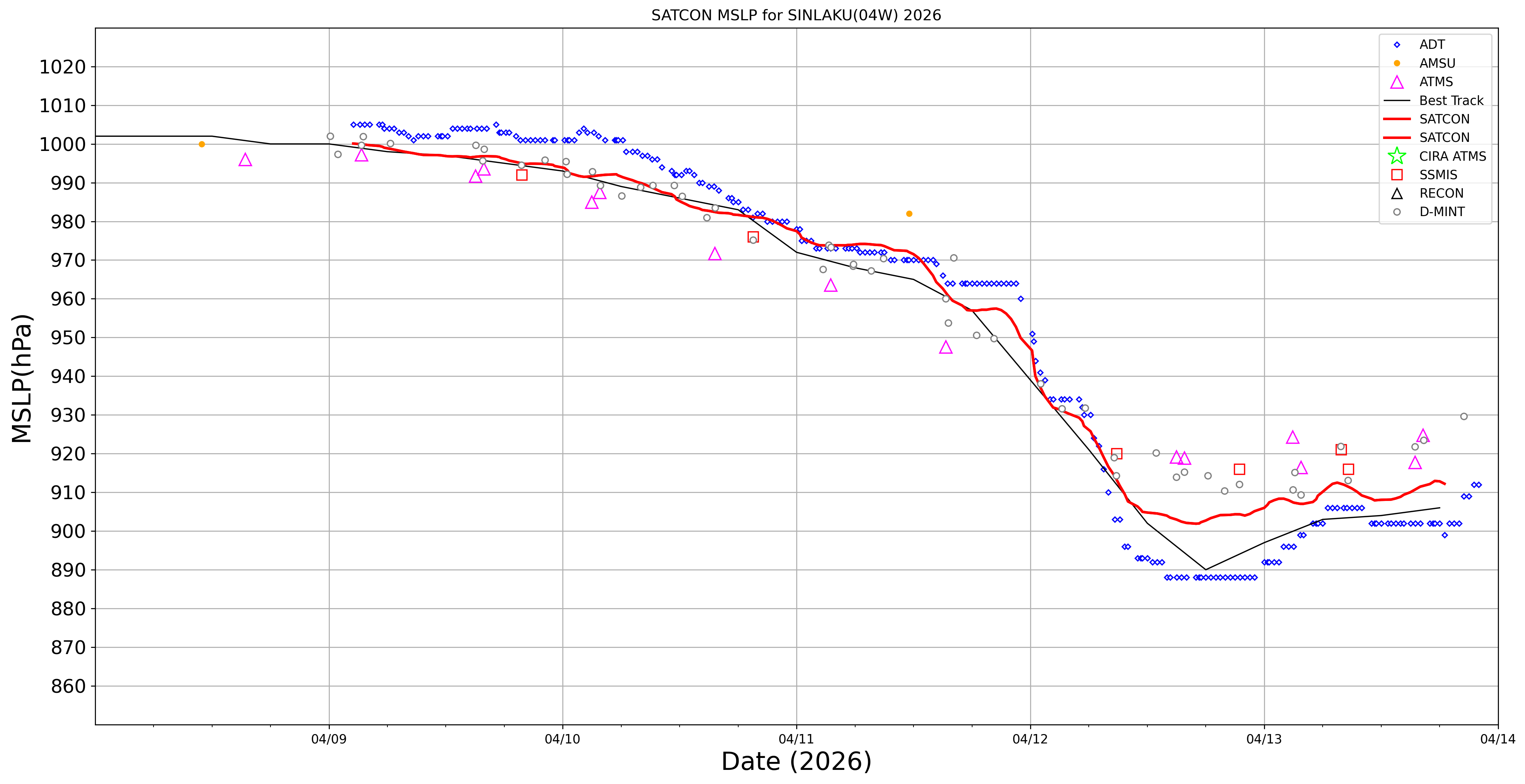
SATCON
|
| Date |
Time |
Vmax |
MSLP |
| 12Apr2026 |
0400UTC |
126 kts |
930 hPa |
| Consensus Members |
| 2 (ADT+Sounders) |
|
|
|