|
Current Intensity Estimates
|
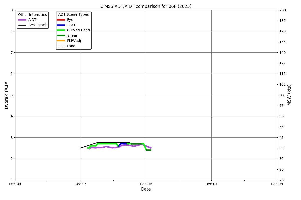
ADT
|
| Date |
Time |
Vmax |
MSLP |
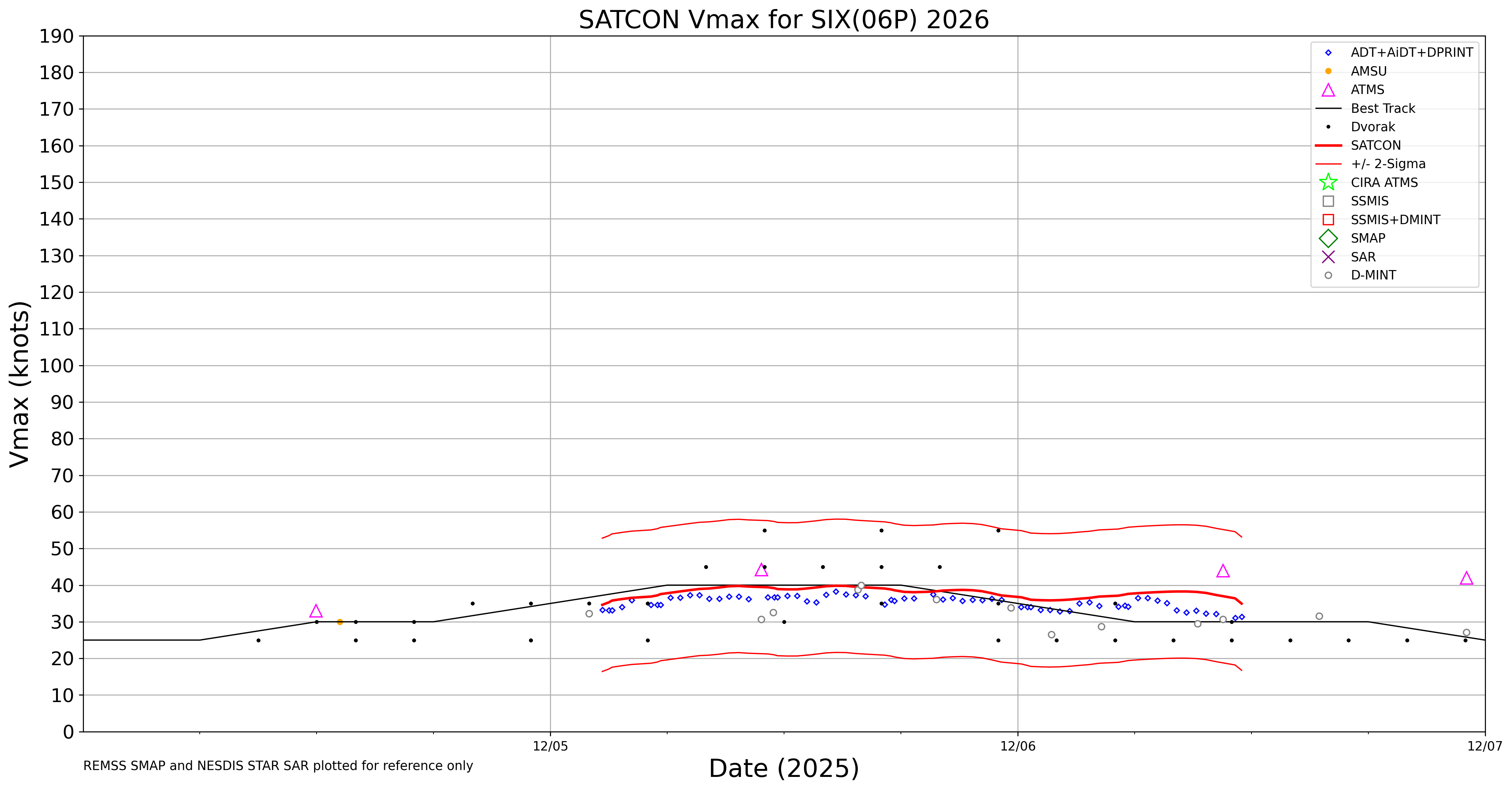
| 06Dec2025 |
0340UTC |
34 kts |
1003 hPa |
| Scene |
CI# |
FT# |
AdjT# |
RawT# |
Eye T |
Cloud T |
| SHEAR |
2.4 |
1.9 |
1.6 |
1.5 |
14.59C |
-6.93C |
|
|
|
|
AiDT
|
| Date |
Time |
Vmax |
|
| 06Dec2025 |
0340UTC |
37 kts |
|
|
|
|
|
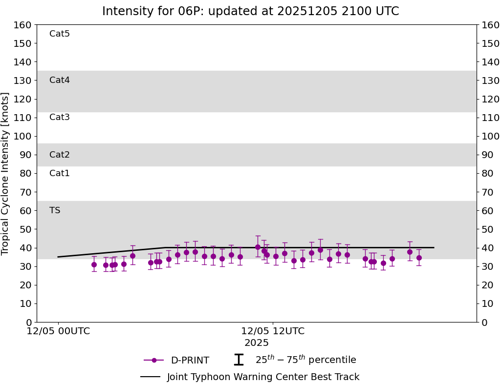
DPRINT
|
| Date |
Time |
Vmax |
MSLP |
| 06Dec2025 |
0340UTC |
35 kts |
1001 hPa |
| Vmax 25% |
Vmax 75% |
|
|
| 31 kts |
39 kts |
|
|
|
|
|
|
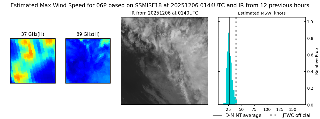
DMINT
|
| Date |
Time |
Vmax |
MSLP |
| 06Dec2025 |
0144UTC |
27 kts |
1000 hPa |
| Vmax 25% |
Vmax 75% |
MW Instr. |
|
| 23 kts |
30 kts |
SSMISF18 |
|
|
|
| Date |
Time |
Vmax |
MSLP |
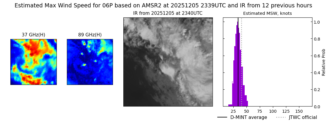
| 05Dec2025 |
2339UTC |
34 kts |
1000 hPa |
| Vmax 25% |
Vmax 75% |
MW Instr. |
|
| 30 kts |
39 kts |
AMSR2 |
|
|
|
|
|
|
MW Sounders
|
| Date |
Time |
Vmax |
MSLP |
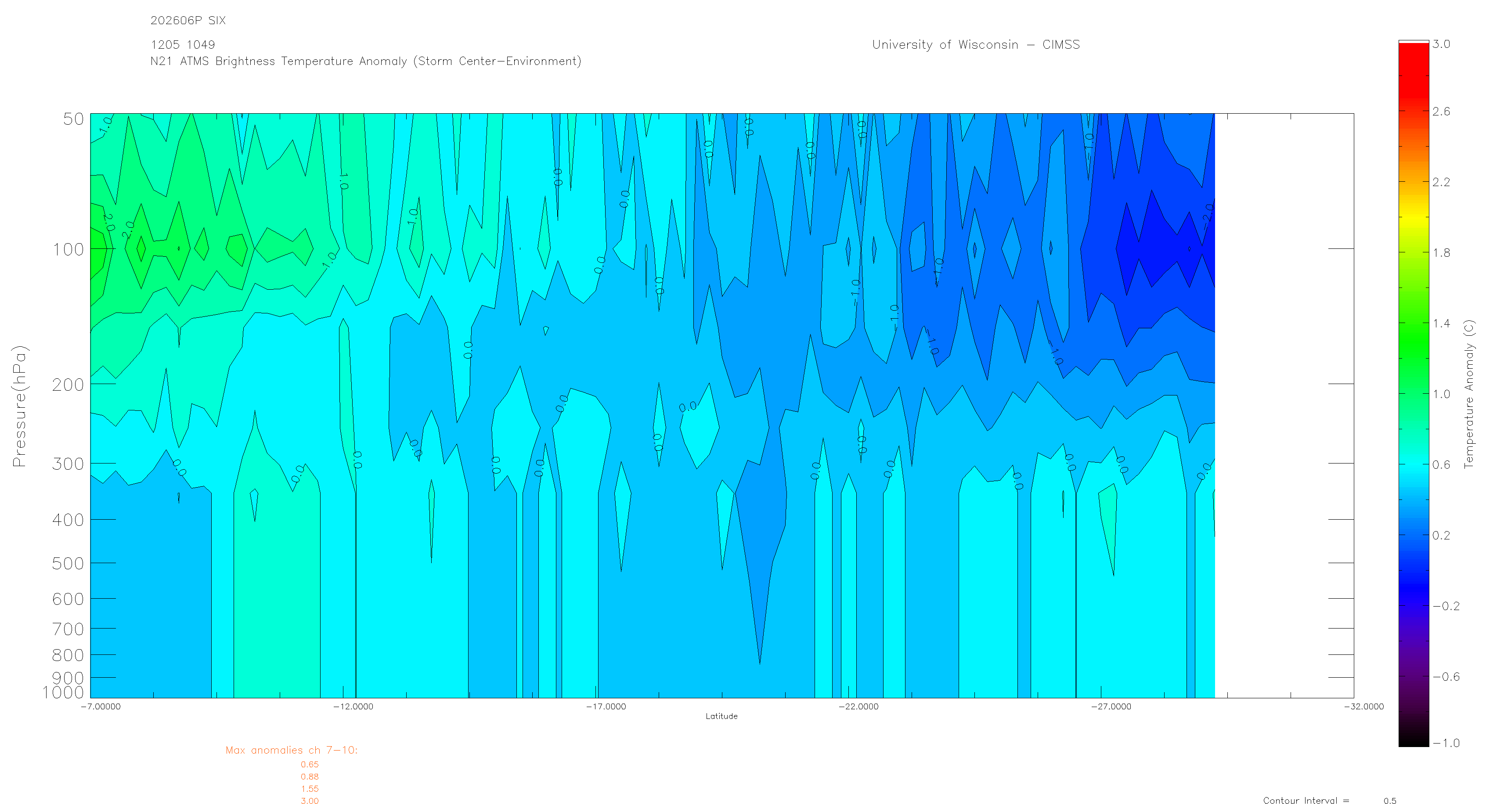
| 05Dec2025 |
1049UTC |
44 kts |
1000 hPa |
|
|
|
|
SATCON
|
| Date |
Time |
Vmax |
MSLP |
| 05Dec2025 |
1310UTC |
40 kts |
1001 hPa |
| Consensus Members |
| 2 (ADT+Sounders) |
|
|
|