|
Current Intensity Estimates
|
ADT
|
| Date |
Time |
Vmax |
MSLP |
| 31Jan2024 |
1645UTC |
25 kts |
994 hPa |
| Scene |
CI# |
FT# |
AdjT# |
RawT# |
Eye T |
Cloud T |
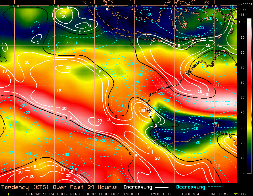
| SHEAR |
1.5 |
1.5 |
1.5 |
1.5 |
15.57C |
10.01C |
|
|
|
|
AiDT
|
| Date |
Time |
Vmax |
|
| 31Jan2024 |
1645UTC |
34 kts |
|
|
|
|
|
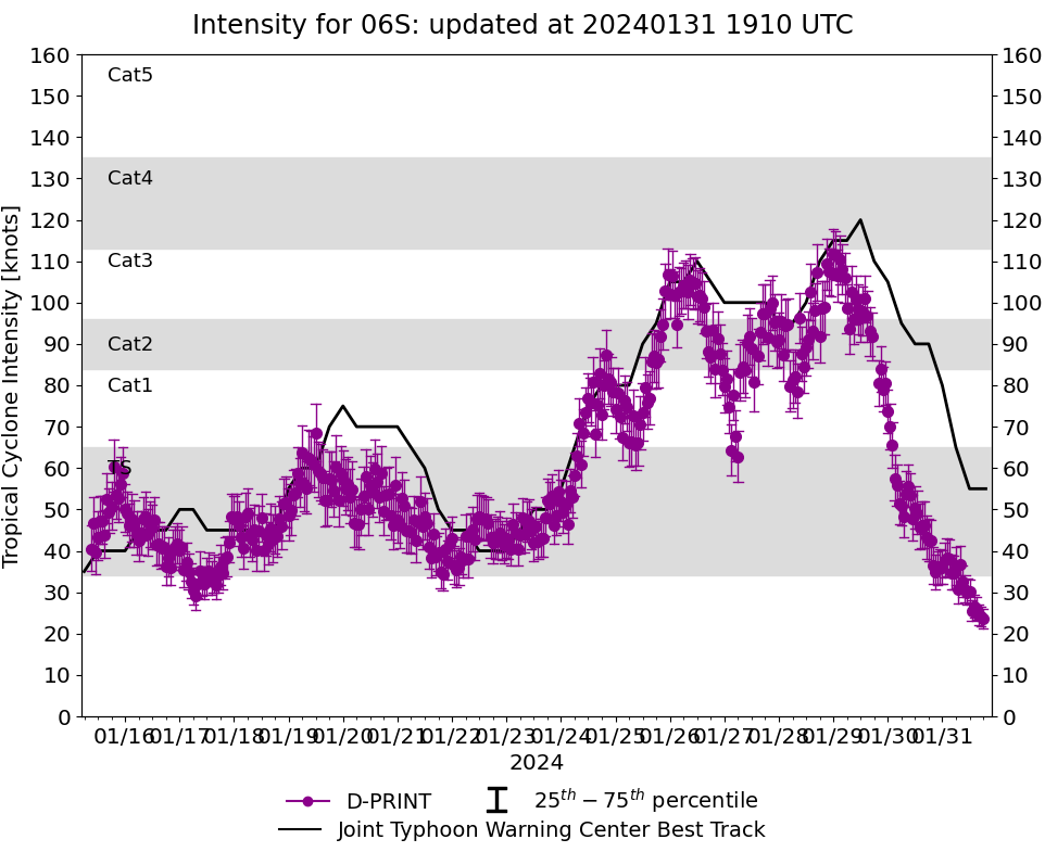
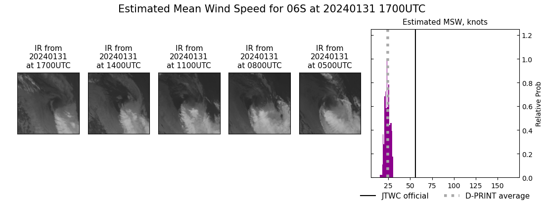
DPRINT
|
| Date |
Time |
Vmax |
MSLP |
| 31Jan2024 |
1700UTC |
24 kts |
995 hPa |
| Vmax 25% |
Vmax 75% |
|
|
| 22 kts |
27 kts |
|
|
|
|
|
|
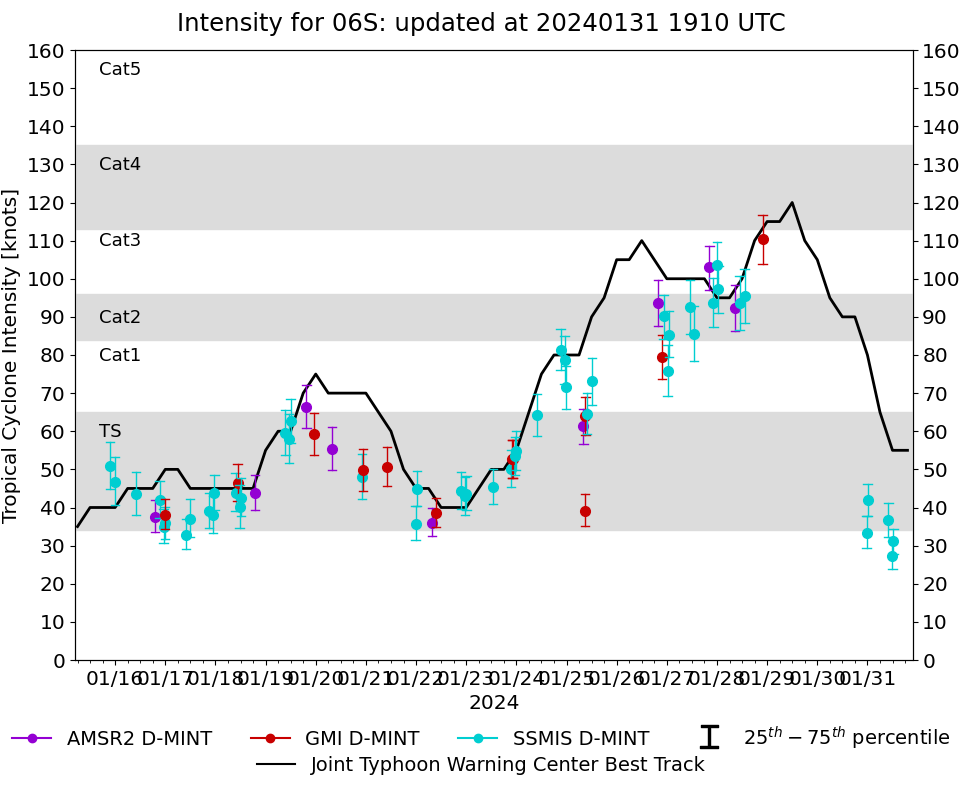
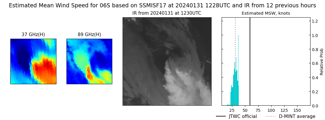
DMINT
|
| Date |
Time |
Vmax |
MSLP |
| 31Jan2024 |
1228UTC |
31 kts |
995 hPa |
| Vmax 25% |
Vmax 75% |
MW Instr. |
|
| 28 kts |
34 kts |
SSMISF17 |
|
|
|
|
|
MW Sounders
|
| Date |
Time |
Vmax |
MSLP |
| 28Jan2024 |
1314UTC |
94 kts |
966 hPa |
|
|
|
|
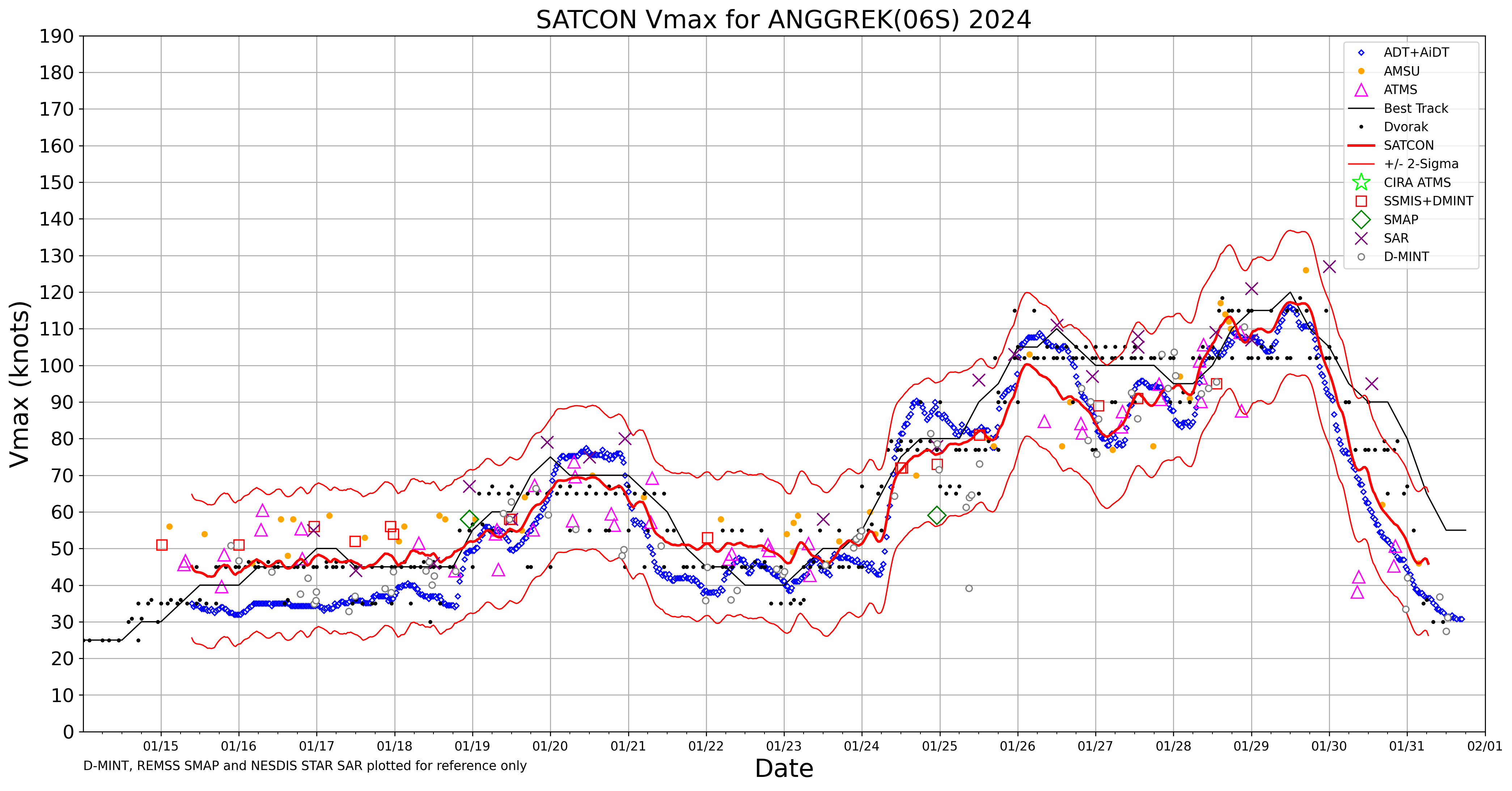
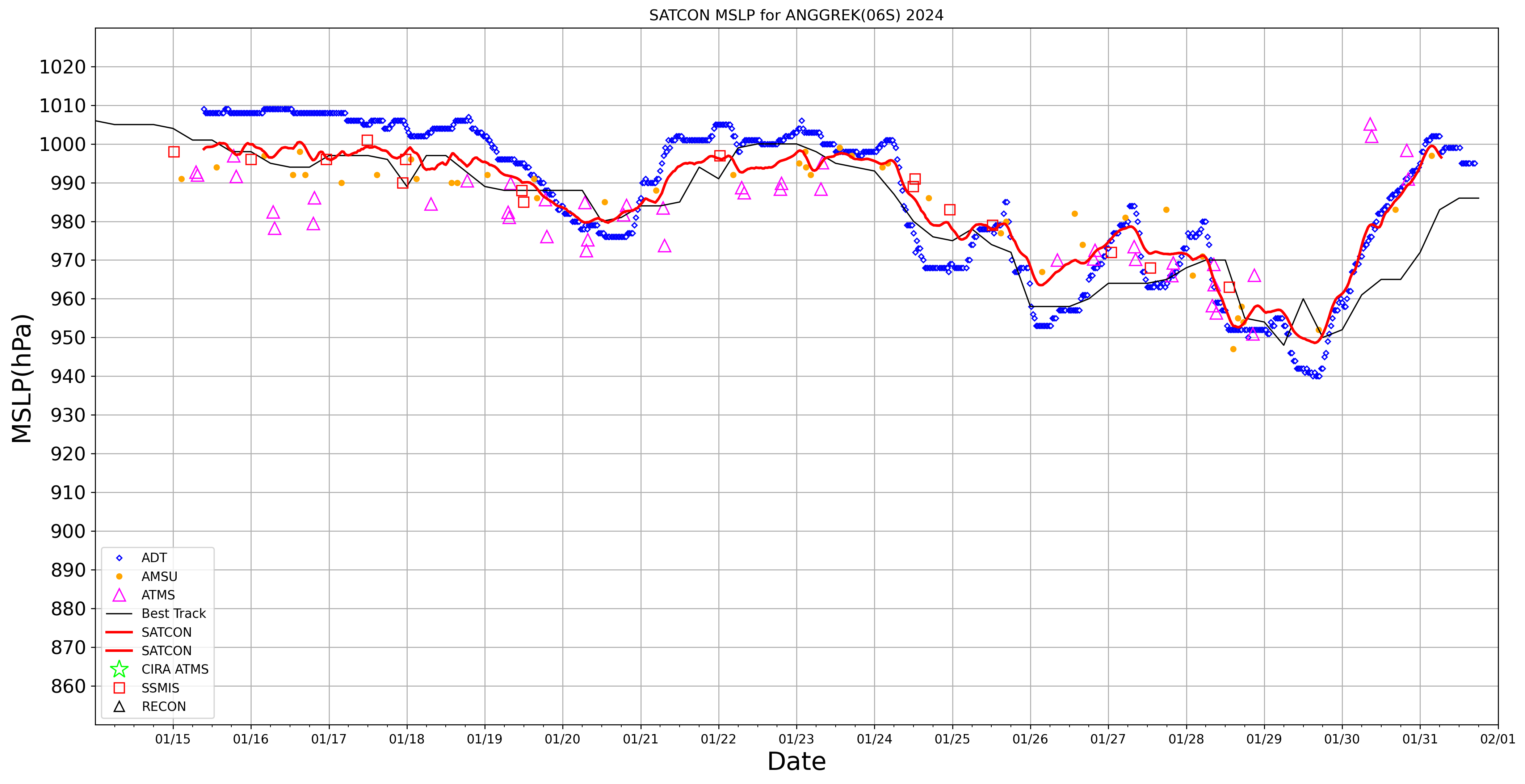
SATCON
|
| Date |
Time |
Vmax |
MSLP |
| 31Jan2024 |
0630UTC |
46 kts |
996 hPa |
| Consensus Members |
| 3 (ADT+Sounders) |
|
|
|