|
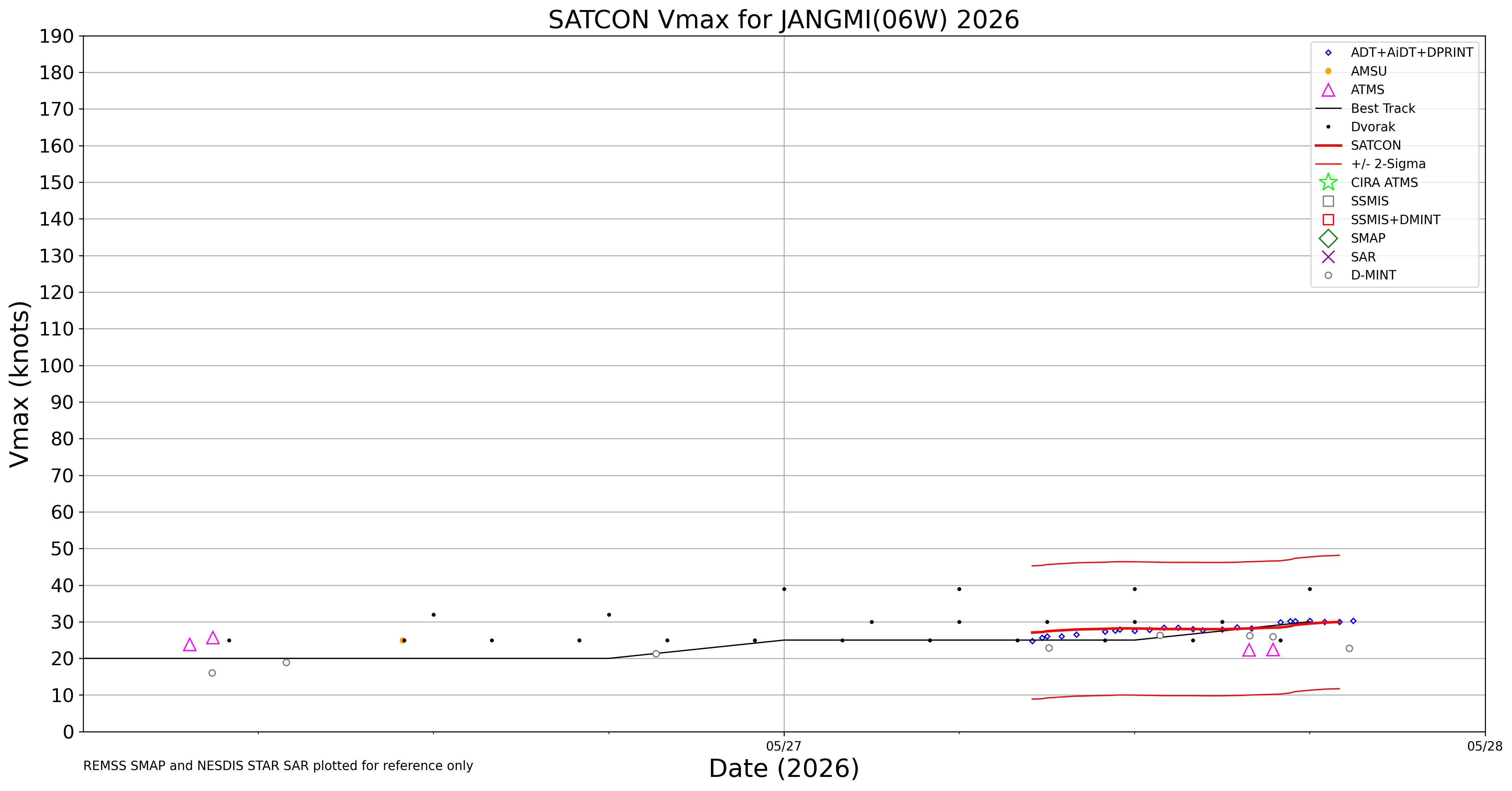
Current Intensity Estimates
|
ADT
|
| Date |
Time |
Vmax |
MSLP |
| 27May2026 |
1530UTC |
33 kts |
1006 hPa |
| Scene |
CI# |
FT# |
AdjT# |
RawT# |
Eye T |
Cloud T |
| SHEAR |
2.3 |
2.3 |
2.5 |
2.5 |
2.68C |
-23.01C |
|
|
|
|
AiDT
|
| Date |
Time |
Vmax |
|
| 27May2026 |
1530UTC |
33 kts |
|
|
|
|
|
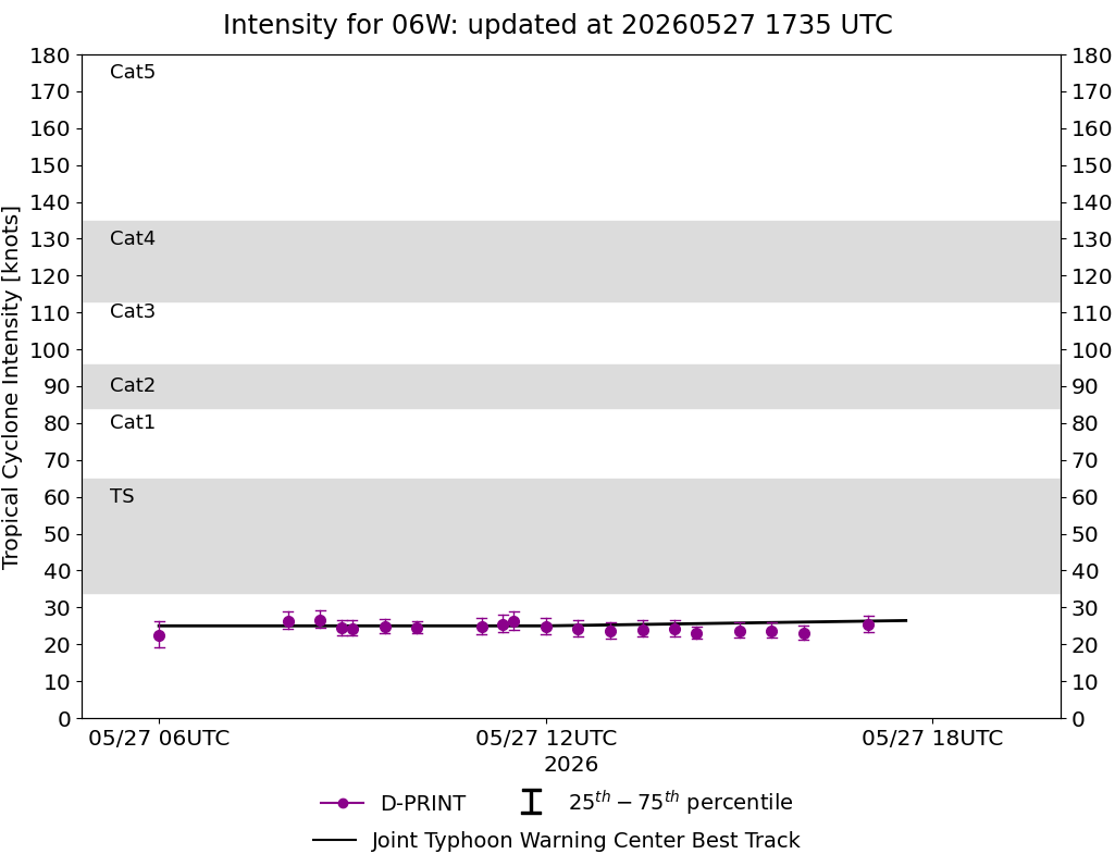
DPRINT
|
| Date |
Time |
Vmax |
MSLP |
| 27May2026 |
1530UTC |
24 kts |
1004 hPa |
| Vmax 25% |
Vmax 75% |
|
|
| 22 kts |
26 kts |
|
|
|
|
|
|
DMINT
|
| Date |
Time |
Vmax |
MSLP |
| 27May2026 |
1252UTC |
26 kts |
1005 hPa |
| Vmax 25% |
Vmax 75% |
MW Instr. |
|
| 24 kts |
29 kts |
AWS |
|
|
|
|
|
MW Sounders
|
| Date |
Time |
Vmax |
MSLP |
| 26May2026 |
1056UTC |
25 kts |
1003 hPa |
|
|
|
|
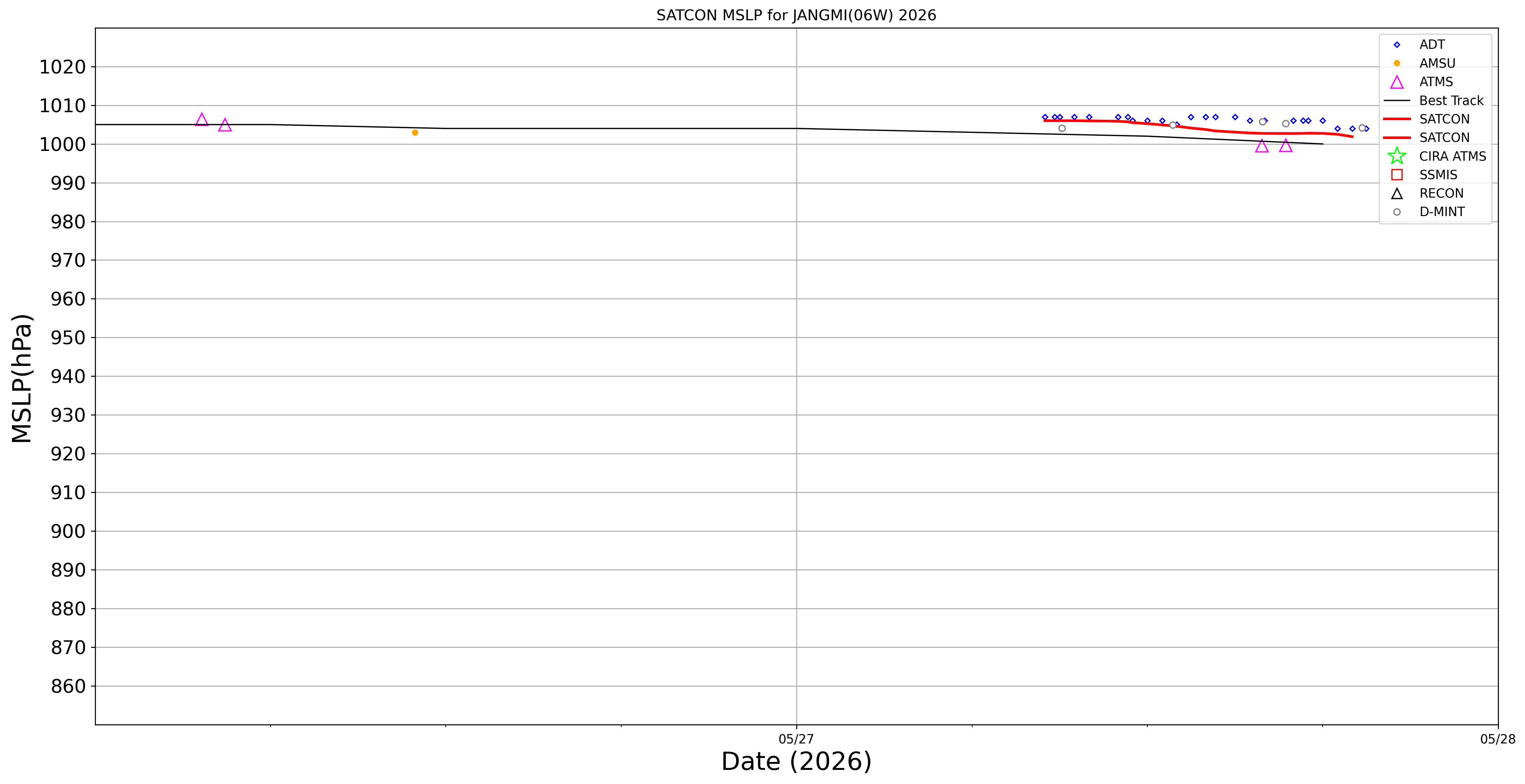
SATCON
|
| Date |
Time |
Vmax |
MSLP |
| N/A |
N/AUTC |
N/A kts |
N/A hPa |
| Consensus Members |
| N/A (ADT+Sounders) |
|
|
|