|
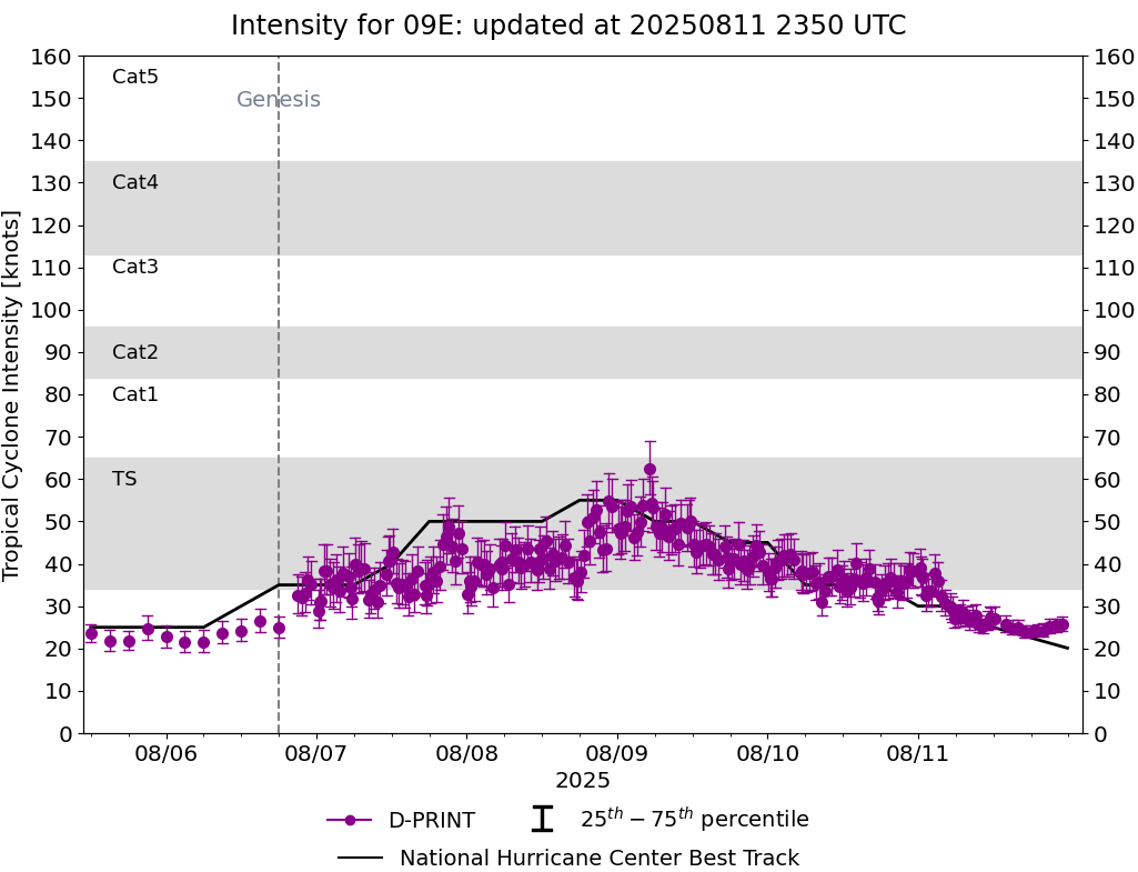
Current Intensity Estimates
|
ADT
|
| Date |
Time |
Vmax |
MSLP |
| 11Aug2025 |
1210UTC |
25 kts |
1009 hPa |
| Scene |
CI# |
FT# |
AdjT# |
RawT# |
Eye T |
Cloud T |
| SHEAR |
1.5 |
1.5 |
1.5 |
1.5 |
17.73C |
12.03C |
|
|
|
|
AiDT
|
| Date |
Time |
Vmax |
|
| 11Aug2025 |
1210UTC |
31 kts |
|
|
|
|
|
DPRINT
|
| Date |
Time |
Vmax |
MSLP |
| 11Aug2025 |
1210UTC |
27 kts |
1009 hPa |
| Vmax 25% |
Vmax 75% |
|
|
| 25 kts |
30 kts |
|
|
|
|
|
|
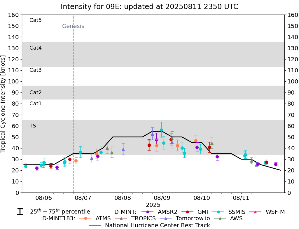
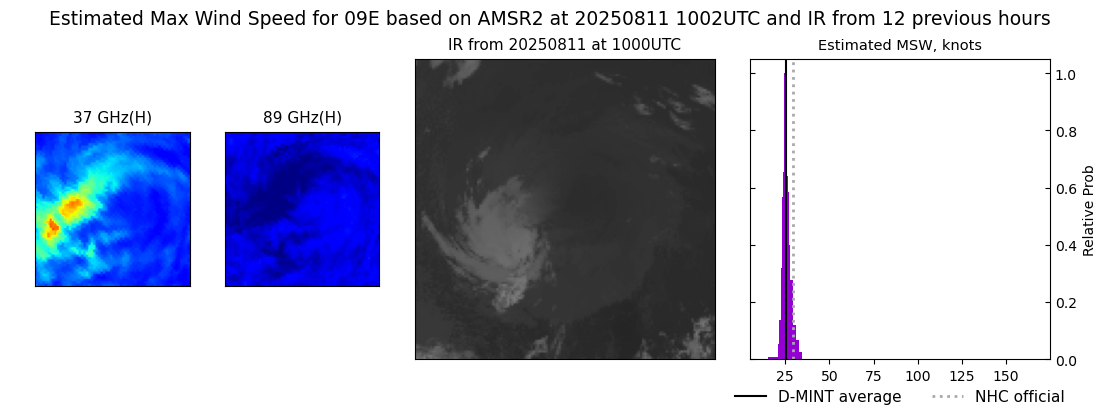
DMINT
|
| Date |
Time |
Vmax |
MSLP |
| 11Aug2025 |
1002UTC |
26 kts |
1009 hPa |
| Vmax 25% |
Vmax 75% |
MW Instr. |
|
| 24 kts |
27 kts |
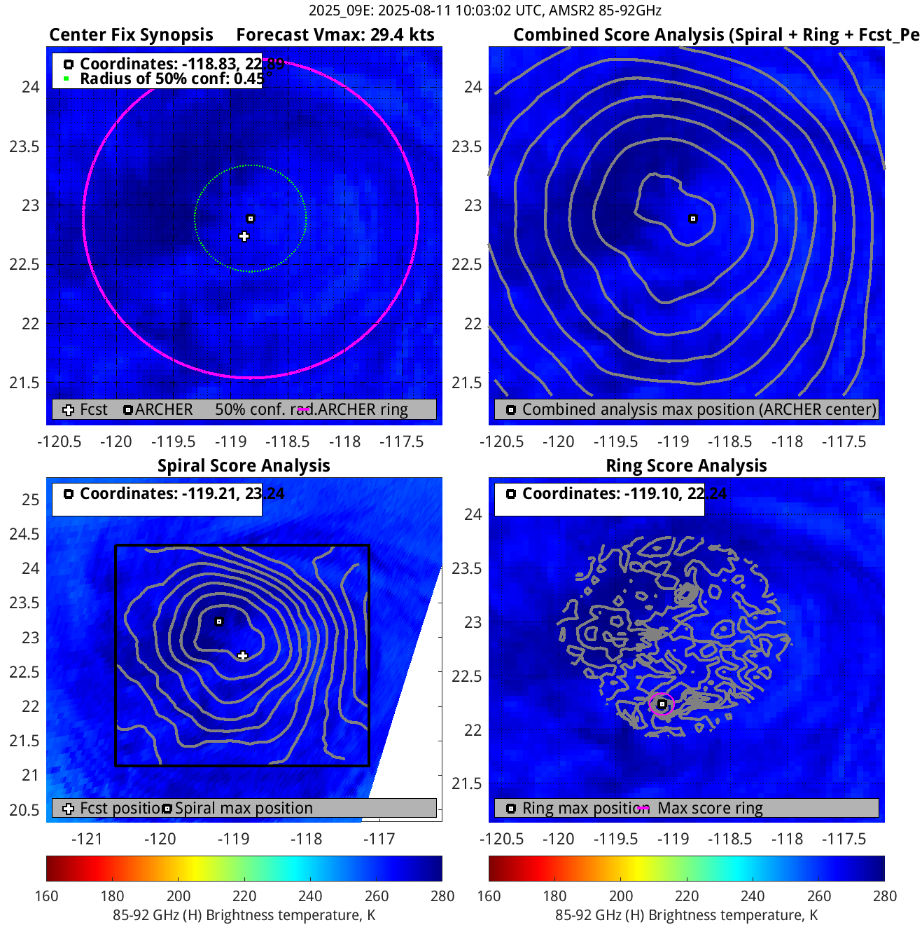
AMSR2 |
|
|
|
|
|
MW Sounders
|
| Date |
Time |
Vmax |
MSLP |
| 11Aug2025 |
0233UTC |
35 kts |
1002 hPa |
|
|
|
|
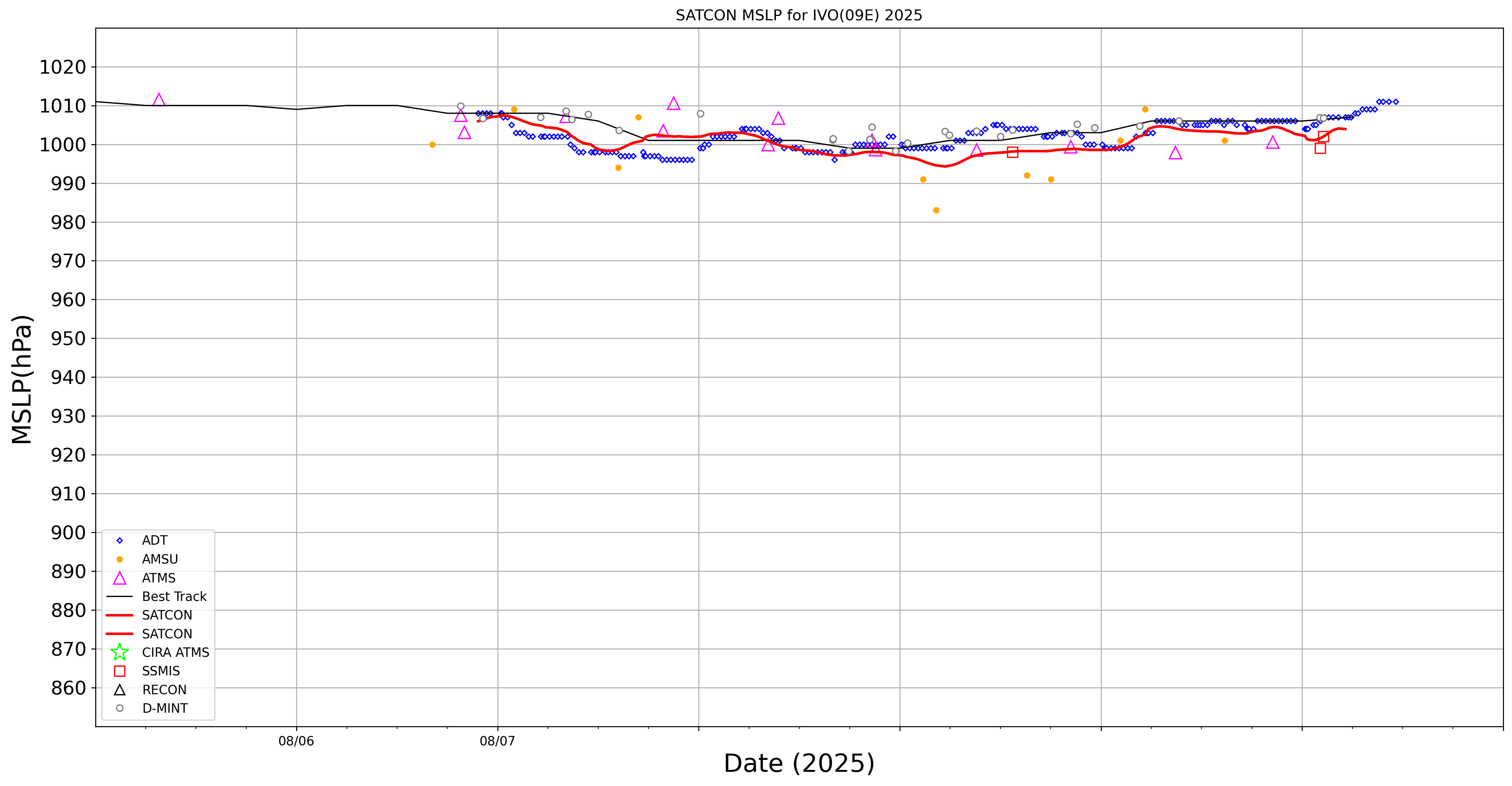
SATCON
|
| Date |
Time |
Vmax |
MSLP |
| 11Aug2025 |
0510UTC |
37 kts |
1004 hPa |
| Consensus Members |
| 2 (ADT+Sounders) |
|
|
|