|
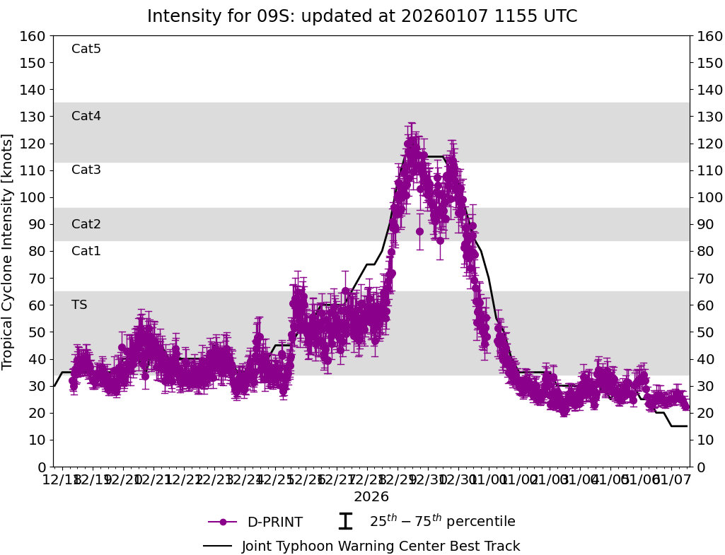
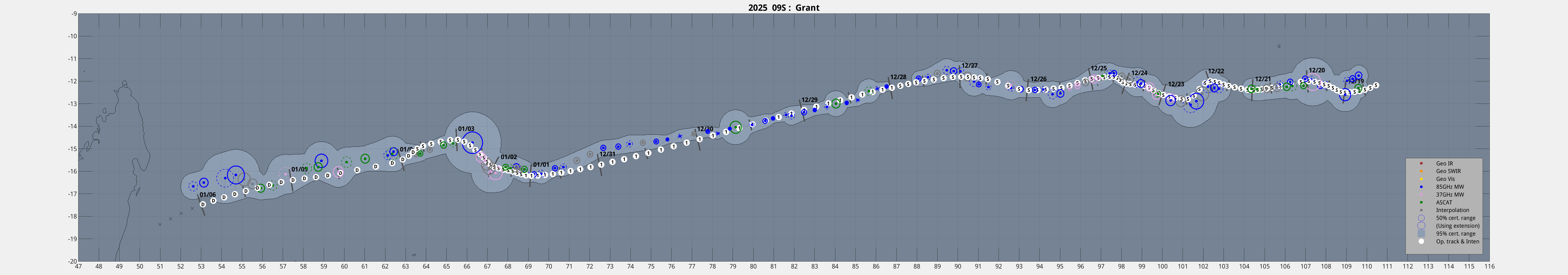
Current Intensity Estimates
|
ADT
|
| Date |
Time |
Vmax |
MSLP |
| 31Dec2025 |
2230UTC |
82 kts |
975 hPa |
| Scene |
CI# |
FT# |
AdjT# |
RawT# |
Eye T |
Cloud T |
| UNIFRM |
4.7 |
4.5 |
4.2 |
3.8 |
-79.43C |
-77.75C |
|
|
|
|
AiDT
|
| Date |
Time |
Vmax |
|
| 31Dec2025 |
2230UTC |
79 kts |
|
|
|
|
|
DPRINT
|
| Date |
Time |
Vmax |
MSLP |
| 31Dec2025 |
2230UTC |
48 kts |
985 hPa |
| Vmax 25% |
Vmax 75% |
|
|
| 42 kts |
55 kts |
|
|
|
|
|
|
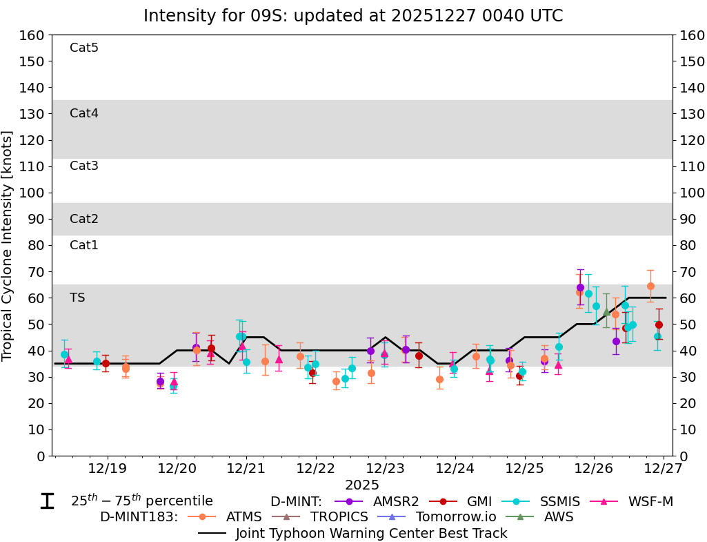
DMINT
|
| Date |
Time |
Vmax |
MSLP |
| 31Dec2025 |
2201UTC |
59 kts |
983 hPa |
| Vmax 25% |
Vmax 75% |
MW Instr. |
|
| 52 kts |
66 kts |
GMI |
|
|
|
|
|
MW Sounders
|
| Date |
Time |
Vmax |
MSLP |
| 31Dec2025 |
0115UTC |
110 kts |
947 hPa |
|
|
|
|
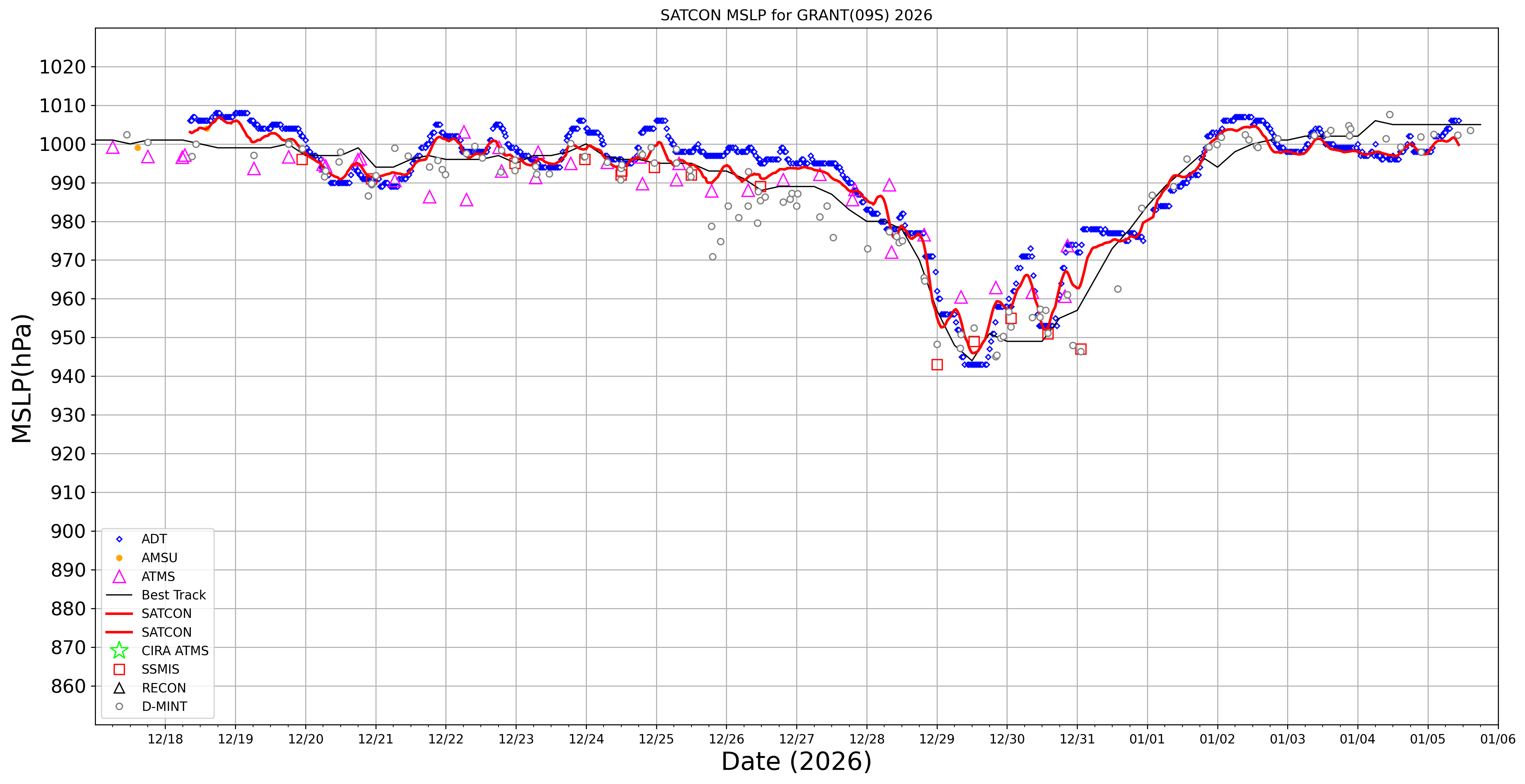
SATCON
|
| Date |
Time |
Vmax |
MSLP |
| 31Dec2025 |
0300UTC |
98 kts |
964 hPa |
| Consensus Members |
| 2 (ADT+Sounders) |
|
|
|