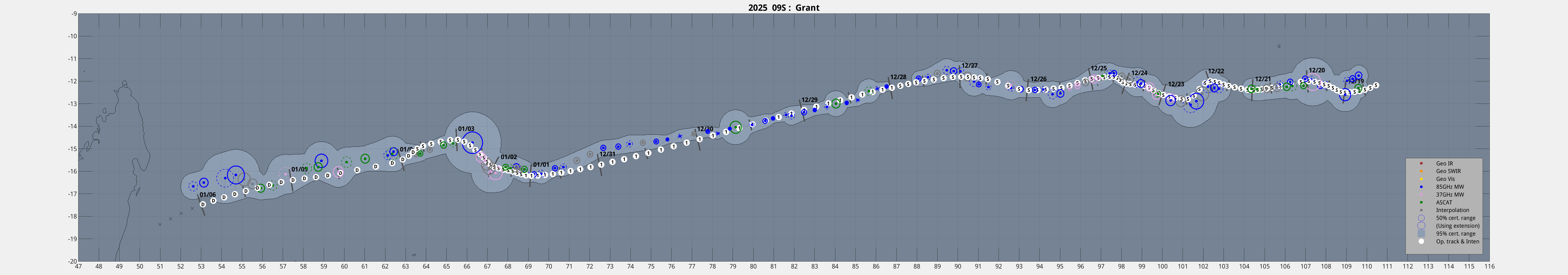
|
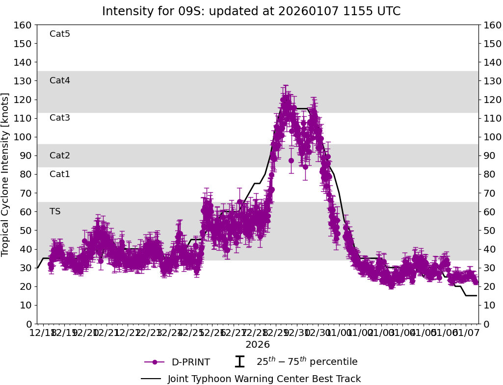
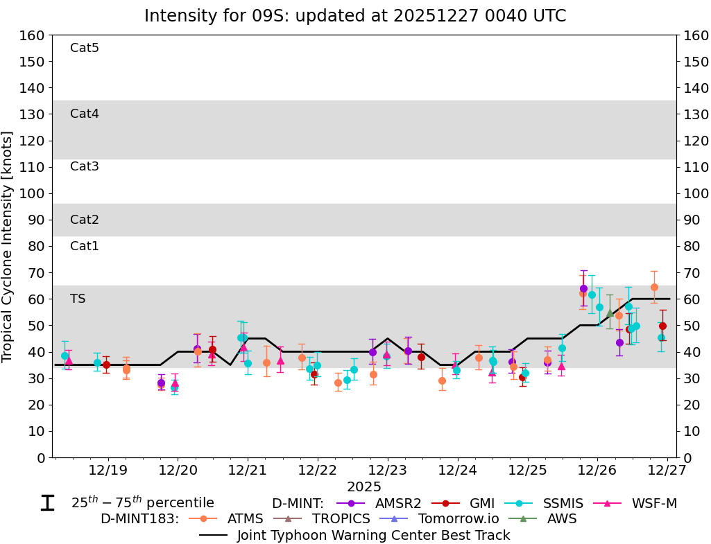
Current Intensity Estimates
|
ADT
|
| Date |
Time |
Vmax |
MSLP |
| 05Jan2026 |
1030UTC |
34 kts |
1005 hPa |
| Scene |
CI# |
FT# |
AdjT# |
RawT# |
Eye T |
Cloud T |
| UNIFRM |
2.4 |
2.4 |
2.4 |
2.4 |
-70.35C |
-62.28C |
|
|
|
|
AiDT
|
| Date |
Time |
Vmax |
|
| 05Jan2026 |
1030UTC |
35 kts |
|
|
|
|
|
DPRINT
|
| Date |
Time |
Vmax |
MSLP |
| 05Jan2026 |
1100UTC |
26 kts |
1002 hPa |
| Vmax 25% |
Vmax 75% |
|
|
| 24 kts |
30 kts |
|
|
|
|
|
|
DMINT
|
| Date |
Time |
Vmax |
MSLP |
| 05Jan2026 |
1009UTC |
29 kts |
1002 hPa |
| Vmax 25% |
Vmax 75% |
MW Instr. |
|
| 27 kts |
32 kts |
ATMS-N21 |
|
|
|
|
|
MW Sounders
|
| Date |
Time |
Vmax |
MSLP |
| 05Jan2026 |
1009UTC |
39 kts |
997 hPa |
|
|
|
|
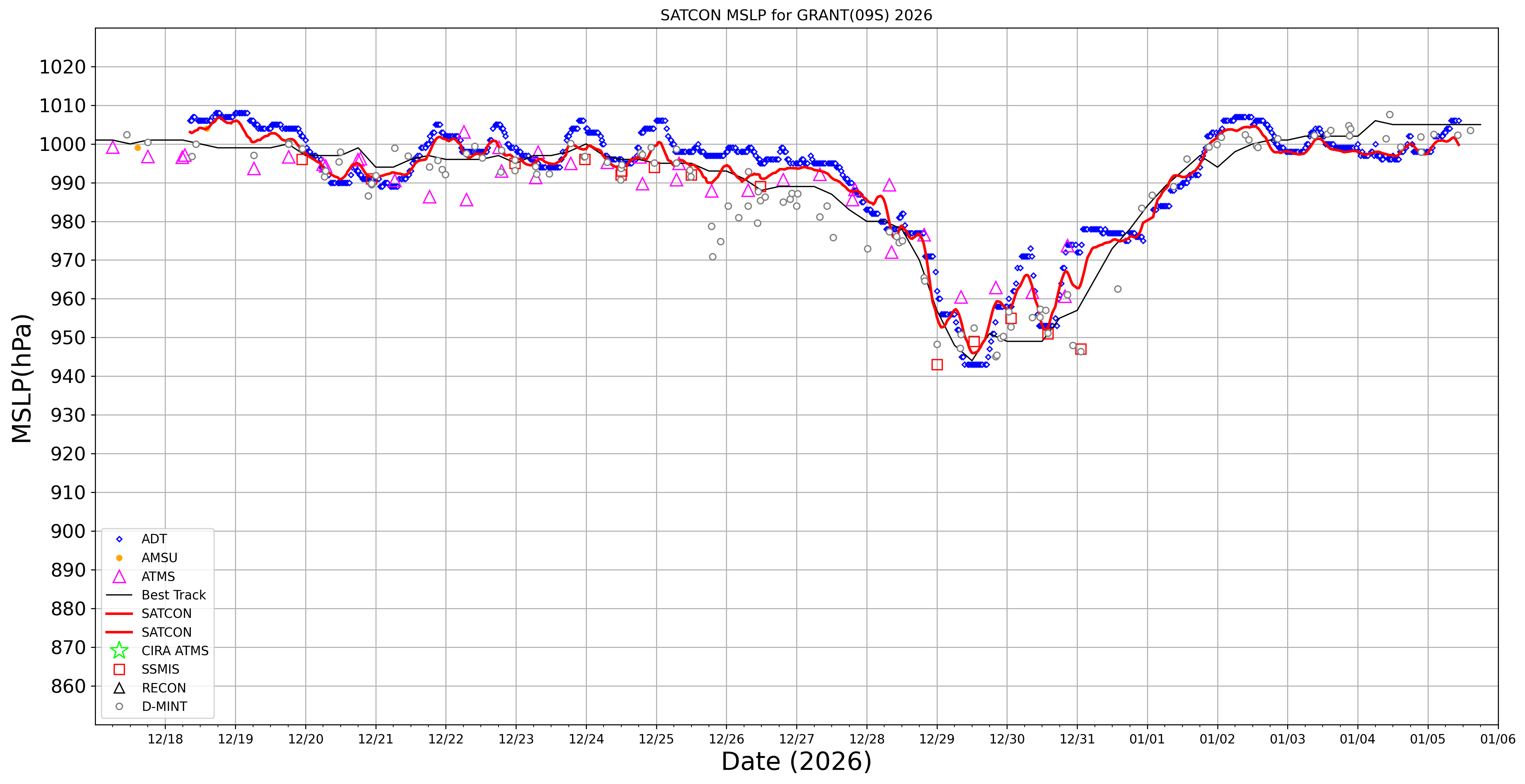
SATCON
|
| Date |
Time |
Vmax |
MSLP |
| 05Jan2026 |
0930UTC |
37 kts |
1001 hPa |
| Consensus Members |
| 2 (ADT+Sounders) |
|
|
|