|
Current Intensity Estimates
|
ADT
|
| Date |
Time |
Vmax |
MSLP |
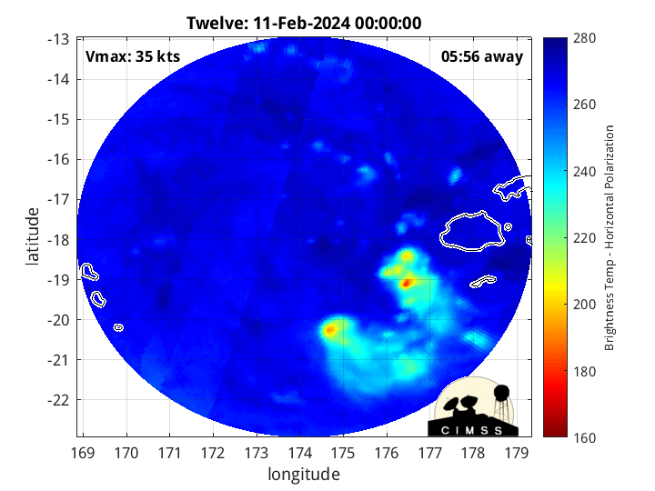
| 11Feb2024 |
1700UTC |
25 kts |
996 hPa |
| Scene |
CI# |
FT# |
AdjT# |
RawT# |
Eye T |
Cloud T |
| SHEAR |
1.5 |
1.5 |
1.5 |
1.5 |
19.79C |
5.10C |
|
|
|
|
AiDT
|
| Date |
Time |
Vmax |
|
| 11Feb2024 |
1700UTC |
31 kts |
|
|
|
|
|
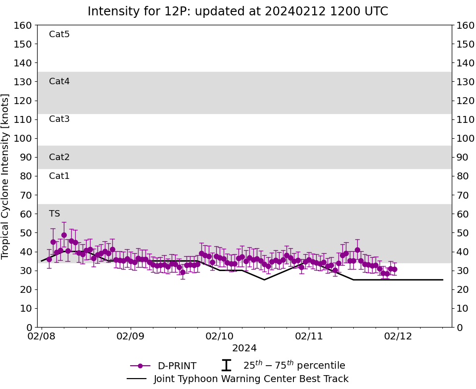
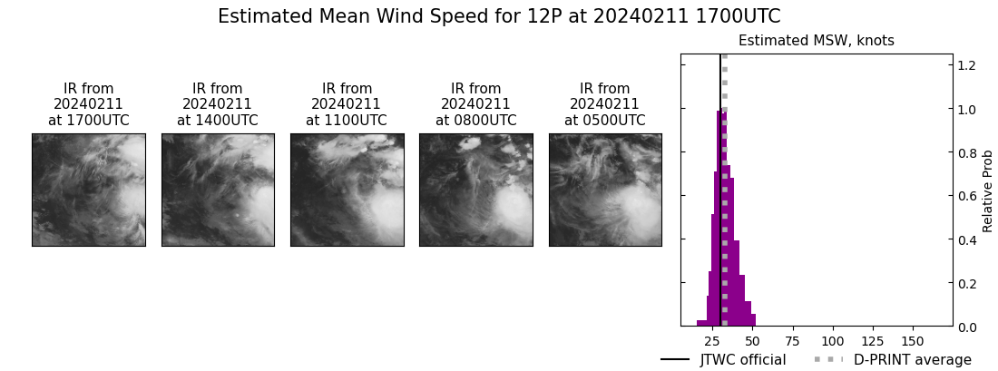
DPRINT
|
| Date |
Time |
Vmax |
MSLP |
| 11Feb2024 |
1700UTC |
33 kts |
999 hPa |
| Vmax 25% |
Vmax 75% |
|
|
| 29 kts |
37 kts |
|
|
|
|
|
|
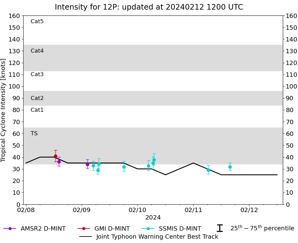
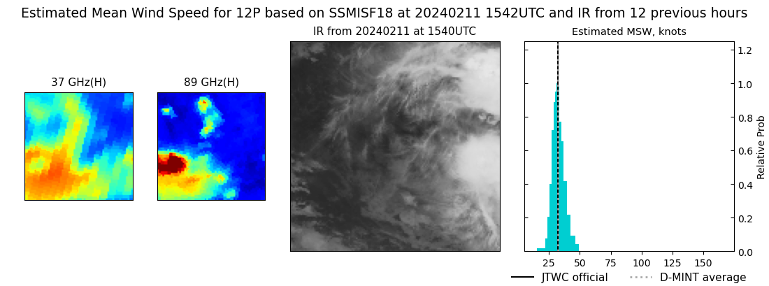
DMINT
|
| Date |
Time |
Vmax |
MSLP |
| 11Feb2024 |
1542UTC |
32 kts |
999 hPa |
| Vmax 25% |
Vmax 75% |
MW Instr. |
|
| 29 kts |
35 kts |
SSMISF18 |
|
|
|
|
|
MW Sounders
|
| Date |
Time |
Vmax |
MSLP |
| 08Feb2024 |
0225UTC |
38 kts |
990 hPa |
|
|
|
|
SATCON
|
| Date |
Time |
Vmax |
MSLP |
| 11Feb2024 |
1230UTC |
39 kts |
994 hPa |
| Consensus Members |
| 3 (ADT+Sounders) |
|
|
|