|
Current Intensity Estimates
|
ADT
|
| Date |
Time |
Vmax |
MSLP |
| 16Sep2024 |
2300UTC |
N/A kts |
N/A hPa |
| Scene |
CI# |
FT# |
AdjT# |
RawT# |
Eye T |
Cloud T |
| LAND |
N/A |
N/A |
N/A |
N/A |
N/AC |
N/AC |
|
|
|
|
AiDT
|
| Date |
Time |
Vmax |
|
| 16Sep2024 |
0730UTC |
64 kts |
|
|
|
|
|
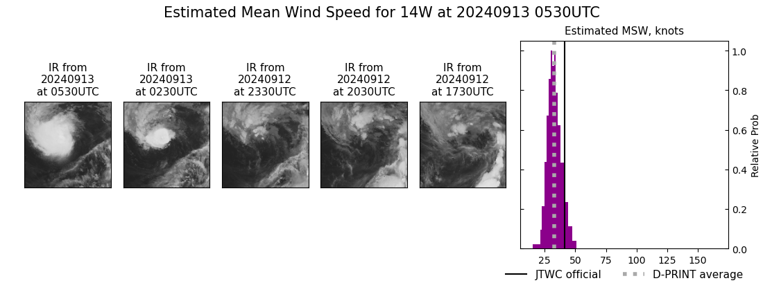
DPRINT
|
| Date |
Time |
Vmax |
MSLP |
| 13Sep2024 |
0530UTC |
33 kts |
994 hPa |
| Vmax 25% |
Vmax 75% |
|
|
| 29 kts |
37 kts |
|
|
|
|
|
|
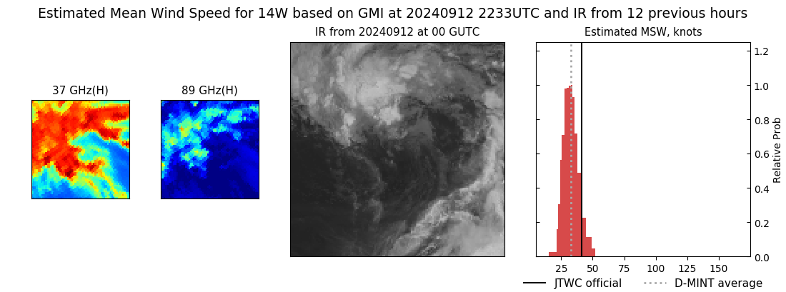
DMINT
|
| Date |
Time |
Vmax |
MSLP |
| 12Sep2024 |
2233UTC |
33 kts |
995 hPa |
| Vmax 25% |
Vmax 75% |
MW Instr. |
|
| 29 kts |
37 kts |
GMI |
|
|
|
|
|
MW Sounders
|
| Date |
Time |
Vmax |
MSLP |
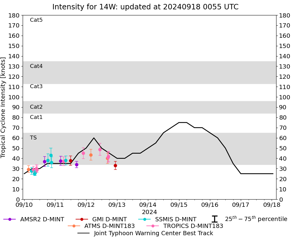
| 15Sep2024 |
1709UTC |
70 kts |
963 hPa |
|
|
|
|
SATCON
|
| Date |
Time |
Vmax |
MSLP |
| 16Sep2024 |
0730UTC |
66 kts |
975 hPa |
| Consensus Members |
| 2 (ADT+Sounders) |
|
|
|