|
Current Intensity Estimates
|
ADT
|
| Date |
Time |
Vmax |
MSLP |
| 22Sep2024 |
1100UTC |
25 kts |
998 hPa |
| Scene |
CI# |
FT# |
AdjT# |
RawT# |
Eye T |
Cloud T |
| SHEAR |
1.5 |
1.5 |
1.7 |
1.7 |
20.63C |
16.40C |
|
|
|
|
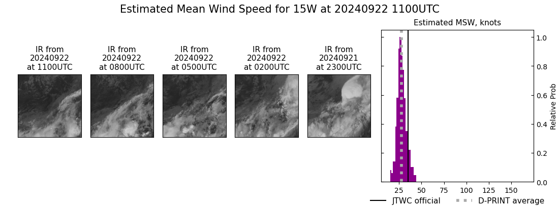
AiDT
|
| Date |
Time |
Vmax |
|
| 22Sep2024 |
1100UTC |
36 kts |
|
|
|
|
|
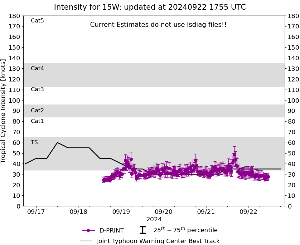
DPRINT
|
| Date |
Time |
Vmax |
MSLP |
| 22Sep2024 |
1100UTC |
28 kts |
NaN hPa |
| Vmax 25% |
Vmax 75% |
|
|
| 25 kts |
31 kts |
|
|
|
|
|
|
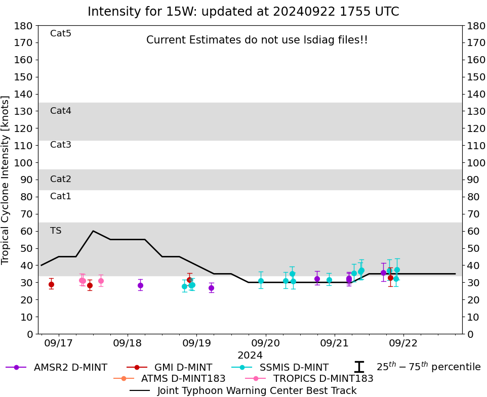
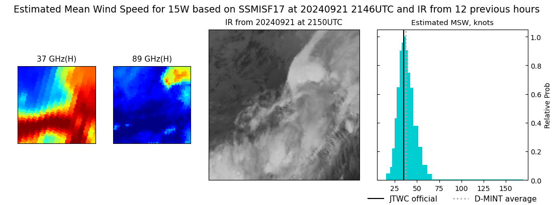
DMINT
|
| Date |
Time |
Vmax |
MSLP |
| 21Sep2024 |
2146UTC |
37 kts |
NaN hPa |
| Vmax 25% |
Vmax 75% |
MW Instr. |
|
| 32 kts |
44 kts |
SSMISF17 |
|
|
|
|
|
MW Sounders
|
| Date |
Time |
Vmax |
MSLP |
| 19Sep2024 |
1757UTC |
41 kts |
996 hPa |
|
|
|
|
SATCON
|
| Date |
Time |
Vmax |
MSLP |
| 21Sep2024 |
0430UTC |
36 kts |
996 hPa |
| Consensus Members |
| 3 (ADT+Sounders) |
|
|
|