|
Current Intensity Estimates
|
ADT
|
| Date |
Time |
Vmax |
MSLP |
| 14Aug2025 |
1500UTC |
N/A kts |
N/A hPa |
| Scene |
CI# |
FT# |
AdjT# |
RawT# |
Eye T |
Cloud T |
| LAND |
N/A |
N/A |
N/A |
N/A |
N/AC |
N/AC |
|
|
|
|
AiDT
|
| Date |
Time |
Vmax |
|
| 13Aug2025 |
1600UTC |
48 kts |
|
|
|
|
|
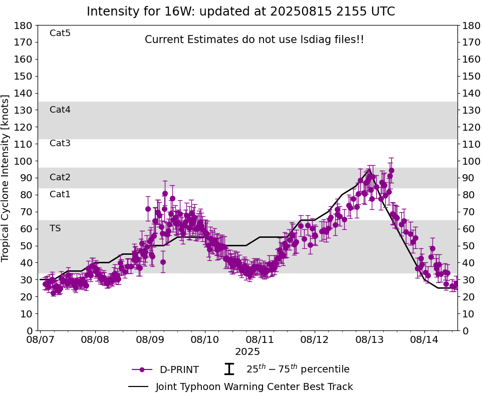
DPRINT
|
| Date |
Time |
Vmax |
MSLP |
| 14Aug2025 |
1700UTC |
28 kts |
999 hPa |
| Vmax 25% |
Vmax 75% |
|
|
| 24 kts |
32 kts |
|
|
|
|
|
|
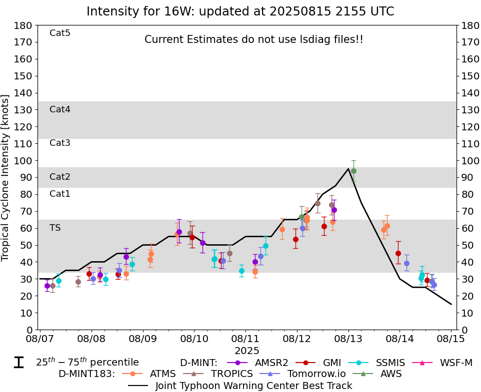
DMINT
|
| Date |
Time |
Vmax |
MSLP |
| 14Aug2025 |
1022UTC |
33 kts |
997 hPa |
| Vmax 25% |
Vmax 75% |
MW Instr. |
|
| 28 kts |
37 kts |
SSMISF16 |
|
|
|
|
|
MW Sounders
|
| Date |
Time |
Vmax |
MSLP |
| 13Aug2025 |
1035UTC |
65 kts |
976 hPa |
|
|
|
|
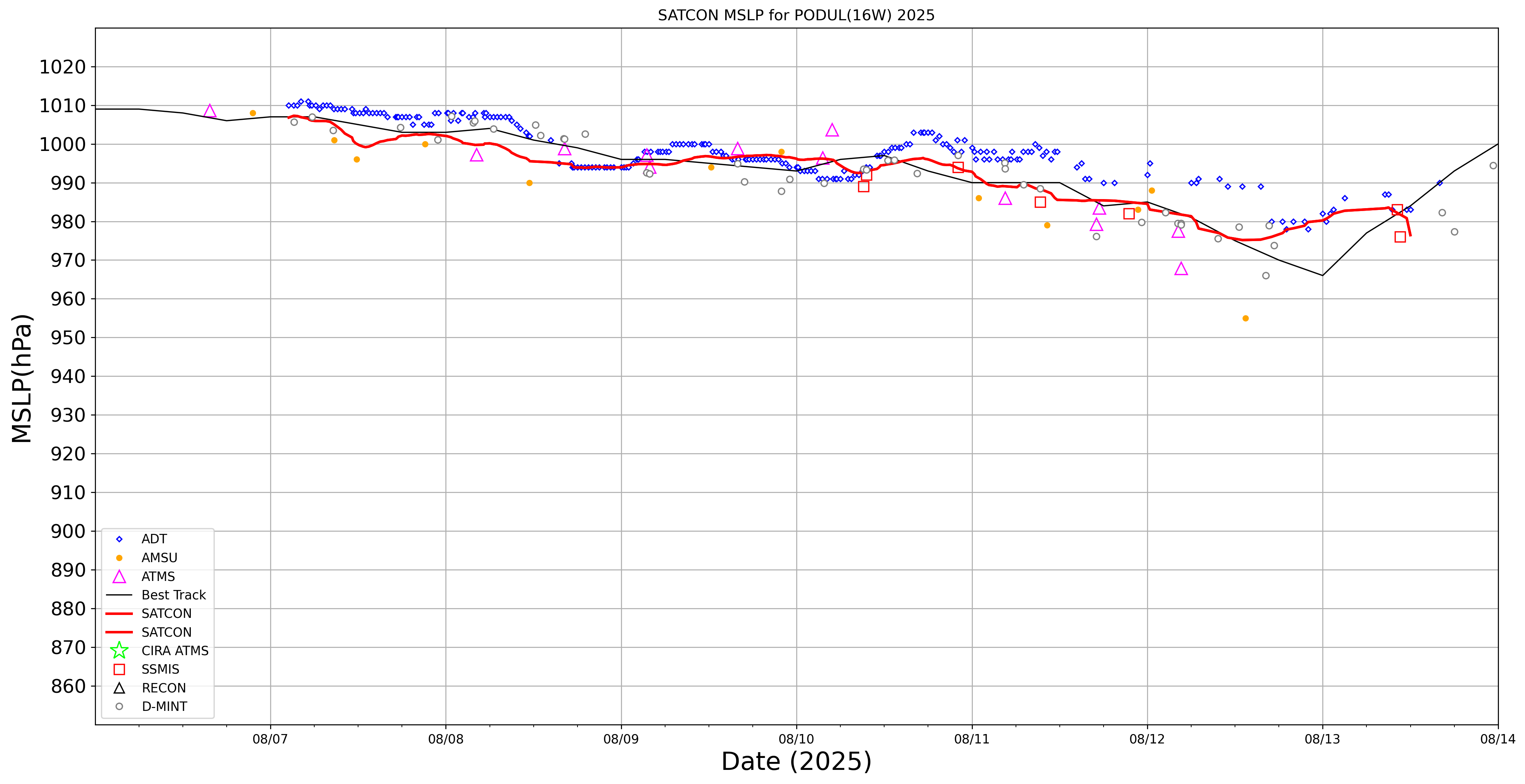
SATCON
|
| Date |
Time |
Vmax |
MSLP |
| 13Aug2025 |
1200UTC |
65 kts |
978 hPa |
| Consensus Members |
| 2 (ADT+Sounders) |
|
|
|