|
Current Intensity Estimates
|
ADT
|
| Date |
Time |
Vmax |
MSLP |
| 25Jan2026 |
1100UTC |
N/A kts |
N/A hPa |
| Scene |
CI# |
FT# |
AdjT# |
RawT# |
Eye T |
Cloud T |
| LAND |
N/A |
N/A |
N/A |
N/A |
N/AC |
N/AC |
|
|
|
|
AiDT
|
| Date |
Time |
Vmax |
|
| 24Jan2026 |
0800UTC |
59 kts |
|
|
|
|
|
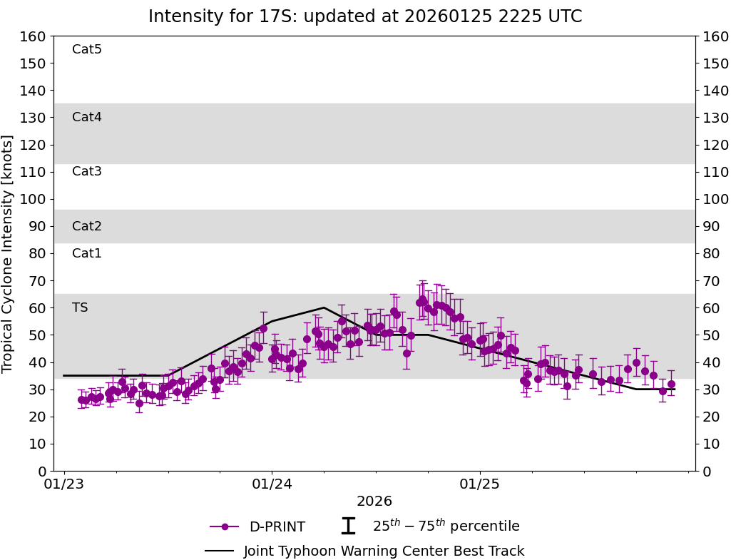
DPRINT
|
| Date |
Time |
Vmax |
MSLP |
| 25Jan2026 |
1100UTC |
35 kts |
993 hPa |
| Vmax 25% |
Vmax 75% |
|
|
| 30 kts |
41 kts |
|
|
|
|
|
|
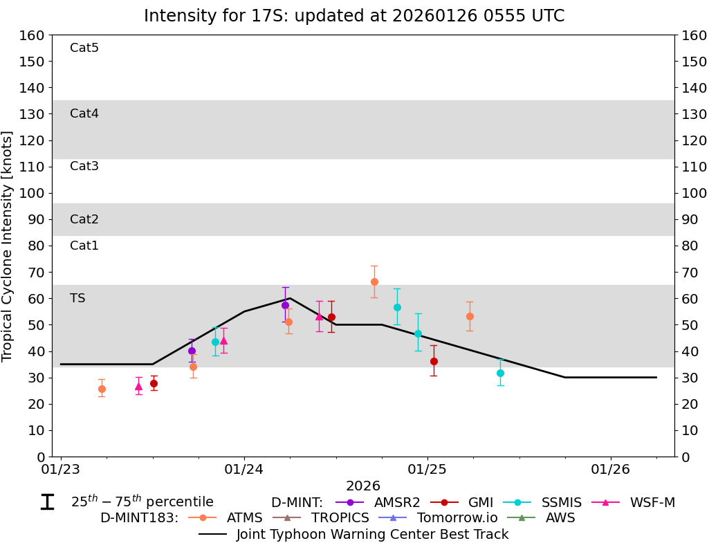
DMINT
|
| Date |
Time |
Vmax |
MSLP |
| 25Jan2026 |
0930UTC |
32 kts |
994 hPa |
| Vmax 25% |
Vmax 75% |
MW Instr. |
|
| 27 kts |
37 kts |
SSMISF17 |
|
|
|
|
|
MW Sounders
|
| Date |
Time |
Vmax |
MSLP |
| 25Jan2026 |
0529UTC |
59 kts |
979 hPa |
|
|
|
|
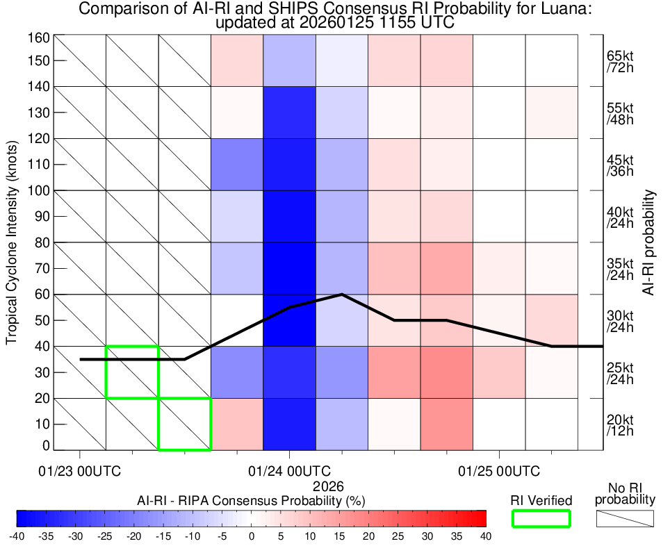
SATCON
|
| Date |
Time |
Vmax |
MSLP |
| 24Jan2026 |
0800UTC |
60 kts |
984 hPa |
| Consensus Members |
| 2 (ADT+Sounders) |
|
|
|