|
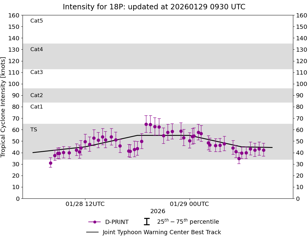
Current Intensity Estimates
|
ADT
|
| Date |
Time |
Vmax |
MSLP |
| 29Jan2026 |
0500UTC |
49 kts |
989 hPa |
| Scene |
CI# |
FT# |
AdjT# |
RawT# |
Eye T |
Cloud T |
| CRVBND |
3.2 |
2.7 |
2.6 |
2.3 |
-3.09C |
-20.69C |
|
|
|
|
AiDT
|
| Date |
Time |
Vmax |
|
| 29Jan2026 |
0500UTC |
43 kts |
|
|
|
|
|
DPRINT
|
| Date |
Time |
Vmax |
MSLP |
| 29Jan2026 |
0500UTC |
44 kts |
992 hPa |
| Vmax 25% |
Vmax 75% |
|
|
| 38 kts |
51 kts |
|
|
|
|
|
|
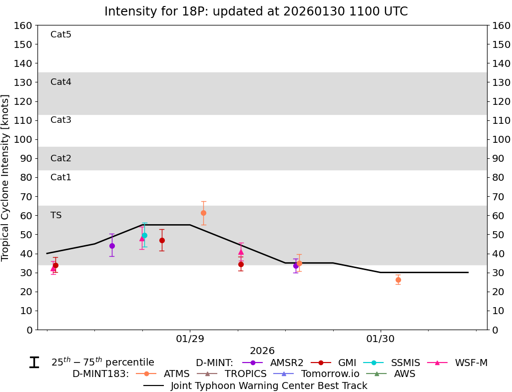
DMINT
|
| Date |
Time |
Vmax |
MSLP |
| 29Jan2026 |
0141UTC |
61 kts |
979 hPa |
| Vmax 25% |
Vmax 75% |
MW Instr. |
|
| 55 kts |
68 kts |
ATMS-N20 |
|
|
|
|
|
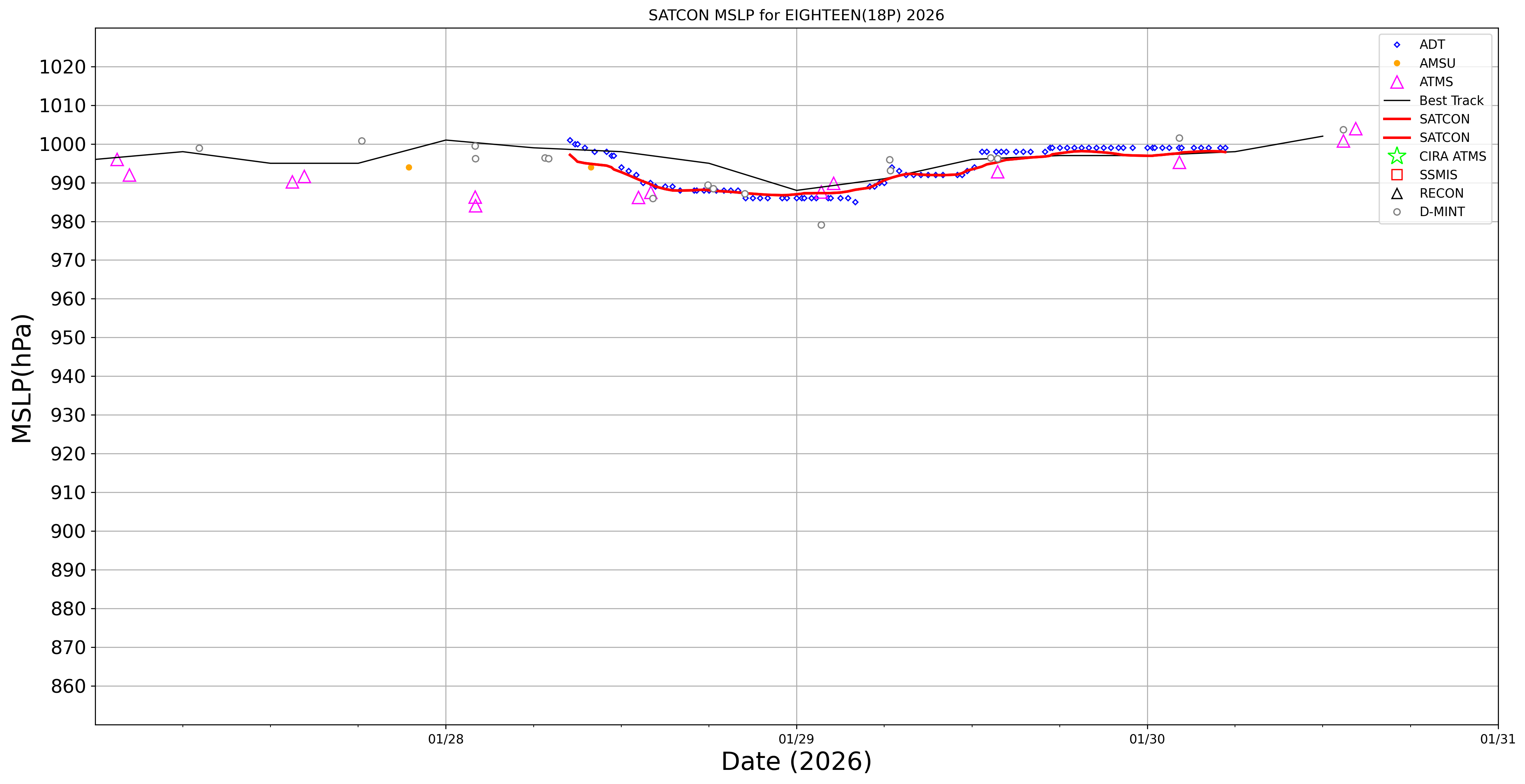
MW Sounders
|
| Date |
Time |
Vmax |
MSLP |
| 29Jan2026 |
0231UTC |
36 kts |
990 hPa |
|
|
|
|
SATCON
|
| Date |
Time |
Vmax |
MSLP |
| 29Jan2026 |
0400UTC |
48 kts |
987 hPa |
| Consensus Members |
| 2 (ADT+Sounders) |
|
|
|