|
Current Intensity Estimates
|
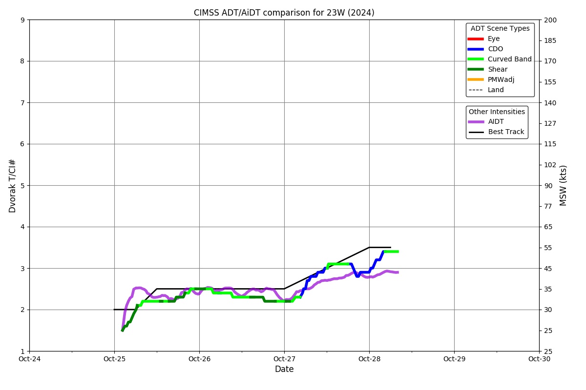
ADT
|
| Date |
Time |
Vmax |
MSLP |
| 02Nov2024 |
1700UTC |
25 kts |
994 hPa |
| Scene |
CI# |
FT# |
AdjT# |
RawT# |
Eye T |
Cloud T |
| SHEAR |
1.5 |
1.5 |
1.5 |
1.5 |
14.17C |
7.55C |
|
|
|
|
AiDT
|
| Date |
Time |
Vmax |
|
| 02Nov2024 |
1700UTC |
34 kts |
|
|
|
|
|
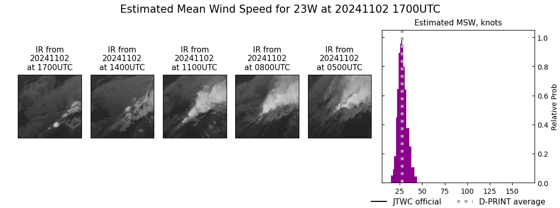
DPRINT
|
| Date |
Time |
Vmax |
MSLP |
| 02Nov2024 |
1700UTC |
28 kts |
NaN hPa |
| Vmax 25% |
Vmax 75% |
|
|
| 25 kts |
31 kts |
|
|
|
|
|
|
DMINT
|
| Date |
Time |
Vmax |
MSLP |
| 02Nov2024 |
0356UTC |
33 kts |
NaN hPa |
| Vmax 25% |
Vmax 75% |
MW Instr. |
|
| 29 kts |
39 kts |
AMSR2 |
|
|
|
|
|
MW Sounders
|
| Date |
Time |
Vmax |
MSLP |
| 01Nov2024 |
1751UTC |
39 kts |
996 hPa |
|
|
|
|
SATCON
|
| Date |
Time |
Vmax |
MSLP |
| 02Nov2024 |
0400UTC |
40 kts |
999 hPa |
| Consensus Members |
| 2 (ADT+Sounders) |
|
|
|