|
Current Intensity Estimates
|
ADT
|
| Date |
Time |
Vmax |
MSLP |
| 05Mar2026 |
1100UTC |
34 kts |
1002 hPa |
| Scene |
CI# |
FT# |
AdjT# |
RawT# |
Eye T |
Cloud T |
| SHEAR |
2.4 |
2.4 |
2.4 |
2.4 |
10.78C |
-13.50C |
|
|
|
|
AiDT
|
| Date |
Time |
Vmax |
|
| 05Mar2026 |
1100UTC |
33 kts |
|
|
|
|
|
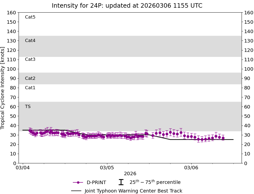
DPRINT
|
| Date |
Time |
Vmax |
MSLP |
| 05Mar2026 |
1100UTC |
32 kts |
1000 hPa |
| Vmax 25% |
Vmax 75% |
|
|
| 28 kts |
35 kts |
|
|
|
|
|
|
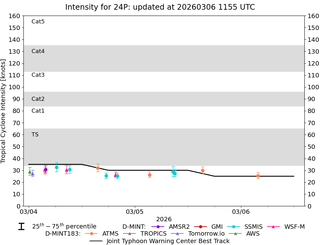
DMINT
|
| Date |
Time |
Vmax |
MSLP |
| 05Mar2026 |
0902UTC |
27 kts |
1001 hPa |
| Vmax 25% |
Vmax 75% |
MW Instr. |
|
| 25 kts |
30 kts |
SSMISF16 |
|
|
|
| Date |
Time |
Vmax |
MSLP |
| 05Mar2026 |
0837UTC |
29 kts |
1001 hPa |
| Vmax 25% |
Vmax 75% |
MW Instr. |
|
| 25 kts |
33 kts |
SSMISF17 |
|
|
|
|
|
|
MW Sounders
|
| Date |
Time |
Vmax |
MSLP |
| 05Mar2026 |
0408UTC |
40 kts |
994 hPa |
|
|
|
|
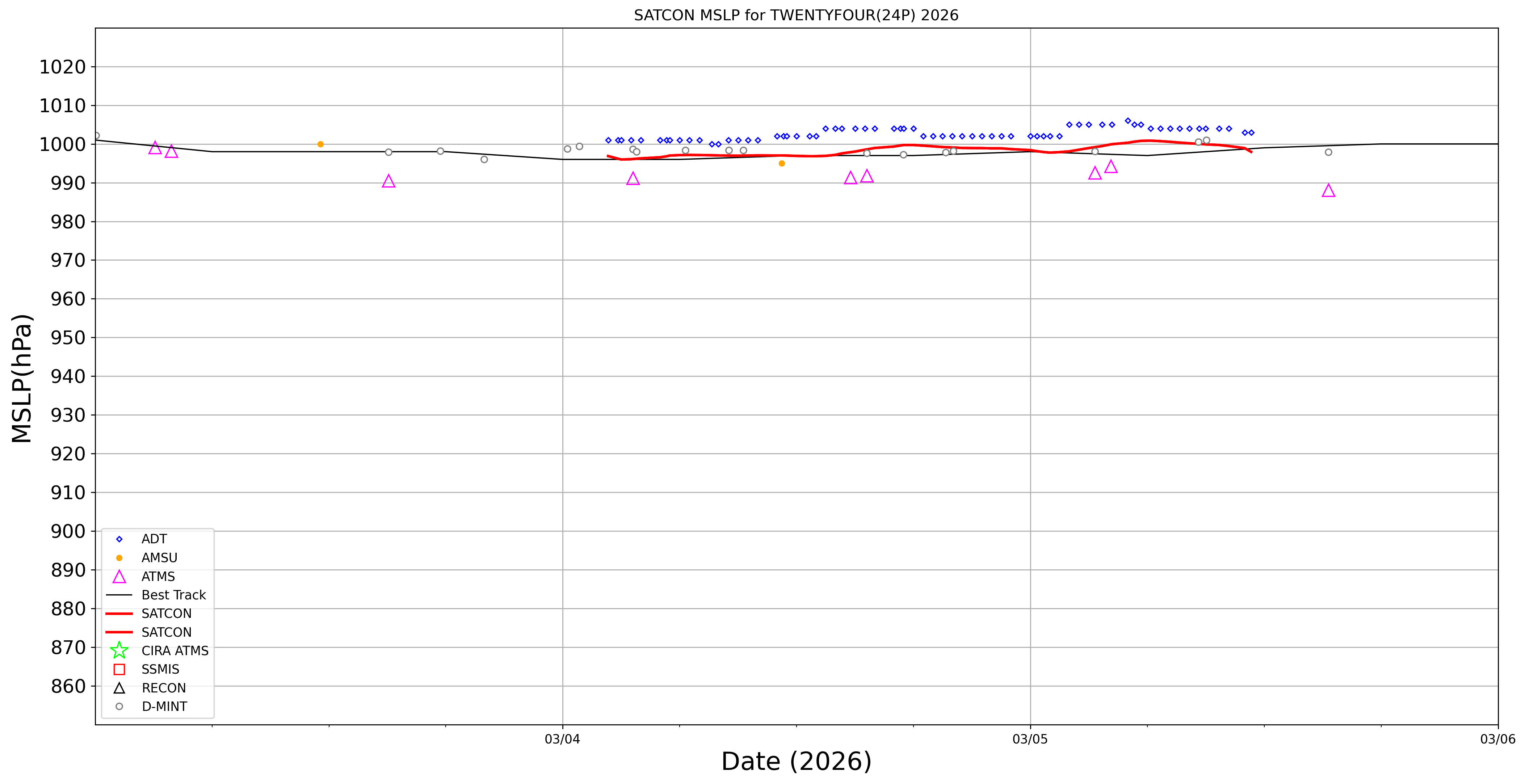
SATCON
|
| Date |
Time |
Vmax |
MSLP |
| 05Mar2026 |
0610UTC |
37 kts |
999 hPa |
| Consensus Members |
| 2 (ADT+Sounders) |
|
|
|