|
Current Intensity Estimates
|
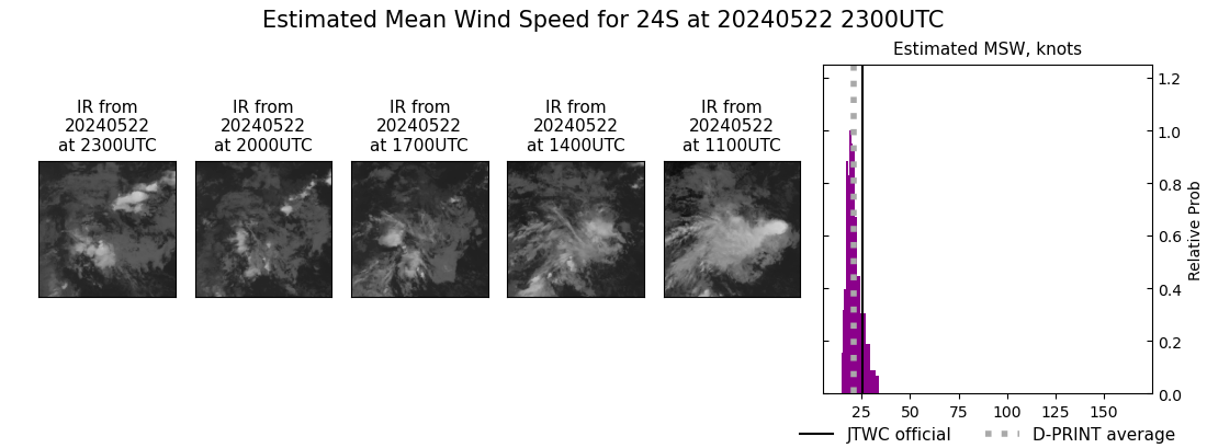
ADT
|
| Date |
Time |
Vmax |
MSLP |
| 22May2024 |
2230UTC |
25 kts |
1012 hPa |
| Scene |
CI# |
FT# |
AdjT# |
RawT# |
Eye T |
Cloud T |
| SHEAR |
1.5 |
1.5 |
1.5 |
1.5 |
19.93C |
3.78C |
|
|
|
|
AiDT
|
| Date |
Time |
Vmax |
|
| 22May2024 |
2230UTC |
32 kts |
|
|
|
|
|
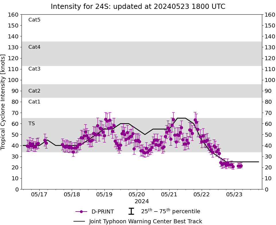
DPRINT
|
| Date |
Time |
Vmax |
MSLP |
| 22May2024 |
2300UTC |
21 kts |
1011 hPa |
| Vmax 25% |
Vmax 75% |
|
|
| 18 kts |
24 kts |
|
|
|
|
|
|
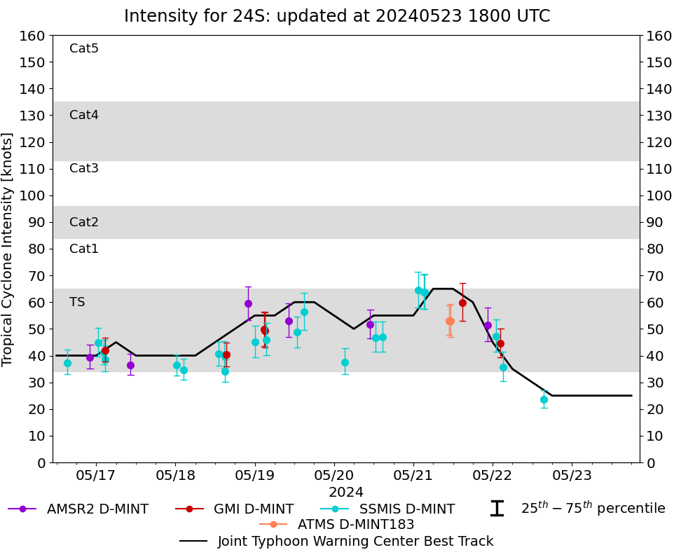
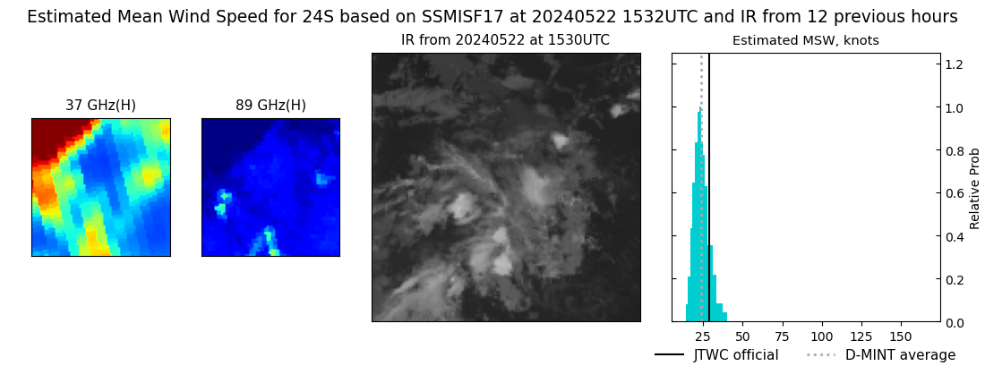
DMINT
|
| Date |
Time |
Vmax |
MSLP |
| 22May2024 |
1532UTC |
24 kts |
1008 hPa |
| Vmax 25% |
Vmax 75% |
MW Instr. |
|
| 21 kts |
27 kts |
SSMISF17 |
|
|
|
|
|
MW Sounders
|
| Date |
Time |
Vmax |
MSLP |
| 22May2024 |
2224UTC |
41 kts |
1004 hPa |
|
|
|
|
SATCON
|
| Date |
Time |
Vmax |
MSLP |
| 22May2024 |
2230UTC |
37 kts |
1009 hPa |
| Consensus Members |
| 2 (ADT+Sounders) |
|
|
|