|
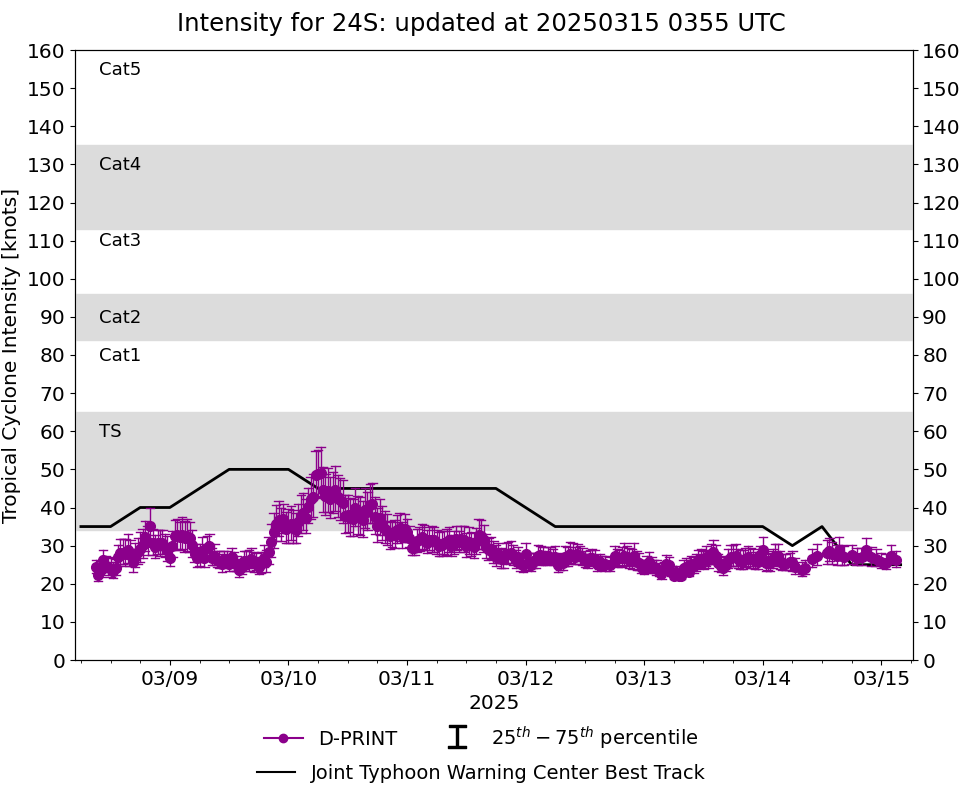
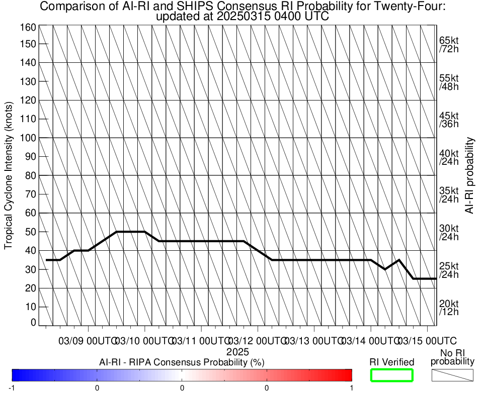
Current Intensity Estimates
|
ADT
|
| Date |
Time |
Vmax |
MSLP |
| 14Mar2025 |
1630UTC |
29 kts |
990 hPa |
| Scene |
CI# |
FT# |
AdjT# |
RawT# |
Eye T |
Cloud T |
| CRVBND |
1.9 |
1.9 |
2.2 |
2.2 |
20.32C |
10.63C |
|
|
|
|
AiDT
|
| Date |
Time |
Vmax |
|
| 14Mar2025 |
1630UTC |
37 kts |
|
|
|
|
|
DPRINT
|
| Date |
Time |
Vmax |
MSLP |
| 14Mar2025 |
1630UTC |
27 kts |
1001 hPa |
| Vmax 25% |
Vmax 75% |
|
|
| 25 kts |
30 kts |
|
|
|
|
|
|
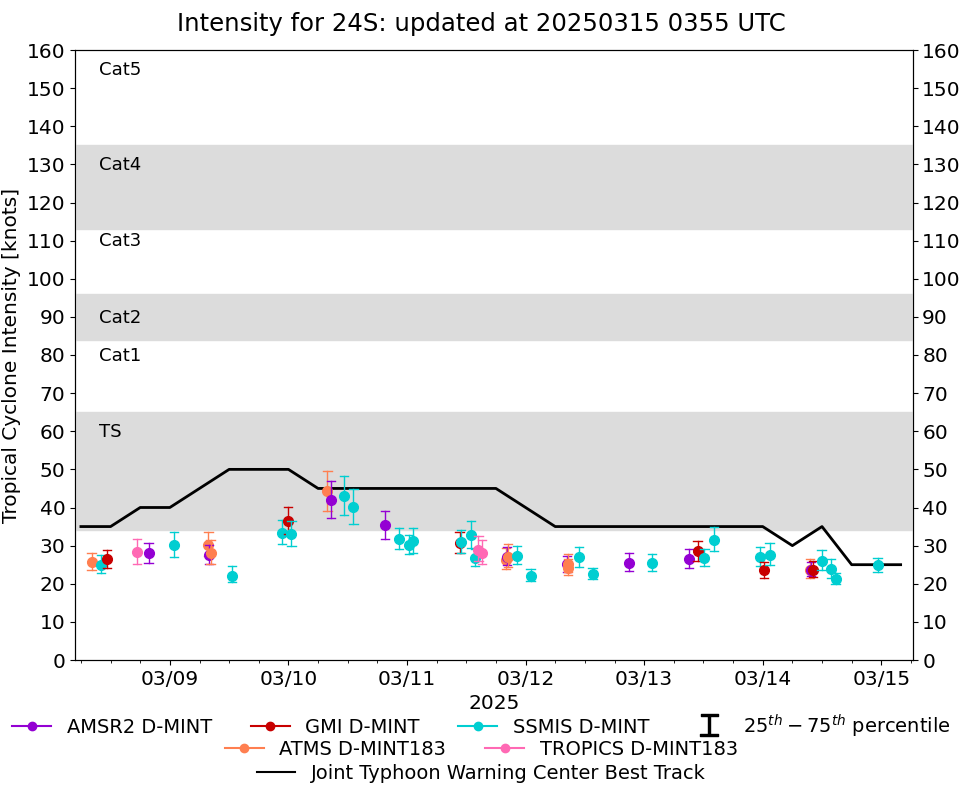
DMINT
|
| Date |
Time |
Vmax |
MSLP |
| 14Mar2025 |
1446UTC |
21 kts |
NaN hPa |
| Vmax 25% |
Vmax 75% |
MW Instr. |
|
| 20 kts |
23 kts |
SSMISF16 |
|
|
|
|
|
MW Sounders
|
| Date |
Time |
Vmax |
MSLP |
| 14Mar2025 |
0934UTC |
41 kts |
995 hPa |
|
|
|
|
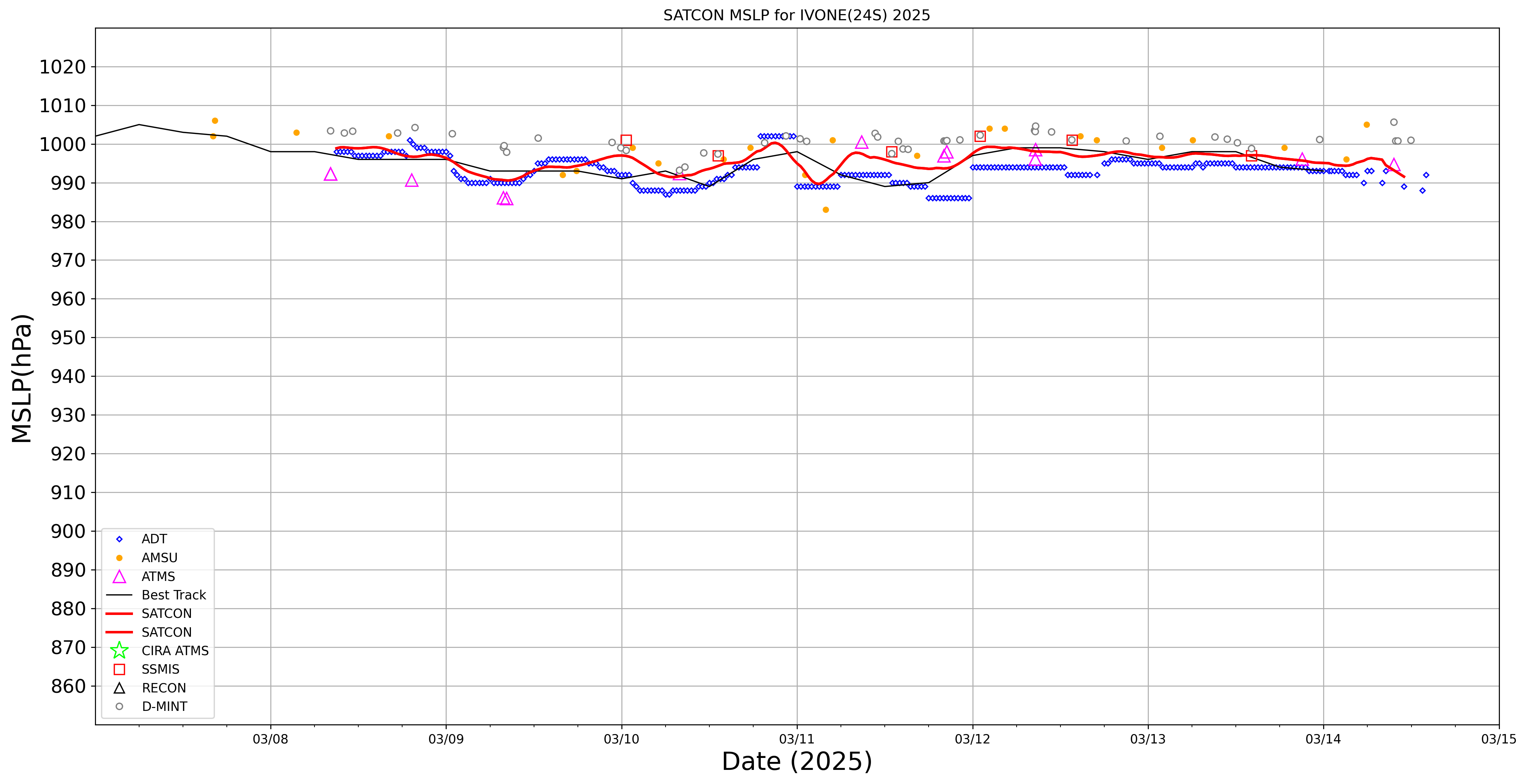
SATCON
|
| Date |
Time |
Vmax |
MSLP |
| 14Mar2025 |
1500UTC |
37 kts |
994 hPa |
| Consensus Members |
| 2 (ADT+Sounders) |
|
|
|