|
Current Intensity Estimates
|
ADT
|
| Date |
Time |
Vmax |
MSLP |
| 21Mar2025 |
1700UTC |
27 kts |
1008 hPa |
| Scene |
CI# |
FT# |
AdjT# |
RawT# |
Eye T |
Cloud T |
| CRVBND |
1.7 |
1.7 |
2.0 |
2.1 |
15.30C |
-32.98C |
|
|
|
|
AiDT
|
| Date |
Time |
Vmax |
|
| 21Mar2025 |
1700UTC |
29 kts |
|
|
|
|
|
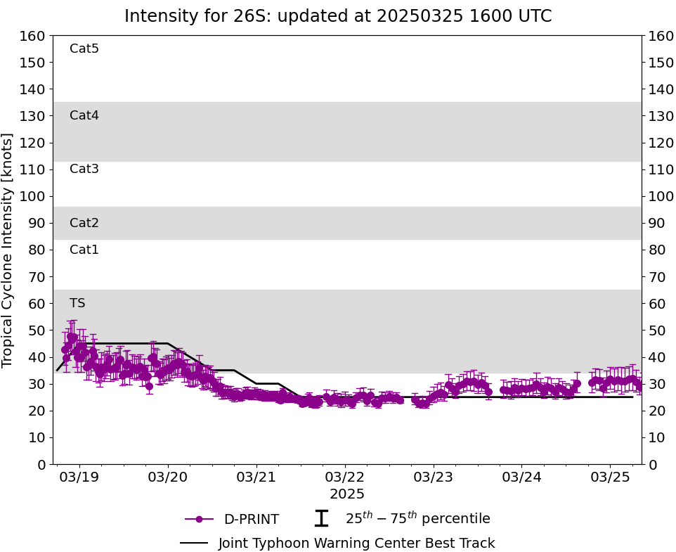
DPRINT
|
| Date |
Time |
Vmax |
MSLP |
| 21Mar2025 |
1700UTC |
23 kts |
1004 hPa |
| Vmax 25% |
Vmax 75% |
|
|
| 22 kts |
26 kts |
|
|
|
|
|
|
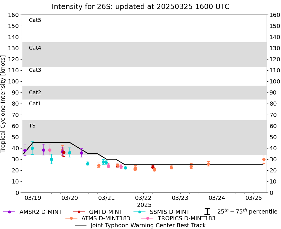
DMINT
|
| Date |
Time |
Vmax |
MSLP |
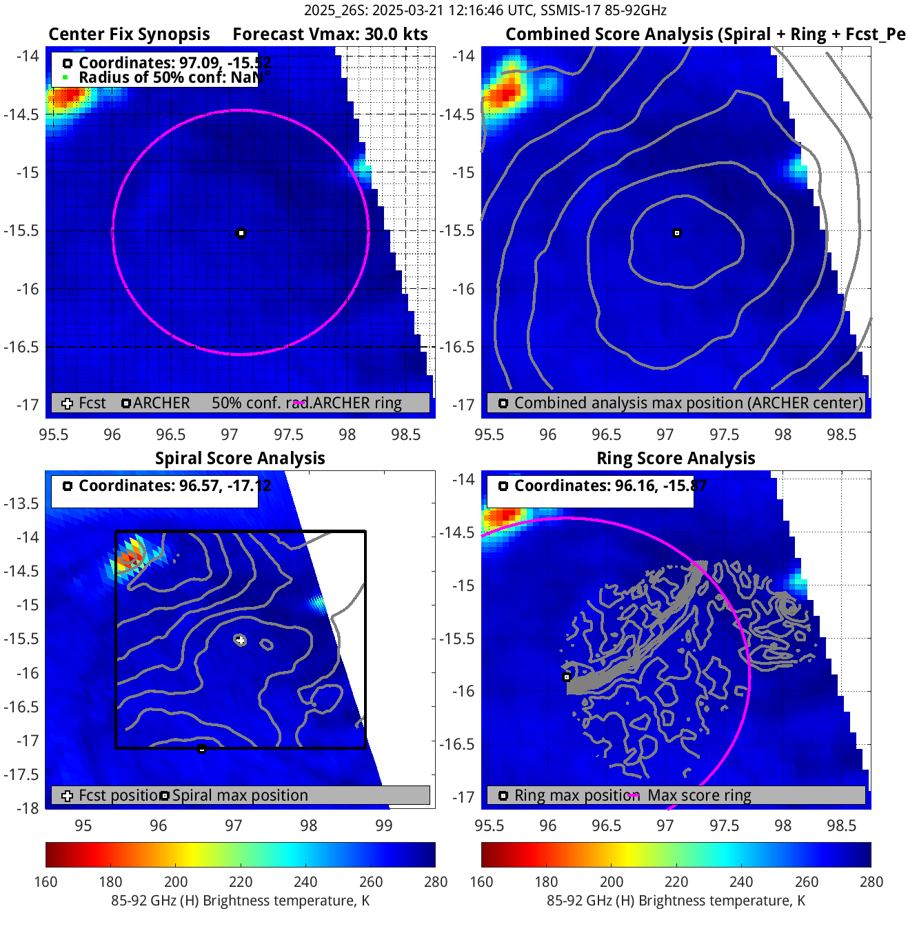
| 21Mar2025 |
1216UTC |
22 kts |
1005 hPa |
| Vmax 25% |
Vmax 75% |
MW Instr. |
|
| 21 kts |
24 kts |
SSMISF17 |
|
|
|
|
|
MW Sounders
|
| Date |
Time |
Vmax |
MSLP |
| 21Mar2025 |
1504UTC |
43 kts |
1002 hPa |
|
|
|
|
SATCON
|
| Date |
Time |
Vmax |
MSLP |
| 21Mar2025 |
1700UTC |
35 kts |
1004 hPa |
| Consensus Members |
| 3 (ADT+Sounders) |
|
|
|