|
Current Intensity Estimates
|
ADT
|
| Date |
Time |
Vmax |
MSLP |
| 28Mar2026 |
1100UTC |
30 kts |
994 hPa |
| Scene |
CI# |
FT# |
AdjT# |
RawT# |
Eye T |
Cloud T |
| SHEAR |
2.0 |
2.0 |
2.0 |
2.0 |
10.92C |
-4.30C |
|
|
|
|
AiDT
|
| Date |
Time |
Vmax |
|
| 28Mar2026 |
1100UTC |
36 kts |
|
|
|
|
|
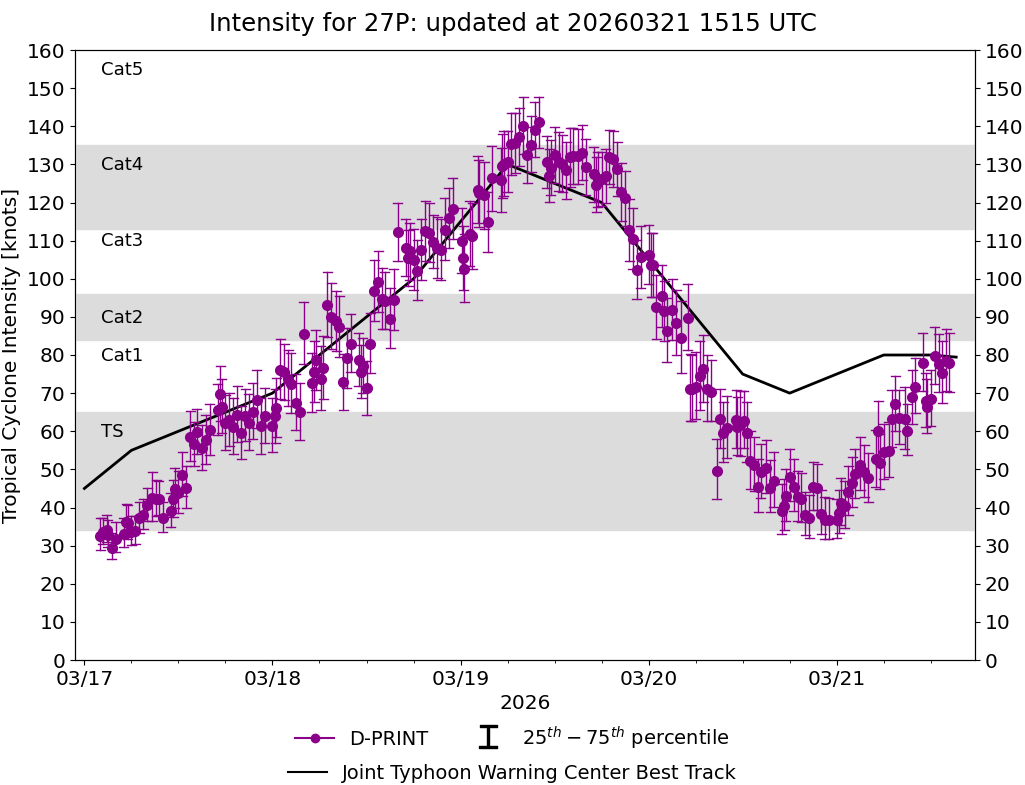
DPRINT
|
| Date |
Time |
Vmax |
MSLP |
| 28Mar2026 |
1100UTC |
33 kts |
997 hPa |
| Vmax 25% |
Vmax 75% |
|
|
| 29 kts |
38 kts |
|
|
|
|
|
|
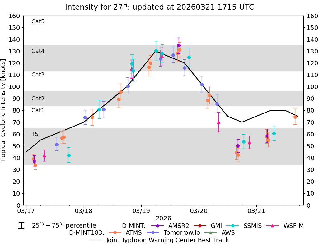
DMINT
|
| Date |
Time |
Vmax |
MSLP |
| 28Mar2026 |
0949UTC |
19 kts |
1004 hPa |
| Vmax 25% |
Vmax 75% |
MW Instr. |
|
| 15 kts |
23 kts |
SSMISF17 |
|
|
|
| Date |
Time |
Vmax |
MSLP |
| 28Mar2026 |
0612UTC |
20 kts |
1005 hPa |
| Vmax 25% |
Vmax 75% |
MW Instr. |
|
| 16 kts |
25 kts |
AMSR2 |
|
|
|
|
|
|
MW Sounders
|
| Date |
Time |
Vmax |
MSLP |
| 28Mar2026 |
0604UTC |
49 kts |
984 hPa |
|
|
|
|
SATCON
|
| Date |
Time |
Vmax |
MSLP |
| 27Mar2026 |
0130UTC |
105 kts |
946 hPa |
| Consensus Members |
| 2 (ADT+Sounders) |
|
|
|